


Mr. Philip D. Burden
P.O. Box 863,
Chalfont St. Giles, Bucks HP6 9HD,
UNITED KINGDOM
Tel: +44 (0) 1494 76 33 13
Email: enquiries@caburden.com
626 rare maps matched your search criteria.
Sould by John Overton at the White Horse at the corner of the little old Baly neere the fountaine tavern without Newgate, London, 1666-[68]
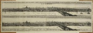
PANORAMAS OF LONDON BEFORE AND AFTER THE FIRE. 225 x 675 mm., two sheets joined, with one small tear at right side fold, laid onto paper, otherwise in good condition.
Stock number: 10470
£ 8,500
Manchester, 1741-[c.46]
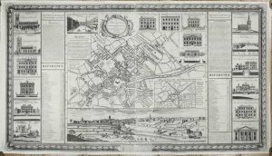
THE FIRST PLAN OF MANCHESTER. 695 x 1230 mm., in two sheets joined, with some support repairs to the verso but no apparent loss, edges re-margined just affecting ornamental border below, otherwise in good condition.
Stock number: 11193
£ 3,500
London, 1643
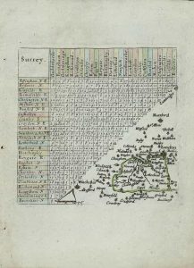
100 x 100 mm., with outline and wash colour, with large margins, in good condition.
Stock number: 11010
£ 110
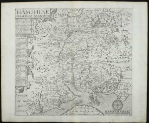
George Bishop and John Norton, London, 1607-[10]
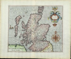
260 x 310 mm., with fine recent wash colour, in good condition
Stock number: 10999
£ 475
London, c.1760
540 x 700 mm., in early outline colour, folded and laid on contemporary linen, imprint below trimmed, in attractive marbled board slipcase, complete with the printed label of the map seller Robert Sayer, otherwise in good condition.
Stock number: 11002
£ 395
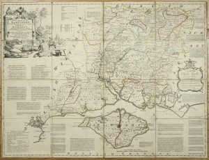
William Faden Charing Cross, London, 4 June 1796
665 x 580 mm., early outline and wash colour, cut and dissected as issued in 20 sections, linen-backed with original publisher's label of Faden attached to the verso, folding into the original marbled paper slipcase, worn, with printed label of William Faden dated 1796, otherwise in good condition.
Stock number: 11003
£ 850
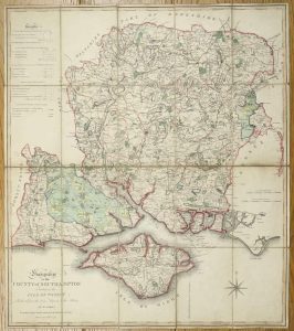
William Faden, London, 4 June 1795
790 x 1915 mm., the whole, in four separate sheets, early outline colour, trimmed to the top and bottom borders, sheet 2 with tear upper left just into the image, repaired, a couple of areas of margin weakness otherwise a good example.
Stock number: 11009
£ 1,750
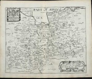
George Bishop and John Norton, London, 1607-[10]
295 x 320 mm., light toning along the centrefold, otherwise in good condition.
Stock number: 10992
£ 325
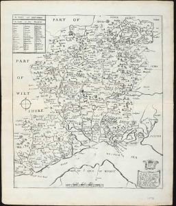
George Bishop and John Norton, London, 1607
FIRST EDITION. 240 x 330 mm., with recent wash colour, light offsetting of text a usual, otherwise in good condition.
Stock number: 10993
£ 150
London, 1695
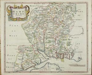
365 x 420 mm., in recent outline and wash colour, in good condition.
Stock number: 10984
£ 195
London, 1673
260 x 310 mm., in good condition.
Stock number: 10987
£ 175
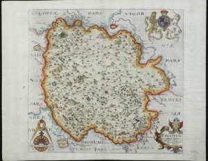
George Bishop and John Norton, London, 1607-[10]
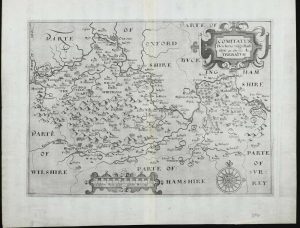
THE FIRST PRINTED MAP OF BERKSHIRE. 240 x 330 mm., in good condition.
Stock number: 10990
£ 250
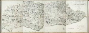
John Bowles Cornhill & Carington Bowles in St. Pauls Church Yard & Robt. Sayer, in Fleet Street, London, 1751-[c.67]
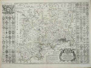
525 x 725 mm., early outline colour, small tear in upper margin repaired, not effecting the image, light fraying to margin lower right, otherwise in good condition.
Stock number: 10974
£ 750
Printed and sold by john Overton at ye white horse without Newgate, London, c.1595-[c.1720]
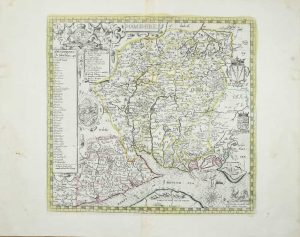
395 x 425 mm., in early outline colour with wash to the sea and cartouche, in good condition.
Stock number: 10977
£ 2,750
Philip Lea, London, 1575-[1693]
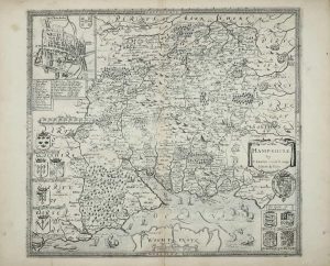
385 x 440 mm., with an old repair to lower centrefold split 30 mm. into the map, otherwise in good condition.
Stock number: 10978
£ 2,250
Amsterdam, 1645-[48]
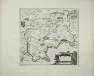
390 x 405 mm., With early outline colour, in double-glazed frame, in good condition.
Stock number: 10979
£ 495
H. Moll over against Devereux Court in ye Strand P .Overton ... near St. Dunstands Church Fleetstreet and by I. King ... at the Globe in the Poultry, London, 1681-[c.1715]
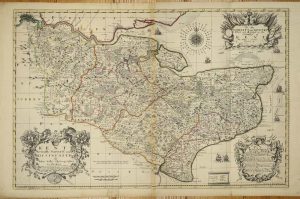
570 x 870 mm., in early outline colour, some professional margin repair, the ink mark near the title is a plate issue as it appears on other examples, otherwise in very good condition.
Stock number: 9548
£ 2,950
London, c.1675
405 x 355 mm., some light foxing, otherwise in good condition.
Stock number: 9588
£ 295
London, c.1675
405 x 360 mm., in good condition.
Stock number: 9590
£ 395