


Mr. Philip D. Burden
P.O. Box 863,
Chalfont St. Giles, Bucks HP6 9HD,
UNITED KINGDOM
Tel: +44 (0) 1494 76 33 13
Email: enquiries@caburden.com
65 rare maps matched your search criteria.
c.1750
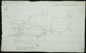
195 x 310 mm., pen and ink manuscript, uncut, two folds, on eighteenth century paper, in good condition.
Stock number: 11362
$ 1,500
Robert Sayer and John Bennett, No. 53 in Fleet Street, London, 1759-[75]
400 x 600 mm., recent outline colour, light crease on right side, otherwise in good condition with wide margins.
Stock number: 11364
$ 2,950
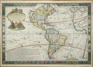
Amsterdam, c.1720
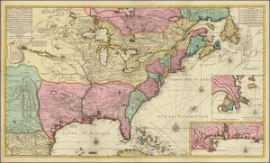
FIRST STATE. 580 x 1020 mm., with recent full wash colour, professional repairs along the original fold lines, otherwise in good condition.
Stock number: 11413
$ 24,500
Washington, 1858
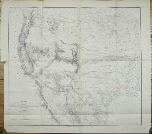
525 x 585 mm., with folds as issued, in good condition.
Stock number: 11200
$ 695
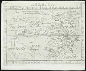
Sebastian Petri, Basle, 1588-[1614]

325 x 370 mm., in good condition.
Stock number: 11100
$ 1,750
Venice, 1691
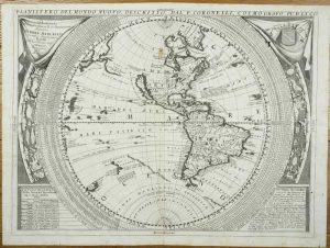
460 x 610 mm., with light mark upper centrefold and small ink mark upper right, otherwise in good condition.
Stock number: 11124
$ 2,400
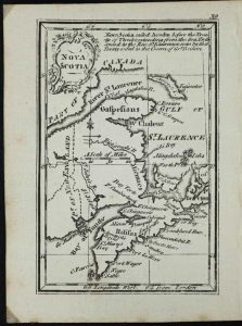
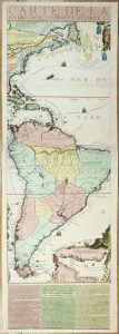
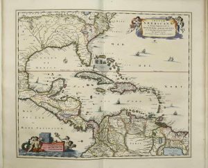
Amsterdam, c.1697
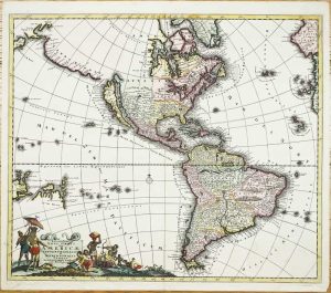
495 x 580 mm., in fine early wash colour, light reinforcement to lower left corner, otherwise in good condition.
Stock number: 11128
$ 2,500
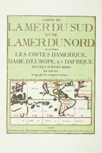
Paris, 1731
FIRST STATE. 490 x 705 mm., with extended margins including some border in facsimile, otherwise in good condition.
Stock number: 11139
$ 3,500
(Chicago?), c.1830
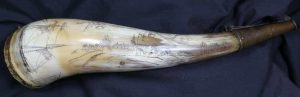
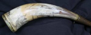
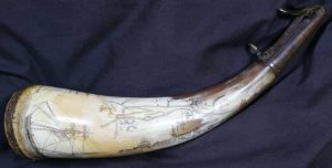
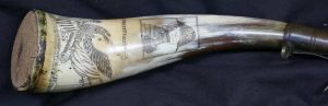
AN ORIGINAL POWDER HORN WITH THE SECOND EARLIEST KNOWN VIEW OF FORT DEARBORN (CHICAGO). An engraved or scrimshawed cow horn using a burin, 26 centimetres (10.5 inches) long with a maximum circumference of 15 cms., with a cork plug at the base secured by four brass pins, one is missing, the spout is capped with a later brass sprung cap with a ring for a strap and was worn on the right-hand side.
Stock number: 11029
$ 150,000
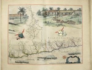
Amsterdam, 1730-[c.55]
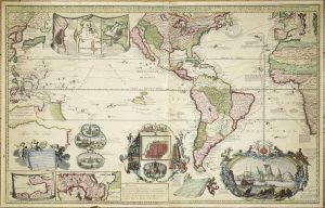
590 x 940 mm., in fine early wash colour, some light restoration to folds at the centre, otherwise in good condition.
Stock number: 11138
$ 19,500
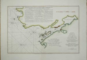
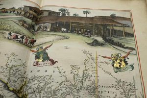
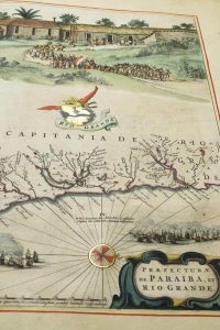
Paris, 1713
1175 x 380 mm., full early wash colour, with accompanying title page included a key map, bookplate of the Duke of York on the verso, in very good condition.
Stock number: 11134
$ 13,500
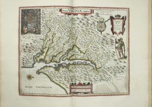
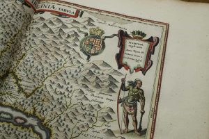
George Humble, London, 1627-[31]
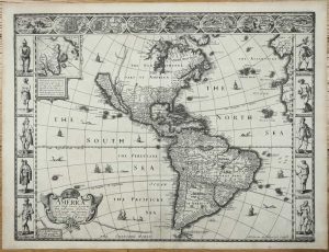
FIRST ATLAS MAP TO DEPICT CALIFORNIA AS AN ISLAND. 390 x 510 mm., with a wormhole near the bottom of the centrefold repaired, otherwise in good condition.
Stock number: 11106
$ 4,500
Amsterdam, 1665
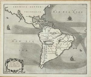
340 x 410 mm. with light toning at margin edges, otherwise in good condition.
Stock number: 11118
$ 995
Printed, Colered, and are/ to be sold by Ro:Walton/ at ye Globe and Compass in St. Paules Church yard between/ ye two north doores, London, 1658-[c.60]
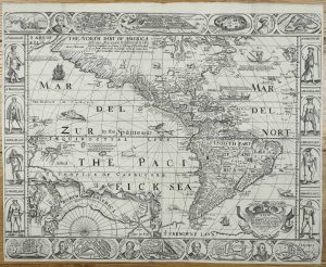
420 x 530 mm., minute area of loss at double fold as expected, otherwise in good condition.
Stock number: 11116
$ 12,500
Ioannis Blaeu, Amsterdam, 1662
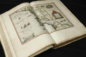
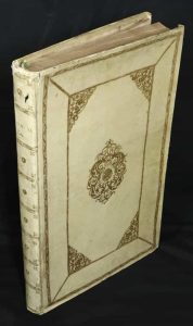
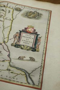

HIGHLIGHTED IN GOLD, EXTRA-ILLUSTRATED. Large folio (560 x 360 mm.), contemporary Dutch yap vellum with gilt panels, central ornate design with decorative corners, with ornate gilt spines, upper edge of spine worn, lacking cloth ties. Typographic title page with central vignette, Latin text, paginated 1-287, (2), with 24 maps all coloured in a fine contemporary hand with gold touches (extra illustrated with a Visscher map of the West Indies), some toning and foxing mostly to some of the text, otherwise a very good example.
Stock number: 11082
$ 95,000
Apud Ioannem Bellerum sub Aquila aurea, Antwerp, 1567
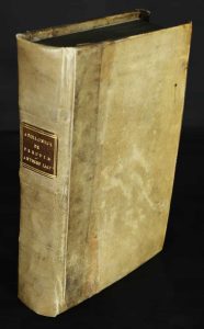
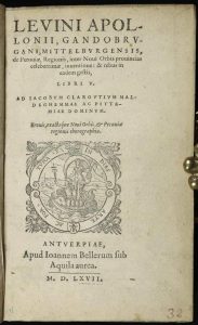
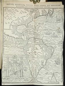
Octavo (160 x 105 mm.), contemporary vellum yap binding, red gilt calf title label affixed to spine. Typographic title with device, pagination of the leaves only 236, (8), and a folding woodcut map, i very good condition.
Stock number: 11079
$ 17,500
Frankfurt, 1631
355 x 445 mm., with professional repair to a tear in the upper margin just left of centre, otherwise in good condition.
Stock number: 11109
$ 850
Paris, 1778
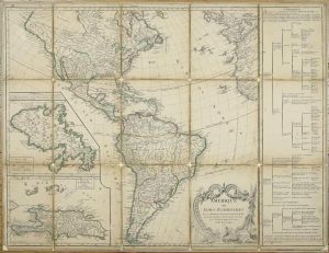
500 x 660 mm., dissected and laid on contemporary linen, laid down on board, early outline colour, some loss of cloth at folds, the folded cloth over the edges masks the scales which appear below the margins, light surface wear.
Stock number: 11148
$ 350