


Mr. Philip D. Burden
P.O. Box 863,
Chalfont St. Giles, Bucks HP6 9HD,
UNITED KINGDOM
Tel: +44 (0) 1494 76 33 13
Email: enquiries@caburden.com
28 rare maps matched your search criteria.
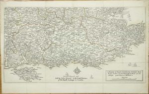
Amsterdam, 1675-[1745]
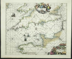
485 x 570 mm., in early wash colour, with centrefold split repaired as is one in the lower margin 4 cms. into the image, otherwise in good condition.
Stock number: 11789
£ 650
1641
270 x 360 mm., dark impression, with extended side margins, otherwise in good condition.
Stock number: 11356
£ 275
Amsterdam, 1681
505 x 570 mm., in fine recent outline and wash colour, in very good condition.
Stock number: 11395
£ 750
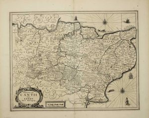
Jean Bellere & Cornelis Claesz, Antwerp, 1583-[90]
350 x 525 mm., light foxing to the left side, otherwise in very good condition.
Stock number: 11331
£ 1,500
John Garrett at the South Entrance of the Royall Exchange, London, 1644-[76]
280 x 505 mm., early outline colour, folds as issued, small area of loss along fold, repaired, otherwise in good condition.
Stock number: 11264
£ 295
London, 1675
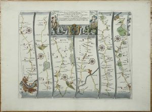
310 x 430 mm., later wash colour, in good condition.
Stock number: 11266
£ 350
London, 1675-[98]
![The Roads from Chelmsford [to] Maldon Raleigh in Essex [to] Gravesend in Kent ... With the branch from Canterbury to Deal by Sandwich thence to Dover](https://www.caburdenraremaps.com/wp-content/uploads/2025/10/11268-300x245.jpg)
330 x 425 mm., evenly toned, a fine engraving in good condition.
Stock number: 11268
£ 250
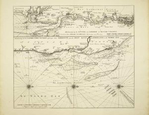
H. Moll over against Devereux Court in ye Strand P .Overton ... near St. Dunstands Church Fleetstreet and by I. King ... at the Globe in the Poultry, London, 1681-[c.1715]
570 x 870 mm., in early outline colour, some professional margin repair, the ink mark near the title is a plate issue as it appears on other examples, otherwise in very good condition.
Stock number: 9548
£ 2,950
London, 1695
360 x 640 mm., small centrefold split repaired, otherwise a good example.
Stock number: 8461
£ 125
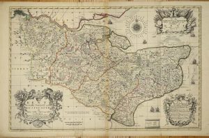
Nuremberg, 1741
510 x 570 mm., full early wash colour, in good condition.
Stock number: 10686
£ 650
London, 1637-[c.45]
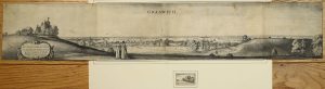
‘EARLIEST DATED LONDON VIEW’. Two sheets joined 150 x 835 mm., laid onto later paper and folded in, imprint lower left trimmed out, otherwise in good condition. With additional small Hollar engraving of 'Grinwich Castle'.
Stock number: 10475
£ 1,950
Phil. Lea at ye Atlas & Hercules in Cheapside, London, c.1690
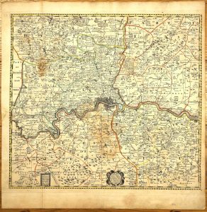
515 x 560 mm., early outline colour, with minor water stain, printed on thick paper, with fold as issued, otherwise in good condition.
Stock number: 9734
£ 4,500
Amsterdam, 1734
510 x 590 mm., printed on thick paper and in good condition.
Stock number: 8771
£ 400
R. Morden and W. Berry at the Atlas in Cornhill and at the Globe between Charing-Cross and White-Hall, London, c.1675-[88]
200 x 175 mm., early outline colour, with extended margin to the right side, two minor centrefold splits either side, otherwise in good condition.
Stock number: 8772
£ 650
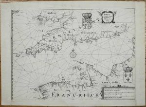
London, c.1672
AN UNRECORDED AND APPARENTLY UNIQUE EXAMPLE. 435 x 550 mm., a tear runs between Flanders and France, there are two others above, two more smaller tears are along the lower margin, and one on the left side. Similarly, a small thumbnail sized area has been filled in lower left of the title where there has been some loss at the fold. All tears have been professionally restored and the whole has been re-margined, not backed, and some of the engraved neatline is lacking on the right, otherwise in good condition.
Stock number: 8773
£ 2,950
Amsterdam, 1734
500 x 295 mm., in good condition.
Stock number: 8111
£ 250
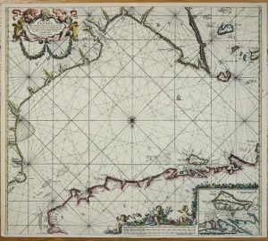
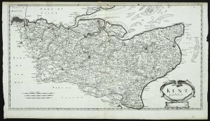
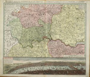
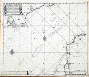
Amsterdam, 1693
580 x 940 mm., two sheets joined, in fabulous early wash colour, royal coat of arms and cities heightened in gold, minor centrefold split just into the lower part of the image, otherwise in excellent condition.
Stock number: 8050
£ 3,950
London, October 1758
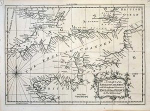
185 x 260 mm., with folds as issued, in good condition.
Stock number: 7612
£ 60
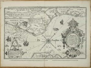
Amsterdam, 1644
380 x 500 mm., small hole in the upper right margin, lower centre fold split, repaired, not affecting the image, otherwise in good condition.
Stock number: 7441
£ 395
Amsterdam, 1734
520 x 600 mm., printed on thick paper in good condition.
Stock number: 5877
£ 250