


Mr. Philip D. Burden
P.O. Box 863,
Chalfont St. Giles, Bucks HP6 9HD,
UNITED KINGDOM
Tel: +44 (0) 1494 76 33 13
Email: enquiries@caburden.com
4 rare maps matched your search criteria.
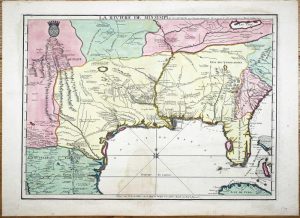
Ernest van Harrevelt; Daniel Jean Changuion, Amsterdam, 1773
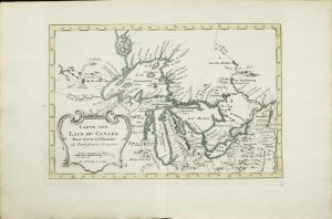
190 x 290 mm., in very nice early outline colour, good condition.
Stock number: 10801
$ 595
George Catlin. Egyptian Hall, Piccadilly [but Chatto & Windus], London, [1875]
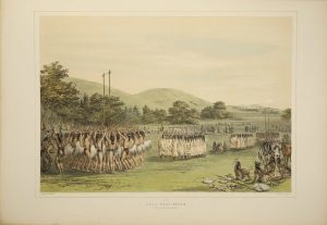
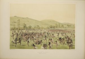
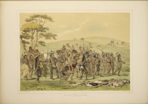
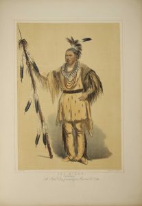
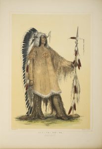
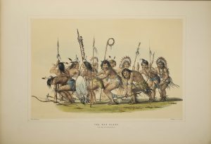
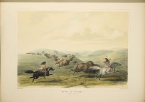
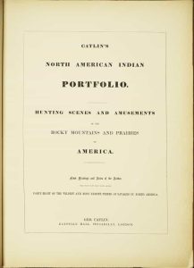
THE RARE 31 PLATE ISSUE. Folio (595 x 430 mm.), contemporary half straight-grained blue morocco by Zaehnsdorf, uncut, blue cloth boards, gilt ruled, spine with ornate gilt raised bands, compartments with ornate central gilt feature and gilt titles, gilt top, marbled endpapers. With title page, Contents and 31 hand coloured lithographic plates (25 numbered and 6 unnumbered), each with blank interleaf, a few margins lightly stained, lower corner of title page chipped, 5 plates with waterstain in the margins effecting the image of only one - 'Attacking the Grizzly Bear', otherwise in good condition.
Stock number: 10495
$ 125,000
A Paris dans l'!sle sur Ie Quay de l'Orloge a la Sphere Royale avec Prive. Du Roy 1715, Paris, 1715
EXTREMELY RARE FIRST STATE OF NICOLAS DE FER'S LANDMARK MAP IN FULL CONTEMPORARY WASH COLOUR. 465 x 640 mm., in full early wash colour, faint water stain lower centrefold, otherwise in excellent condition.
Stock number: 9768
$ 49,500
Robert Sayer, London, 1772-[75]
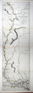
FIRST LARGE SCALE ENGLISH MAP OF THE REGION AFTER THE TREATY. 1120 x 340 mm., in fine early outline colour. Two sheets joined, printed on strong paper, in good condition.
Stock number: 8848
$ 5,500