


Mr. Philip D. Burden
P.O. Box 863,
Chalfont St. Giles, Bucks HP6 9HD,
UNITED KINGDOM
Tel: +44 (0) 1494 76 33 13
Email: enquiries@caburden.com
626 rare maps matched your search criteria.
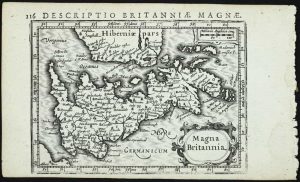
London, 1676-[77]
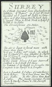
INCREDIBLY RARE. 60 x 95 mm., in good condition.
Stock number: 11846
£ 1,250
London, c.1690
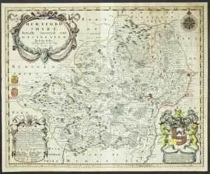
420 x 520 mm., early outline colour, light even tone, otherwise a good example.
Stock number: 11850
£ 1,100
Printed & Sold by Tho. Bowles Print & Map Seller next ye Chapter-House in St. Pauls Church yard & John Bowles Print & Map Seller at the Block Horse in Cornhill, London, c.1680-[1733]
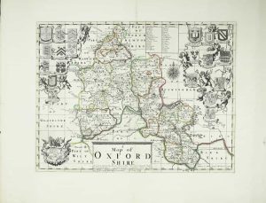
EXTREMELY RARE. 370 x 490 mm., in early outline colour, with very wide margins, with a couple of edge repairs, otherwise in very good condition.
Stock number: 11851
£ 3,500
Nuremberg, 1493
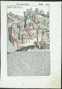
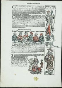
235 x 225 mm., woodblock engraving on a folio leaf of text, with old wash colour, with wax mark in lower margin, otherwise in good condition.
Stock number: 11853
£ 450
Published by W: Faden, Geographer to His Majesty and to His Royal Highness the Prince of Wales, Charing Cross, London, 12 August 1799
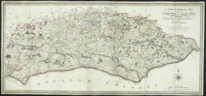
DAVID KINGSLEY'S COPY. 365 x 790 mm., dissected and laid on contemporary linen, full early wash colour, Faden's paper label affixed to verso, with publisher's original marbled paper slipcase, with Faden's label on front, a good example.
Stock number: 11854
£ 350
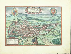
Cologne, 1581-[88]
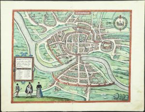
THE FIRST PRINTED PLAN OF BRISTOL. 340 x 440 mm., early wash colour, with minor crease in right margin, with Latin text to the verso, otherwise in good condition.
Stock number: 11754
£ 750
Mary Ann Rocque ye Corner of Old round Court Strand, London, c.1775
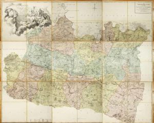
Folio engraved map on nine separate sheets, each approximately 540 x 685 mm., each dissected in four and backed on contemporary linen, each numbered in manuscript on the verso, in full contemporary wash colour, with original marbled paper slipcase, worn, with William Faden's label affixed, otherwise in good condition.
Stock number: 11798
£ 3,950
Cologne, 1581
THE FIRST AVAILABLE PLAN OF NORWICH. 295 x 425 mm., early wash colour, with small rust hole lower centrefold in the image, tear in the lower margin only repaired, otherwise in good condition.
Stock number: 11755
£ 595
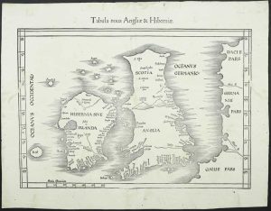
Leiden, 1584-[1588]
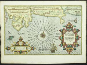
355 x 520 mm., with recent wash colour, a good example.
Stock number: 11758
£ 1,950
London, 1607-[37]
255 x 310 mm., with early outline and wash colour, small rust mark in upper margin, otherwise in good condition.
Stock number: 11761
£ 110
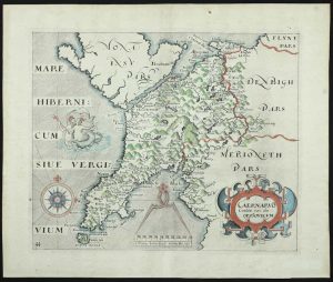
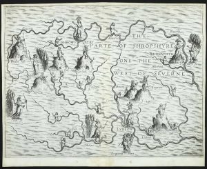
London, 1607-[37]
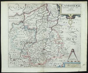
FIRST EDITION OF THE FIRST MAP OF CAMBRIDGESHIRE. 280 x 320 mm., recent outline and wash colour, light mark lower right corner, otherwise in good condition.
Stock number: 11762
£ 160
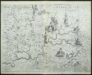
John Sudbury and George Humble, London, 1610-[12]
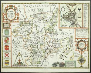
FIRST EDITION. 385 x 515 mm., recent outline and wash colour, two very small holes top and bottom of the centrefold just outside the borders, otherwise in very good condition.
Stock number: 11764
£ 1,250
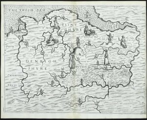
John Sudbury and George Humble, London, 1612-[32]
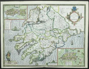
FIRST STATE. 390 x 515 mm., in recent wash colour, in good condition.
Stock number: 11765
£ 550
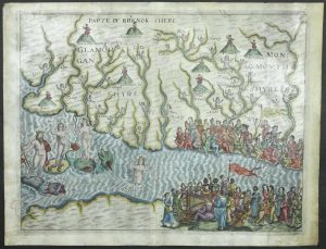
London, 1612
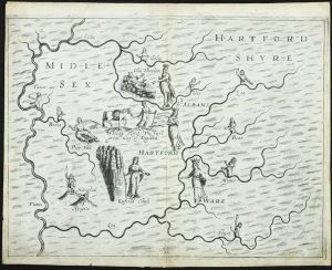
FIRST STATE. 250 x 335 mm., lower centrefold split professionally repaired, light mark in lower right corner, otherwise in good condition.
Stock number: 11766
£ 325
London, 1622
FIRST STATE. 255 x 340 mm., reinforcement to lower centrefold in the margin, otherwise in good condition.
Stock number: 11767
£ 295
London, 1612
FIRST STATE. 255 x 335 mm., reinforcement to lower centrefold, otherwise in good condition.
Stock number: 11768
£ 250
London, 1612
255 x 335 mm., cut close upper right with no loss of engraved surface, otherwise in good condition
Stock number: 11769
£ 225
London, 1612
250 x 330 mm., in fine modern wash colour, with a professionally extended margin to the right side and light stain lower left corner, otherwise in good condition.
Stock number: 11770
£ 395
Amsterdam, 1616
FIRST EDITION. 105 x 140 mm., in good condition.
Stock number: 11771
£ 125
Vienne, 1522-[41]
295 x 410 mm., with worm tracks in the margins repaired, one further at centrefold repaired, otherwise in good condition.
Stock number: 11736
£ 1,950