


Mr. Philip D. Burden
P.O. Box 863,
Chalfont St. Giles, Bucks HP6 9HD,
UNITED KINGDOM
Tel: +44 (0) 1494 76 33 13
Email: enquiries@caburden.com
14 rare maps matched your search criteria.
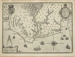
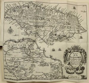
Sold by Tho:Bassett in Fleetstreet and Richard Chiswell in St. Pauls Church Yard, London, 1676
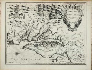
380 x 500 mm., with a small upper right corner margin repair, otherwise in good condition.
Stock number: 10915
$ 4,500
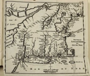
Ernest van Harrevelt; Daniel Jean Changuion, Amsterdam, 1773
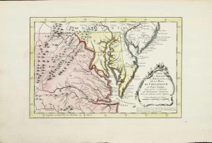
200 x 290 mm., in very nice full early wash colour, good condition.
Stock number: 10803
$ 450
Florence, c.1665
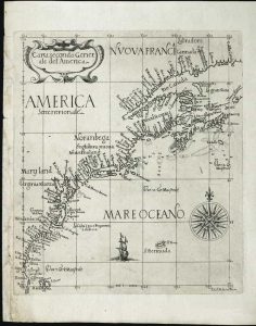
ONE OF ONLY TWO KNOWN EXAMPLES. 225 x 195 mm., small tear lower left corner repaired, otherwise in good condition.
Stock number: 10391
$ 65,000
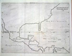
Paris, 1612
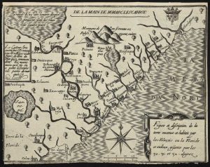
AN EXCEEDINGLY RARE MAP. 160 x 210 mm., with tight margins as always, lower margin just into the neatline, otherwise a good example of an extremely rare map.
Stock number: 10481
$ 22,500
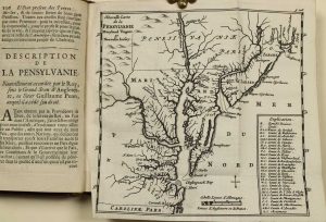
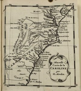
Printed by T. Milbourn, and sold by J. Williams Junior, in Cross-Keys-Court, in Little-Brittain, London, 1672
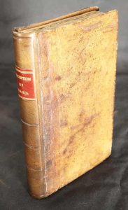
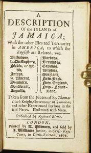
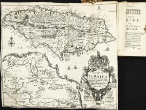
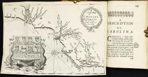
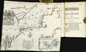
INCLUDING THE SECOND MAP OF CAROLINA. Octavo (150 x 95 mm.), full contemporary calf, blind panelled, rebacked with blind ruled compartments, red calf gilt title label, original endpapers. With typographic title page, dedication to Charles II, Preface, pp. (8), 192, with three folding maps, in excellent condition.
Stock number: 10277
$ 26,500
A Paris dans l'!sle sur Ie Quay de l'Orloge a la Sphere Royale avec Prive. Du Roy 1715, Paris, 1715
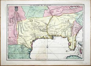
EXTREMELY RARE FIRST STATE OF NICOLAS DE FER'S LANDMARK MAP IN FULL CONTEMPORARY WASH COLOUR. 465 x 640 mm., in full early wash colour, faint water stain lower centrefold, otherwise in excellent condition.
Stock number: 9768
$ 49,500
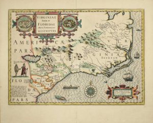
Theodore de Bry, Frankfurt, 1590
305 x 415 mm., with good margins in good condition.
Stock number: 8221
$ 18,500
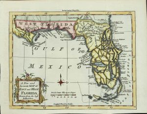
London, 1700-[c.05]
350 x 480 mm., in recent wash colour and good condition.
Stock number: 7988
$ 2,950
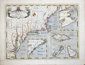
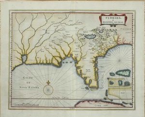
London, 1765
180 x 220 mm., in recent wash colour, good condition.
Stock number: 3993
$ 450
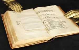
Chez Abraham Wolfgang, pres la Bourse, Amsterdam, 1688
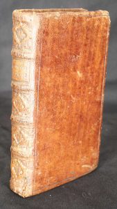
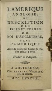
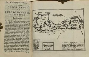
WITH A PREVIOUSLY UNRECORDED FIRST STATE OF THE MAP OF NEW ENGLAND. Duodecimo (150 x 85 mm.), full contemporary calf, blind panelled, with ribbed spine, very ornate gilt decoration to compartments, gilt title, gilt slightly worn. With typographic title page, pp. [4], 331, [1], p. 236 erroneously numbered 136, with 7 folding maps, otherwise in excellent condition.
Stock number: 9894
$ 4,950
Madrid, 1601
215 x 280 mm., in good condition.
Stock number: 6446
$ 1,950
Amsterdam, 1606-[19]
350 x 490 mm., early wash colour with French text, in good condition.
Stock number: 9123
$ 3,500
Iohn Thornton at ye Platt in ye Minories./ By Robt. Morden at the Atlas in Corn-hill./ And by Phillip Lea at ye Atlas & Herculus/ in the Poultry, London, c.1685
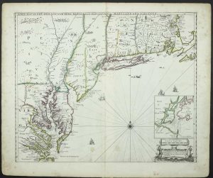
The FIRST STATE in fine EARLY OUTLINE COLOUR of the FIRST PLAN OF NEW YORK HARBOUR. 450 x 550 mm., in early outline colour, with two marks lower centre, otherwise in good condition.
Stock number: 8223
$ 29,500
Leiden, 1630
275 x 350 mm., in recent wash colour, good condition.
Stock number: 6044
$ 3,950