


Mr. Philip D. Burden
P.O. Box 863,
Chalfont St. Giles, Bucks HP6 9HD,
UNITED KINGDOM
Tel: +44 (0) 1494 76 33 13
Email: enquiries@caburden.com
11 rare maps matched your search criteria.
Sold by Tho:Bassett in Fleetstreet and Richard Chiswell in St. Pauls Church Yard, London, 1676
380 x 505 mm., in good condition.
Stock number: 10914
$ 5,500
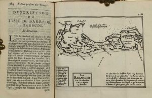
Ernest van Harrevelt; Daniel Jean Changuion, Amsterdam, 1773
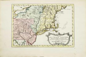
210 x 295 mm., in very nice full early wash colour, good condition.
Stock number: 10802
$ 350
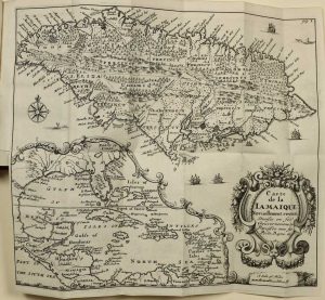
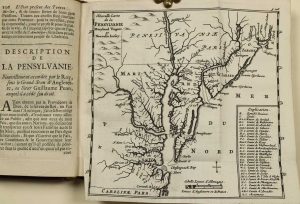
Printed by T. Milbourn, and sold by J. Williams Junior, in Cross-Keys-Court, in Little-Brittain, London, 1672
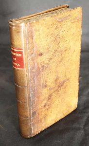
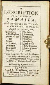
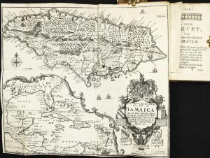
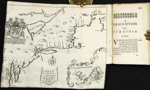
INCLUDING THE SECOND MAP OF CAROLINA. Octavo (150 x 95 mm.), full contemporary calf, blind panelled, rebacked with blind ruled compartments, red calf gilt title label, original endpapers. With typographic title page, dedication to Charles II, Preface, pp. (8), 192, with three folding maps, in excellent condition.
Stock number: 10277
$ 26,500
Florence, c.1665
ONE OF ONLY TWO KNOWN EXAMPLES. 225 x 195 mm., small tear lower left corner repaired, otherwise in good condition.
Stock number: 10391
$ 65,000
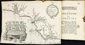
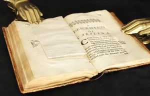
Chez Abraham Wolfgang, pres la Bourse, Amsterdam, 1688
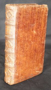
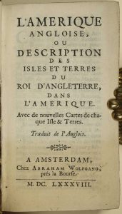
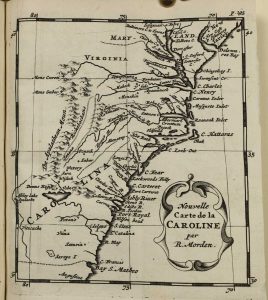
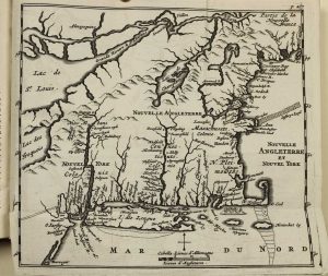
WITH A PREVIOUSLY UNRECORDED FIRST STATE OF THE MAP OF NEW ENGLAND. Duodecimo (150 x 85 mm.), full contemporary calf, blind panelled, with ribbed spine, very ornate gilt decoration to compartments, gilt title, gilt slightly worn. With typographic title page, pp. [4], 331, [1], p. 236 erroneously numbered 136, with 7 folding maps, otherwise in excellent condition.
Stock number: 9894
$ 4,950
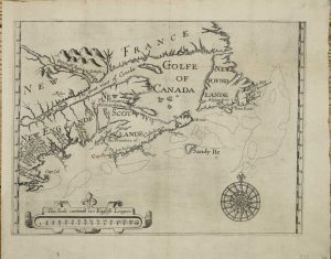
London, 1700-[c.05]
350 x 480 mm., in recent wash colour and good condition.
Stock number: 7988
$ 2,950
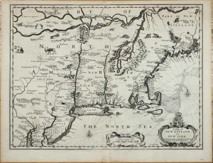
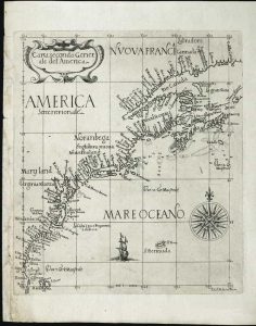
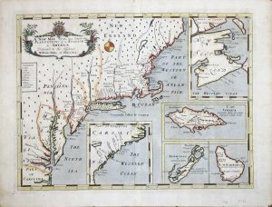
London, 1624
AN EXCEEDINGLY RARE MAP in its FIRST STATE. 250 x 340 mm., with wide margins, with some repair to double folds as might be expected, light fold along the centre, otherwise in good condition.
Stock number: 9881
$ 15,950
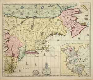
Iohn Thornton at ye Platt in ye Minories./ By Robt. Morden at the Atlas in Corn-hill./ And by Phillip Lea at ye Atlas & Herculus/ in the Poultry, London, c.1685
The FIRST STATE in fine EARLY OUTLINE COLOUR of the FIRST PLAN OF NEW YORK HARBOUR. 450 x 550 mm., in early outline colour, with two marks lower centre, otherwise in good condition.
Stock number: 8223
$ 29,500
Boston, 1796-1803
520 x 830 mm., light browning to the margins. There is insignificant tiny loss to the margin line lower left, and to the margin upper left.
Stock number: 4259
$ 12,500
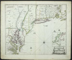
C. Browne at the North gate of the Royal Exchange & by him at the Globe by the West end of St. Paul's Church, London, 1712
BEAUTIFUL EARLY WASH COLOUR. 500 x 595 mm., in magnificent full early wash colour, good condition.
Stock number: 8247
$ 49,500
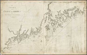
London, 5 August 1775
![[Chart of the Harbour of Boston]/ Nautical Remarks and Observations for the Chart of the Harbour of Boston. Composed from different Surveys; but principally from that taken in 1769, by George Callendar, Late Master of His Majesty's Ship the Romney.](https://www.caburdenraremaps.com/wp-content/uploads/2022/01/8314a-300x213.jpg)
![[Chart of the Harbour of Boston]/ Nautical Remarks and Observations for the Chart of the Harbour of Boston. Composed from different Surveys; but principally from that taken in 1769, by George Callendar, Late Master of His Majesty's Ship the Romney.](https://www.caburdenraremaps.com/wp-content/uploads/2022/01/8314b-233x300.jpg)
![[Chart of the Harbour of Boston]/ Nautical Remarks and Observations for the Chart of the Harbour of Boston. Composed from different Surveys; but principally from that taken in 1769, by George Callendar, Late Master of His Majesty's Ship the Romney.](https://www.caburdenraremaps.com/wp-content/uploads/2022/01/8314c-246x300.jpg)
FIRST STATE. ACQUIRED BY HUGH PERCY, THE SAVIOUR OF THE BRITISH AT LEXINGTON AND CONCORD. 705 x 1040 mm., in 2 sheets joined, large aquatint and etched engraving, UNFOLDED AND UNCUT, with the LVG watermark. With pamphlet, quarto (280 x 230 mm.), original blue wrappers, typographic title, pp. 5-(12), there are no pages 3-4 which agrees with the John Carter Brown example.
Stock number: 8314
$ 22,500