


Mr. Philip D. Burden
P.O. Box 863,
Chalfont St. Giles, Bucks HP6 9HD,
UNITED KINGDOM
Tel: +44 (0) 1494 76 33 13
Email: enquiries@caburden.com
29 rare maps matched your search criteria.
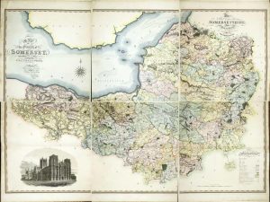
Published by W: Faden, Geographer to His Majesty and to His Royal Highness the Prince of Wales, Charing Cross, London, 12 August 1799
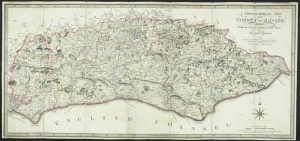
DAVID KINGSLEY'S COPY. 365 x 790 mm., dissected and laid on contemporary linen, full early wash colour, Faden's paper label affixed to verso, with publisher's original marbled paper slipcase, with Faden's label on front, a good example.
Stock number: 11854
£ 350
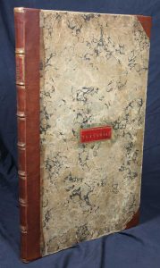
Mary Ann Rocque ye Corner of Old round Court Strand, London, c.1775
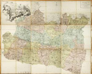
Folio engraved map on nine separate sheets, each approximately 540 x 685 mm., each dissected in four and backed on contemporary linen, each numbered in manuscript on the verso, in full contemporary wash colour, with original marbled paper slipcase, worn, with William Faden's label affixed, otherwise in good condition.
Stock number: 11798
£ 3,950
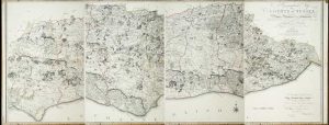
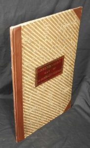
Published for the Proprietors Greenwood, Pringle & Co, 13 Regent Street, Pall Mall, London, 12 December 1820
1445 x 1115 mm., in four individual sheets, a couple of marks on the lower left sheet, otherwise in good condition.
Stock number: 11277
£ 1,500
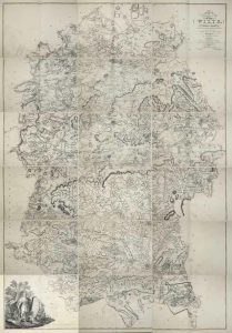
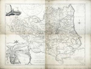
William Faden, London, 1773-[1 January 1810]
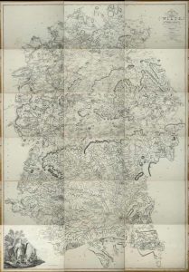
A VERY LARGE TWO INCH TO THE MILE MAP. Eighteen double-page sheets each approximately 465 x 645 mm., all in early outline colour, most internal edges trimmed to neatline with no loss of any imprint, a couple of minor tears repaired, extreme lower right corner a little waterstained, otherwise in good condition.
Stock number: 11278
£ 1,250
Manchester, 1741-[c.46]
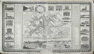
THE FIRST PLAN OF MANCHESTER. 695 x 1230 mm., in two sheets joined, with some support repairs to the verso but no apparent loss, edges re-margined just affecting ornamental border below, otherwise in good condition.
Stock number: 11193
£ 3,500
William Faden, London, 4 June 1795
790 x 1915 mm., the whole, in four separate sheets, early outline colour, trimmed to the top and bottom borders, sheet 2 with tear upper left just into the image, repaired, a couple of areas of margin weakness otherwise a good example.
Stock number: 11009
£ 1,750
William Faden, London, 1773-[1 January 1810]
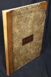
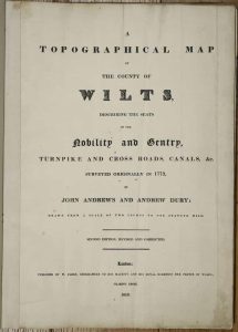
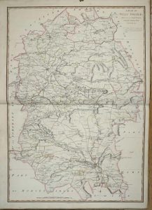
Folio (560 x 400 mm.), contemporary half calf, ornate blind ruled, with original red calf gilt title label affixed to upper board, rebacked. With typographic title page, index table, general index map of the county, and 18 double page sheets each approximately 460 x 630 mm., all in early outline colour, light offsetting as usual, otherwise in good condition.
Stock number: 9574
£ 1,750
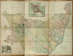
Published for the Proprietors By George Pringle Junr. 70 Queen Street, Cheapside, London, 1 October 1822
LARGE SCALE. Folio (660 x 420 mm.), later half calf, preserving original red morocco gilt title label affixed to upper board, housed in a modern solander box. Six double page sheets making up a map 1360 x 1860 mm., printed on J. Whatman wove paper watermarked 1821 all in full early wash colour, crease in lower corner of first sheet, otherwise in good condition.
Stock number: 10880
£ 1,950
William Faden, Geographer to the King, (Successor to Mr. Jefferys) Charing Cross, London, 1783
LARGE SCALE. 1310 x 1610 mm., on six sheets, each dissected and mounted on linen, in full early wash colour, minor surface dirt, folding into near contemporary marbled paper slipcase, early gilt red calf label affixed to upper cover, in very good condition.
Stock number: 10881
£ 3,750
No. 81 Fleet Street, London. (From 38 Ludgate Street), London, 1830-[40]
UNRECORDED ISSUE. 525 x 1380 mm., early outline and wash colour, dissected and laid on linen, green cloth ends, one small split, otherwise in good condition.
Stock number: 10850
£ 2,500
Printed for John Chapman Land Surveyor, London, 1768
THE FIRST LARGE SCALE MAP OF THE COUNTY. Four uncut sheets 490 x 630 mm. each, with deckled edges, some surface dirt commensurate with separate publication, otherwise in good condition.
Stock number: 10486
£ 1,250
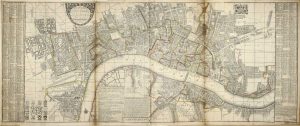
Sold by Robert Green at ye Rose and Crown, in Budg-Row. And by Robert Morden. at ye Atlas in Cornhill, London, 1675
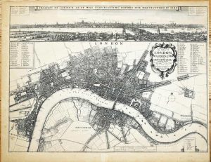
FIRST STATE. 435 x 585 mm., etching, light toning to the paper, otherwise in very good condition.
Stock number: 10468
£ 17,500
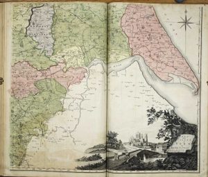
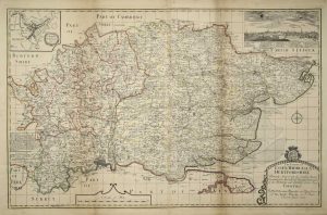
R. Wilkinson, No. 58 Cornhill, London, 7 September 1786
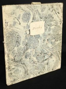
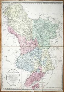
735 x 525 mm., in fine early wash colour, cut and dissected, laid on contemporary linen, with original marbled paper slipcase in excellent condition, paper label with manuscript 'Derby' on one side, very good condition.
Stock number: 9888
£ 550
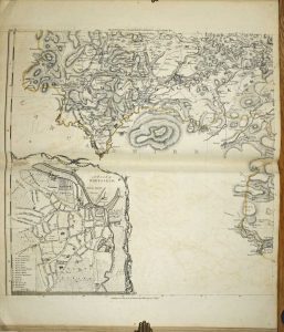
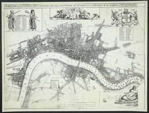
John Rocque, London, 1750
450 x 690 mm., in very good condition printed on excellent thick paper.
Stock number: 9299
£ 2,500
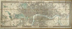
Roadway Timetables, Bookings & Publications Ltd., London, [1932]
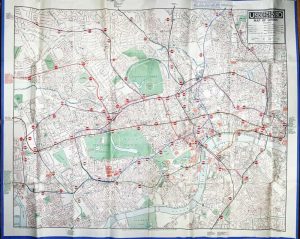
1010 x 1265 mm., colour printed lithographic map with blue edged border all the way around, with original folds in very good condition.
Stock number: 9018
£ 2,500
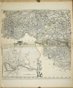
Thomas Bowles, Robert Wilkinson and Robert Sayer, London, 1735-[c.79]
515 x 700 mm., early outline colour, with light vertical fold parallel to the centrefold, otherwise in good condition.
Stock number: 8953
£ 950
London, 1772-[87]
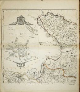
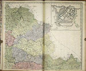
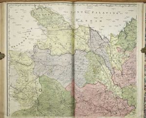
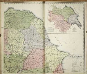
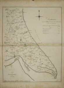
Large folio (620 x 390 mm.), contemporary half russia, gilt stamped red calf title label affixed to both boards, with marbled endpapers, blank endpapers, Jeffreys map of Yorkshire in 20 sheets in early outline colour each approximately 600 x 600 mm., including key map as plate V; bound with the Tuke large scale map of the county in 4 sheets, each approximately 600 x 725 mm., each in full early wash colour; bound with Tuke's map of Holderness 625 x 485 mm. With light offsetting to the Jefferys, some foxing to the Holderness otherwise in very good condition.
Stock number: 8684
£ 7,500
John Bowles at Mercers Hall in Cheapside, London, 1728
590 x 1440 mm., early outline colour, five sheets joined (three folio and two side panels), some light toning along two joins with professional restoration, minimal loss, otherwise in good condition.
Stock number: 8227
£ 4,500
London, 1726
590 x 925 mm., early outline colour, with secondary folds as issued to facilitate binding, some to lower right fold repair work and at the double folds, light brown to right fold otherwise in good condition.
Stock number: 8175
£ 1,500
John Seller and John Hill, London, c.1676
ONLY THREE RECORDED EXAMPLES. 445 x 590 mm., with some loss of engraved area upper and lower right and lower left, trimmed close to the engraved border but with extended margins, the double folds are generally in good condition with some light reinforcement on the verso only, otherwise okay for an extremely rare map.
Stock number: 8176
£ 4,950