


Mr. Philip D. Burden
P.O. Box 863,
Chalfont St. Giles, Bucks HP6 9HD,
UNITED KINGDOM
Tel: +44 (0) 1494 76 33 13
Email: enquiries@caburden.com
11 rare maps matched your search criteria.
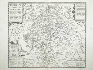
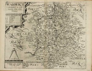
London, 1612
FIRST STATE. 255 x 335 mm., reinforcement to lower centrefold, otherwise in good condition.
Stock number: 11768
£ 250
Amsterdam, 1646
410 x 500 mm., in early outline colour with wash to the cartouches, Dutch text to the verso, in good condition.
Stock number: 10900
£ 275
Amsterdam, 1645
410 x 500 mm., in early outline colour with wash to the cartouches, French text to the verso, in good condition.
Stock number: 10442
£ 375
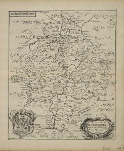
Amsterdam, 1765-[70]
190 x 175 mm., in very good condition.
Stock number: 9755
£ 70
Printed and sould by Jo. Overton over against St: Pulchers church, London, c.1603-[c.1720]
390 x 470 mm., with wide margins, in very good condition.
Stock number: 9624
£ 1,250
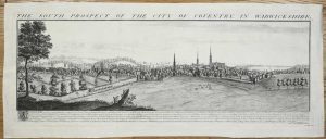
London, 1772
360 x 420 mm., with accompanying text in good condition.
Stock number: 8339
£ 80
London, 1681-[93]
195 x 205 mm., in good condition.
Stock number: 5706
£ 90
London, 1865
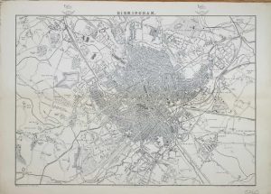
310 x 450 mm., with a light crease otherwise in good condition.
Stock number: 5260
£ 85
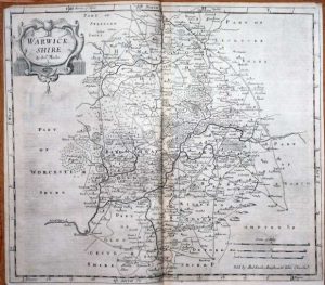
Robert Sayer, London, 1731-[74]
310 x 800 mm., margins trimmed but still ample, otherwise in good condition.
Stock number: 3648
£ 450
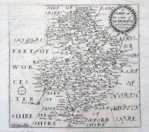
London, 1673
315 x 260 mm. later outline colour, with small hole in centrefold repaired,
Stock number: 2618
£ 150
London, 1607
290 x 350 mm., uncoloured, folded as issued.
Stock number: 2619
£ 175