


Mr. Philip D. Burden
P.O. Box 863,
Chalfont St. Giles, Bucks HP6 9HD,
UNITED KINGDOM
Tel: +44 (0) 1494 76 33 13
Email: enquiries@caburden.com
630 rare maps matched your search criteria.
London, 1803
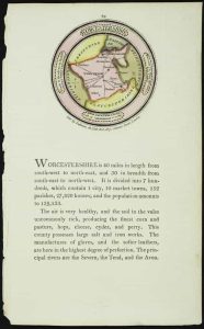
70 x 70 mm., with text below, in fine full early wash colour.
Stock number: 11790
£ 95
Paris, 1824
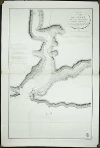
930 x 595 mm., small margin tear repaired, light offsetting, otherwise in good condition.
Stock number: 11792
£ 175
Cornelis Claesz and Jodocus Hondius , Amsterdam, 1595-[1628]
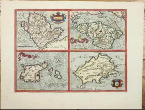
320 x 435 mm., with recent wash colour, small paper fault near centrefold by that of Jersey, otherwise in good condition.
Stock number: 11325
£ 295
Amsterdam, 1607-[08]
135 x 170 mm., a nice dark impression, in good condition.
Stock number: 11337
£ 135
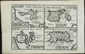
T. Cotes, for Michael Sparke and Samuel Cartwright, London, 1637
135 x 170 mm., English text on the verso, in good condition.
Stock number: 11339
£ 110
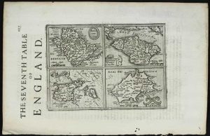
John Sudbury and George Humble, London, 1610-[27]
![Holy Iland [on sheet with] Garnsey [and] Farne [and] Iarsey](https://www.caburdenraremaps.com/wp-content/uploads/2026/02/11341-300x234.jpg)
THE FIRST REASONABLY ACCURATE MAP OF JERSEY. 385 x 510 mm., with recent outline and wash colour, in good condition.
Stock number: 11341
£ 495
London, 1627-[46]
85 x 120 mm., in good condition.
Stock number: 11348
£ 125
Paris, 1757
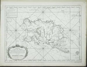
440 x 575 mm., on thick paper, light foxing at extremities, otherwise in good condition.
Stock number: 11522
£ 750
Laurie & Whittle, 53, Fleet Street, London, 1779-[96]
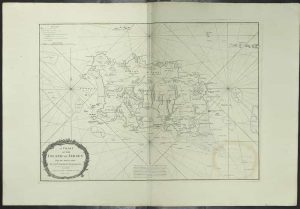
500 x 695 mm., two minor tears lower margin repaired, light offset of title cartouche, evenly toned, otherwise in good condition.
Stock number: 11604
£ 1,500
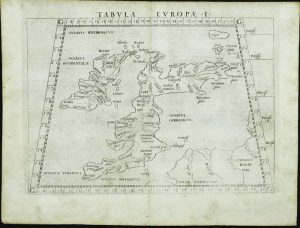
Venice, 1528
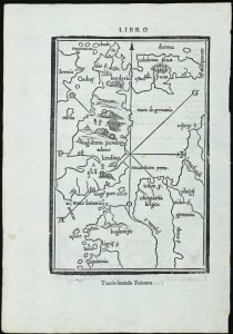
FIRST EDITION. 230 x 155 mm. & 135 x 145 mm., in good condition.
Stock number: 11735
£ 995
Basle, 1540-[45]
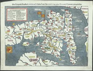
265 x 345 mm., recent wash colour, trimmed upper left corner, otherwise in good condition.
Stock number: 11739
£ 595
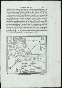
Lyon, 1564
90 x 130 mm., on a page with text, in good condition.
Stock number: 11741
£ 150
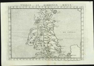
Venice, 1561
FIRST EDITION, FIRST ISSUE. 190 x 255 mm., light even toning, otherwise in good condition.
Stock number: 11742
£ 295
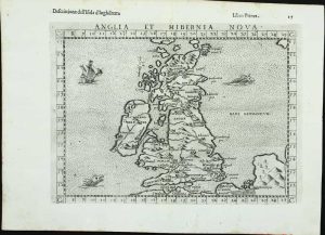
Venice, 1561
FIRST EDITION, FIRST ISSUE. 190 x 255 mm., light even toning, otherwise in good condition.
Stock number: 11743
£ 375
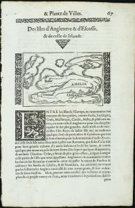
Heirs of Melchoir Sessa, Venice, 1561-[98]
205 x 260 mm., light foxing in upper margin, otherwise in good condition.
Stock number: 11744
£ 350
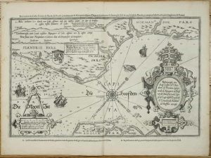
Antwerp, 1570-[79]
345 x 500 mm., in good condition.
Stock number: 11746
£ 850
Paris, c.1605
385 x 480 mm., with double folds as usual, small tear at double fold professionally repaired, otherwise in good condition.
Stock number: 11759
£ 1,850
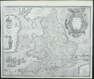
Arthur Tooker over against Northumberland house in ye Strand and Wm. Battersby at Thavies Inn Gate in Holborn, London, 1680
ONE OF ONLY FOUR RECORDED EXAMPLES. 550 x 455 mm., early outline colour, repaired centrefold splits both sides, otherwise in good condition.
Stock number: 11783
£ 3,500
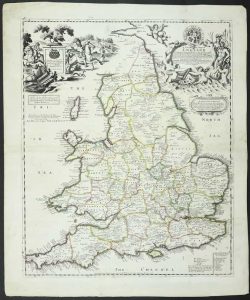
Robert Morden at the Atlas in Cornhill and by Jos. Pask at the 3 Ink Bottles in Castle Ally ath the West end of the Royall Exchang, London, c.1690
FOUR RECORDED EXAMPLES. 600 x 520 mm., with professional repair to splits around the centrefold, with extended margins both sides and facsimile neatline lower left, otherwise in good condition.
Stock number: 11784
£ 2,750
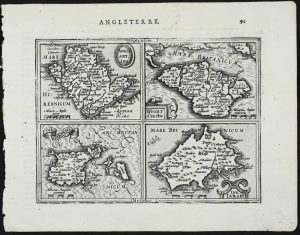
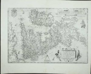
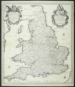
Jean Bellere & Cornelis Claesz, Antwerp, 1583-[90]
350 x 525 mm., light foxing to the left side, otherwise in very good condition.
Stock number: 11331
£ 1,500