


Mr. Philip D. Burden
P.O. Box 863,
Chalfont St. Giles, Bucks HP6 9HD,
UNITED KINGDOM
Tel: +44 (0) 1494 76 33 13
Email: enquiries@caburden.com
69 rare maps matched your search criteria.
Venice, 1528-[47]
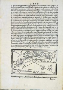
85 x 145 mm., small area of margin loss repaired in far upper right margin level with the text, otherwise good condition.
Stock number: 5237
$ 1,950
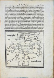
Leiden, 1630
275 x 350 mm., in recent wash colour, good condition.
Stock number: 6044
$ 3,950
John Stockdale, London, 1792
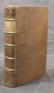
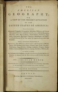
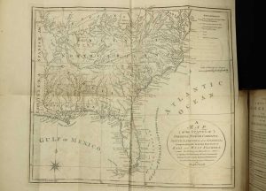
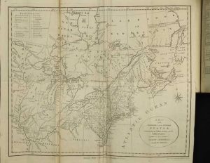
Octavo (220 x 145 mm.), full modern calf, gilt ruled ribbed spine with calf gilt title label, pp. xvi, 536. With two large folding maps and a folding table, in good condition.
Stock number: 7142
$ 1,250
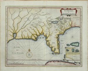
Madrid, 1601
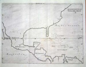
215 x 280 mm., in good condition.
Stock number: 6446
$ 1,950
Strasbourg, 1522-[25]
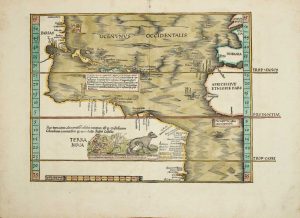
290 x 380 mm., in FULL EARLY WASH COLOUR, in good condition.
Stock number: 8220
$ 19,500
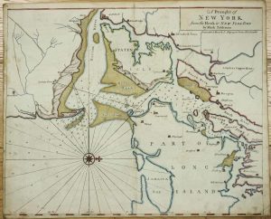
Iohn Thornton at ye Platt in ye Minories./ By Robt. Morden at the Atlas in Corn-hill./ And by Phillip Lea at ye Atlas & Herculus/ in the Poultry, London, c.1685
The FIRST STATE in fine EARLY OUTLINE COLOUR of the FIRST PLAN OF NEW YORK HARBOUR. 450 x 550 mm., in early outline colour, with two marks lower centre, otherwise in good condition.
Stock number: 8223
$ 29,500
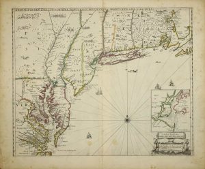
I. Mount & T. Page upon Tower Hill, London, 1732-[73]
460 x 570 mm., in recent outline and wash colour, with margin's all round, slim on the lower and lower left, light offsetting and foxing otherwise in good condition.
Stock number: 8225
$ 3,950
London, 1765
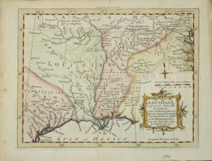
180 x 230 mm., modern wash colour, in good condition.
Stock number: 3994
$ 450
Amsterdam, 1698
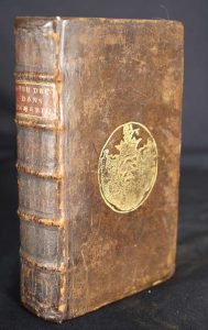
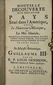
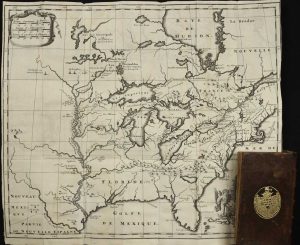
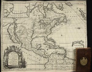
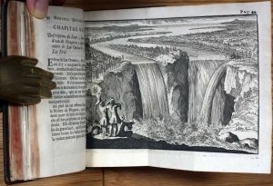
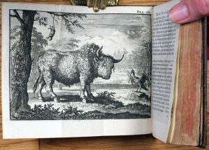
CONTAINING THE FIRST ILLUSTRATION OF NIAGARA FALLS. Duodecimo, full contemporary calf, gilt boards bearing arms, raised bands to spine with gilt red calf title label. With 2 engraved folding maps and 2 engraved folding plates in excellent condition. With engraved frontispiece; (70), 313, (8 num 313*), pp. 315-506.
Stock number: 1731
$ 9,500