Rare Maps and Prints
- World & Celestial
- North America
- West Indies, South & Central America
- British Isles
- All
- British Isles
- English counties
- All
- Large-scale
- Bedfordshire
- Berkshire
- Buckinghamshire
- Cambridgeshire
- Cheshire
- Cornwall
- Cumberland
- Derbyshire
- Devon
- Dorset
- Durham
- Essex
- Gloucestershire
- Hampshire
- Herefordshire
- Hertfordshire
- Huntingdonshire
- Islands
- Kent
- Lancashire
- Leicestershire
- Lincolnshire
- Middlesex
- Norfolk
- Northamptonshire
- Northumberland
- Nottinghamshire
- Oxfordshire
- Rutland
- Shropshire
- Somerset
- Staffordshire
- Suffolk
- Surrey
- Sussex
- Warwickshire
- Westmoreland
- Wiltshire
- Worcestershire
- Yorkshire
- Wales
- Scotland
- Ireland
- Western Europe
- Eastern Europe
- Middle East
- Africa
- Asia
- Australasia & Pacific
- Decorative Prints
- Title Pages
Mr. Philip D. Burden
P.O. Box 863,
Chalfont St. Giles, Bucks HP6 9HD,
UNITED KINGDOM
Tel: +44 (0) 1494 76 33 13
Email: enquiries@caburden.com
Rare maps of Cornwall
22 rare maps matched your search criteria.
WAGHENAER, Lucas Jansz.
Amsterdam, 1583-[85]
330 x 520 mm., dark impression, light soiling and staining to margins, paper fault to lower right margin, some small holes filled with old paper at centrefold, only visible from the verso, otherwise a very good example.
Stock number: 4135
£ 1,950
TUNNICLIFF, William
Printed for the Author, by B. C. Collins, and Sold by him, Salisbury, 1791
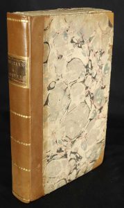
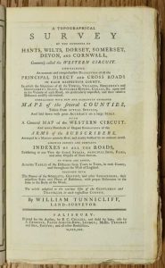
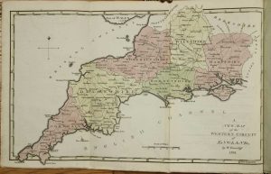
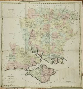
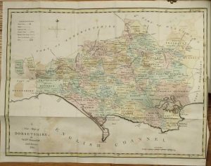
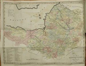
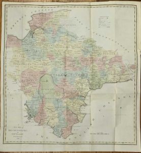
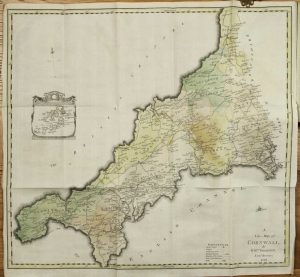
Octavo (230 x 140 mm.), recent half calf, preserving original marbled paper boards, uncut, spine with gilt ruled compartments preserving original gilt calf title label. Six parts bound as one, pp. (xii), 256, with 7 folding maps comprising one general map of the region and large folding ones for each of the six counties, all in early wash colour, each with a double page Index Table of Distances and 48 plates of the Arms of the Nobility for each county, in good condition.
Stock number: 10336
£ 650


