


Mr. Philip D. Burden
P.O. Box 863,
Chalfont St. Giles, Bucks HP6 9HD,
UNITED KINGDOM
Tel: +44 (0) 1494 76 33 13
Email: enquiries@caburden.com
17 rare maps matched your search criteria.
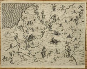
John Sudbury and George Humble, London, 1612
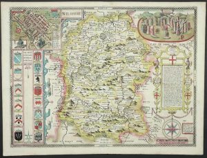
FIRST EDITION IN FULL EARLY WASH COLOUR. 380 x 510 mm., full early wash colour, small paper crease upper right corner, otherwise in very good condition.
Stock number: 11256
£ 1,950
London, c.1785
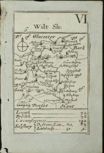
95 x 60 mm., laid on paper as issued, in good condition.
Stock number: 11274
£ 350
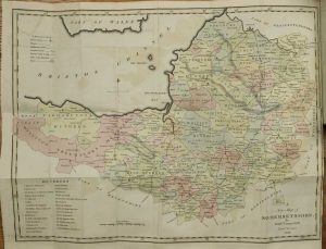
Published for the Proprietors Greenwood, Pringle & Co, 13 Regent Street, Pall Mall, London, 12 December 1820
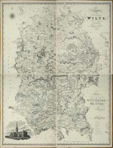
1445 x 1115 mm., in four individual sheets, a couple of marks on the lower left sheet, otherwise in good condition.
Stock number: 11277
£ 1,500
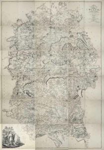
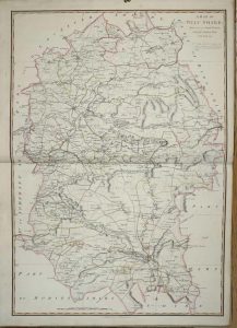
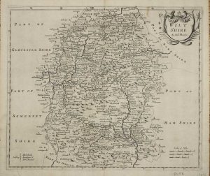
William Faden, London, 1773-[1 January 1810]
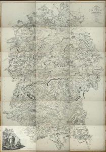
A VERY LARGE TWO INCH TO THE MILE MAP. Eighteen double-page sheets each approximately 465 x 645 mm., all in early outline colour, most internal edges trimmed to neatline with no loss of any imprint, a couple of minor tears repaired, extreme lower right corner a little waterstained, otherwise in good condition.
Stock number: 11278
£ 1,250
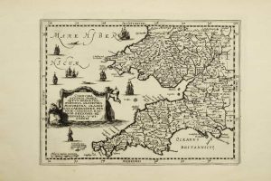
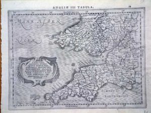
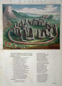
Amsterdam, 1645
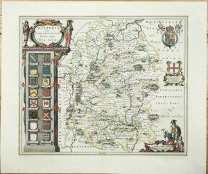
415 x 505 mm., early outline and wash colour, with very light grey wash marks in portions of the margin, otherwise in good condition.
Stock number: 11261
£ 295
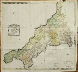
Sold by Geo: Willdey at the Great Toy, Spectacle, China ware, & PrintShop, the Corner of Ludgate Street near St. Pauls, London, 1576-[c.1732]
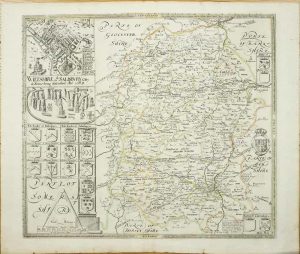
420 x 475 mm., early outline colour, in good condition.
Stock number: 11263
£ 1,250
London, 1607-[10]
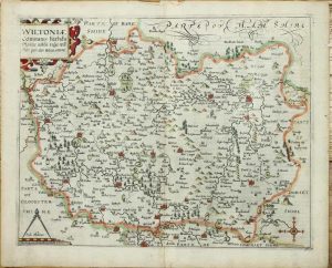
285 x 355 mm., recent outline colour, good condition.
Stock number: 11259
£ 225
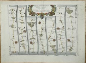
London, 1675
335 x 470 mm., later wash colour, very small paper flaw in second strip, otherwise in good condition.
Stock number: 11265
£ 425
London, 1675
340 x 455 mm., recent wash colour, light paper crease in upper right margin, otherwise a fine engraving in good condition.
Stock number: 11267
£ 250
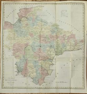
William Faden, London, 1773-[1 January 1810]
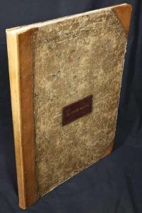
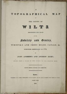
Folio (560 x 400 mm.), contemporary half calf, ornate blind ruled, with original red calf gilt title label affixed to upper board, rebacked. With typographic title page, index table, general index map of the county, and 18 double page sheets each approximately 460 x 630 mm., all in early outline colour, light offsetting as usual, otherwise in good condition.
Stock number: 9574
£ 1,750
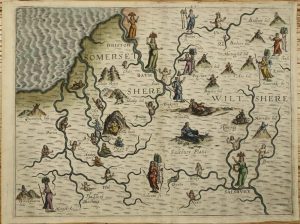
London, 1612-[13]
250 x 330 mm., with minor repair to verso upper right, otherwise in good condition.
Stock number: 10911
£ 275
London, 1612-[13]
250 x 330 mm., recent outline colour, in good condition.
Stock number: 10903
£ 350
Amsterdam, 1630-[1735]
185 x 255 mm., in good condition.
Stock number: 10678
£ 150
Amsterdam, 1630
195 x 255 mm., in good condition.
Stock number: 6234
£ 150
London, 1695
360 x 420 mm., faint mark upper right margin, otherwise in good condition.
Stock number: 5458
£ 65
Amsterdam, c.1650
195 x 250 mm., on a sheet of text, in superb early wash colour, good condition.
Stock number: 5377
£ 165
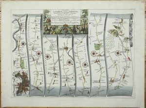
Printed for the Author, by B. C. Collins, and Sold by him, Salisbury, 1791
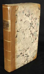
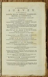
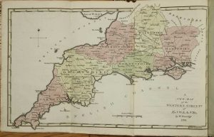
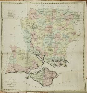
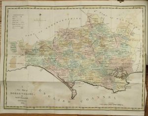
Octavo (230 x 140 mm.), recent half calf, preserving original marbled paper boards, uncut, spine with gilt ruled compartments preserving original gilt calf title label. Six parts bound as one, pp. (xii), 256, with 7 folding maps comprising one general map of the region and large folding ones for each of the six counties, all in early wash colour, each with a double page Index Table of Distances and 48 plates of the Arms of the Nobility for each county, in good condition.
Stock number: 10336
£ 650