Mr. Philip D. Burden
P.O. Box 863,
Chalfont St. Giles, Bucks HP6 9HD,
UNITED KINGDOM
Tel: +44 (0) 1494 76 33 13
Email: enquiries@caburden.com
48 rare maps matched your search criteria.
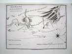
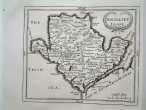
London, 1578-[1645]
EXTREMELY RARE STATE. 355 x 465 mm. Uncoloured, light age toning to the margins, a centrefold split in the lower margin and a short tear, again in the lower margin, both repaired with old paper, both short of the image, otherwise a very good example.
Stock number: 4268
£ 2,250
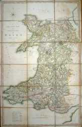
London, 1797
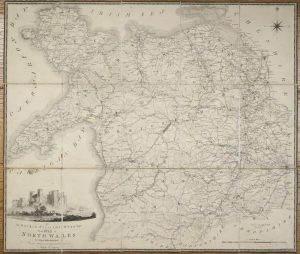
FIRST EDITION. 620 x 730 mm. Dissected and laid on linen, folding into the original marbled slipcase, with contemporary label inscribed by the owner 'Dawson', worn. A couple of minor marks to the map but generally a fine copy.
Stock number: 4255
£ 395
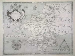
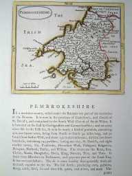
London, 1577-[c.1689]
395 x 485 mm., early outline colour; short centrefold splits to upper and lower margin, small hole upper centre in the map, repaired, with very large margins, otherwise a fine example.
Stock number: 4265
£ 890
London, 1808
Large folding map (870 x 550 mm.), printed in two sheets, joined, dissected, backed on contemporary linen. In early outline colour. With very minor foxing.
Stock number: 3974
£ 180
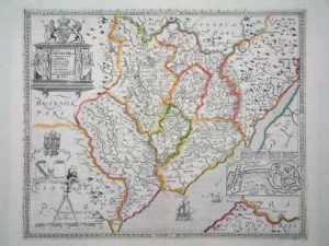
Amsterdam, 1645
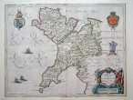
380 x 500 mm. Early outline wash colour. Slight split to upper centrefold. Some paper thinning. Some ink stains to text on reverse.
Stock number: 2654
£ 250