


Mr. Philip D. Burden
P.O. Box 863,
Chalfont St. Giles, Bucks HP6 9HD,
UNITED KINGDOM
Tel: +44 (0) 1494 76 33 13
Email: enquiries@caburden.com
95 rare maps matched your search criteria.
Paris, 1757
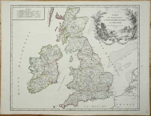
FIRST STATE. 475 x 580 mm., early outline colour, in good condition.
Stock number: 11273
£ 225
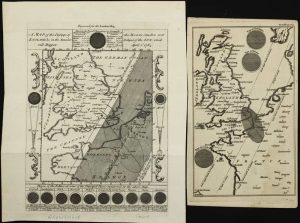
Vienna, 1787-[c.90]
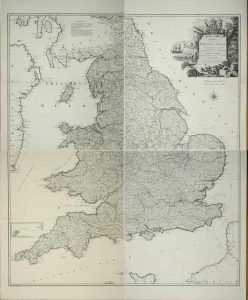
Four loose double-page sheets, each approximately 635 x 540 mm., making a map about 1270 x 1080 mm. in total, early outline colour, in very good condition.
Stock number: 11275
£ 275
Robert Laurie and James Whittle, London, 1752-[94]
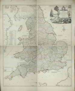
1270 x 1080 mm., four sheets deckled edged, in early outline colour, with a couple of margin tears, one in lower right sheet just touching the engraved plate mark, otherwise in good condition.
Stock number: 11276
£ 350
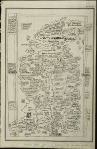
London, c.1675
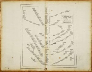
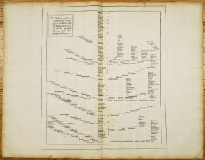
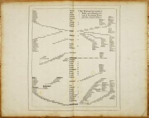

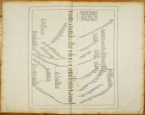
FIRST EDITION, FIRST ISSUE OF THE FIRST DIAGRAMMATIC ROAD MAP OF ENGLAND AND WALES. Five folio pages (405 x 360 mm. each), a couple of rustmarks on one sheet, light centrefold browning, otherwise in good condition.
Stock number: 9572
£ 1,350
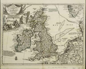
Leipzig, c.1745
![Gros Britanni[en] oder Engelland Schottland und Irrland](https://www.caburdenraremaps.com/wp-content/uploads/2023/11/10626-300x202.jpg)
160 x 240 mm., early wash colour, light soiling lower right, otherwise in good condition.
Stock number: 10626
£ 125
Augsburg, 1744
200 x 260 mm., early outline colour, light foxing to margins, otherwise in good condition.
Stock number: 10606
£ 250
Covens & Mortier, Amsterdam, 1714-[c.1735]
225 x 295 mm., early outline colour, in good condition.
Stock number: 10605
£ 150
London, 1780
Four engraved maps, each circa 245 x 370 mm., in good condition.
Stock number: 10604
£ 195
London, 1764
215 x 160 mm., and 195 x 115 mm. light stain to smaller item, otherwise in good condition.
Stock number: 10878
£ 295
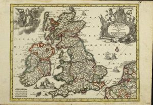
London, 1668-[70]
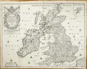
400 x 515 mm., with folds as published some reinforced folds on the verso, otherwise in good condition.
Stock number: 10564
£ 275
Amsterdam, c.1695-[c.1720]
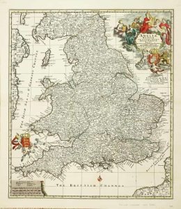
565 x 495 mm., early outline colour, on good thick paper in very good condition.
Stock number: 10549
£ 295
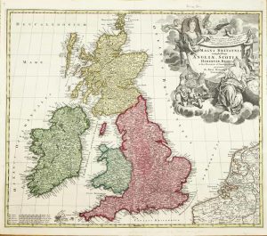
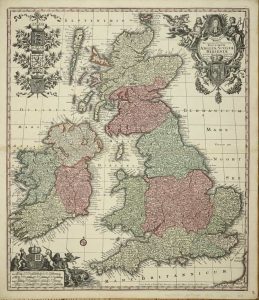
Amsterdam, c.1695
475 x 570 mm., in full recent wash colour, one small margin tear in right margin only repaired and lower left corner strengthened, otherwise in good condition.
Stock number: 10547
£ 325
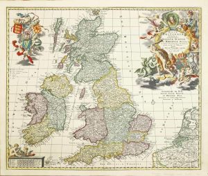
Nuremberg, c.1714-[c.20]
480 x 575 mm., early wash colour, lower centrefold split repaired, margin edge trimmed, otherwise in good condition.
Stock number: 10542
£ 295
London, 1761
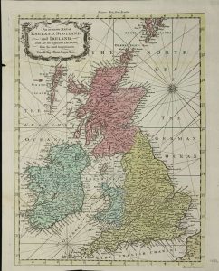
355 x 265 mm., full early wash colour, in good condition.
Stock number: 10584
£ 195
Nuremberg, 1707-[c.15]
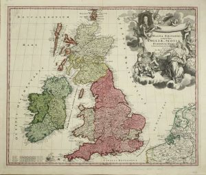
480 x 575 mm., early wash colour, margin edge trimmed, otherwise in good condition.
Stock number: 10539
£ 275
Augsburg, c.1720-[c.35]
580 x 495 mm., full early wash colour, in good condition.
Stock number: 10530
£ 275
James Gardner, with pasted on label of J. Wyld, Geographer to the King Charing Cross East (nearly opposite Northumberland House), London, July 21st 1826
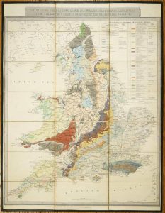
THE FIRST EDITION, SECOND ISSUE, OF THE FIRST REDUCTION OF GREENOUGH'S GEOLOGICAL MAP. 685 x 535 mm., dissected laid on contemporary linen, in full early wash colour, endpapers, silk edged, with Wyld's printed label over the imprint below, in good condition.
Stock number: 10848
£ 1,950
Pierre Mariette, Paris, 1648
210 x 150 mm., in good condition.
Stock number: 10622
£ 195
Amsterdam, 1607-[09]
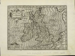
140 x 180 mm., in good condition.
Stock number: 10618
£ 175
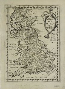
London, 1600
175 x 210 mm., light toning to top and bottom margin, otherwise in good condition.
Stock number: 10617
£ 650