


Mr. Philip D. Burden
P.O. Box 863,
Chalfont St. Giles, Bucks HP6 9HD,
UNITED KINGDOM
Tel: +44 (0) 1494 76 33 13
Email: enquiries@caburden.com
94 map-related books matched your search criteria.
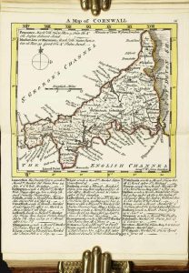
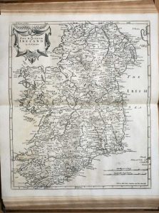
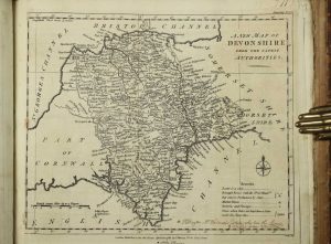
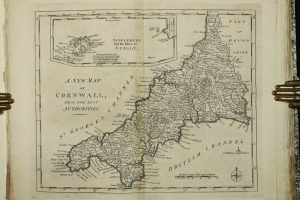
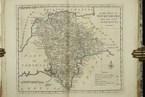
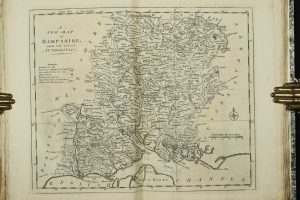
Carington Bowles, London, 1764
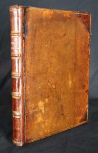
Octavo (195 x 155 mm.), full contemporary calf, rebacked with corners repaired, spine with raised bands, gilt ruled compartments and gilt red calf title label. pp. 12, 273. Internally very clean, complete with contemporary endpapers.
Stock number: 8832
£ 1,250
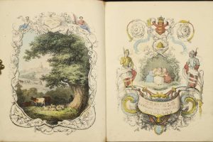
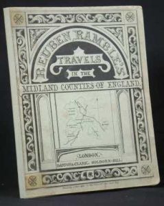
Darton and Clark, London, 1843
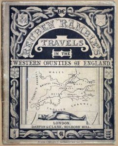
Quarto (210 x 170 mm.), one part (of five), with contemporary paper wrappers, with ornate printed title to upper wrapper with map vignette and advert to the lower one. With 8 early wash coloured lithographic plates, 2 pasted to insides of the covers. With modern quarter calf slipcase with marbled paper boards, title affixed and silk ties.
Stock number: 7745
£ 650
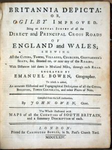
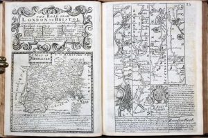
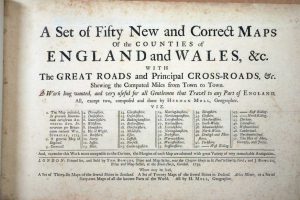
London, July 1st., 1790
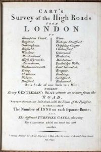
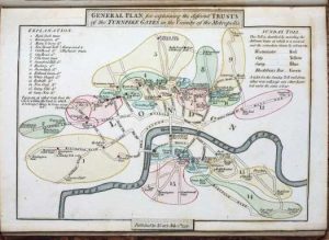
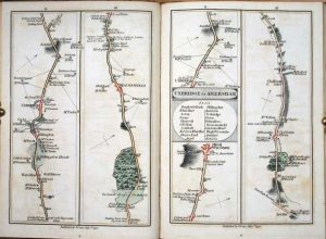
FIRST EDITION. Quarto (215 x 155 mm.), full contemporary calf, ornate gilt spine with red calf gilt title. With engraved title page, folding general map, foxed, map of the Turnpike Gates, both in early wash colour, Explanation and Advertisement, and 80 strip road maps on 40 double-page sheets all in early wash colour. Engraved throughout, with minor offsetting. Complete with original endpapers.
Stock number: 7657
£ 995
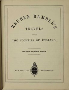
London, c.1881
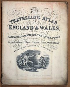
Small quarto (240 x 195 mm.), original paper wrappers with title. With 45 lithographic maps back to back, including a large folding map of England and Wales. Light wear, generally in good condition.
Stock number: 7502
£ 260
Lackington, Allen & Co, London, 1806
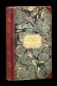
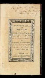
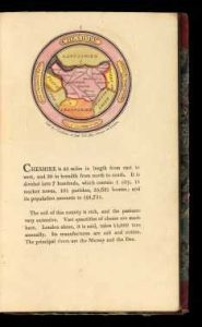
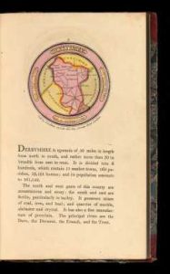
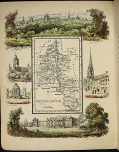
Octavo (190 x 120 mm.), contemporary half red calf, marbled boards, gilt ruled, with original paper title label affixed to the upper board, gilt ruled spine. With engraved title, Preface, map of England and 42 circular maps of the English counties, half title 'Wales', 12 maps of the Welsh counties, an Index map of England and Wales in early outline colour, Index leaf, with two endpapers. 54 early wash colour roundel maps in total, each with typographic text below, some light show through on a few maps to the versos, otherwise the maps are VERY FRESH.
Stock number: 7453
£ 5,000
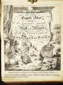
Thomas Bowles and John Bowles, London, 1739
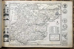
Oblong quarto (245 x 365 mm.), quarter calf, marbled paper boards, gilt title to the spine. With typographic title page (lightly foxed) and fifty engraved maps (2 general) as called for, 2 of which are folding, in good condition.
Stock number: 7389
£ 2,950
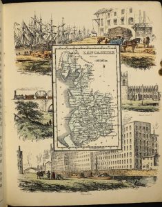
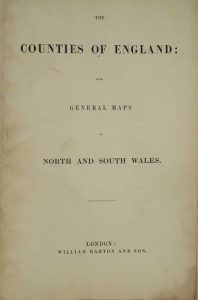
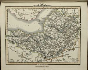
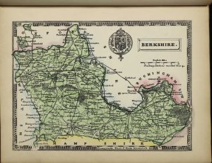
Henry Teesdale & Co. 2 Brunswick Row, Queen Sqe. and Sold by D. W. Marti, 16 Westmoreland Place, City Road, London, 1843-[c.45]
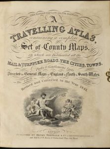
Quarto (235 x 185 mm.), nineteenth century half red calf, red cloth boards with gilt 'Atlas' embossed to upper board, ornate blind ruled and gilt decorated spine with title, light wear. With early endpapers, engraved title page, engraved Contents leaf and 45 engraved maps including 1 large folding general map of England and Wales with minor tear where bound in and 44 single page maps of North and South Wales and the English counties, all in early wash colour, in good condition.
Stock number: 7188
£ 950
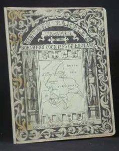
Darton and Clark, 58 Holborn Hill, London, c.1844
Quarto (215 x 175 mm.), full contemporary cloth, ornate blind ruling to boards, gilt embossed title to upper board, rebacked preserving original spine with gilt title. Five parts in one volume, with pictorial frontispiece and title, typographic title, Preface and 40 early wash coloured lithographic plates. The first two maps with some marginal waterstaining, some light offsetting as usual, otherwise a good example.
Stock number: 7098
£ 2,250
London, 1751
Octavo (160 x 115 mm.), full contemporary calf, gilt embossed panels, with gilt bands to spine along with red calf gilt title label. Engraved throughout, pictorial title, one leaf containing preface and index, 50 engraved maps, ALL IN EARLY OUTLINE COLOUR with yellow wash borders, Rutland with tear in the map repaired, otherwise a good example.
Stock number: 5245
£ 4,500
London, 1753
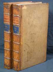
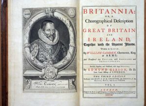
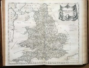
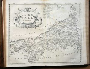
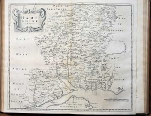
Folio (400 x 250 mm.), two volumes, full contemporary calf. Spine ribbed with 7 compartments, gilt lined, calf labels for title and volume. Volume 1; with engraved portrait of Camden by R. White, typographic title page within double rule border, 36 double page county maps by Robert Morden, 9 engraved plates. Volume 2; typographic title page within double ruled border, 15 double page county maps by Robert Morden. pp. (64), cclxvii, 696 (numbered columns, actually 348); (2), 829 (numbered columns paginated in continuation 697-1526); (176). With some light browning and occasional offsetting, generally a fine looking example.
Stock number: 1852
£ 1,950
Darton and Clark, London, 1843
Quarto (205 x 165 mm.), one part (of five) contemporary paper wrappers, with ornate printed title to upper wrapper and advert to the lower one. Repaired spine. With 8 early wash coloured lithographic plates, 2 pasted to insides of the covers.
Stock number: 1952
£ 495
Darton and Clark, London, 1843
Quarto (205 x 165 mm.), one part (of five) contemporary paper wrappers, with ornate printed title to upper wrapper and advert to the lower one. Repaired spine. With 8 early wash coloured lithographic plates, 2 pasted to insides of the covers.
Stock number: 1953
£ 550
R. H. Laurie, No. 53, Fleet Street, London, 1832
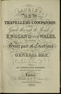
Quarto (265 x 175 mm.), full contemporary limp red morocco, with locking flap (retainer missing) and marbled endpapers. With engraved title page as above, an Advertisement, Directions and Explanation, Index, Parliamentary Representation, pp. ii, 8, (4), folding general map of England and Wales and 25 double page engraved maps all in early outline colour, complete with blank endpapers, with some light offsetting, otherwise a good example.
Stock number: 10394
£ 395
William Darton and Son, London, c.1835
VERY RARE. Folio (370 x 255 mm.), contemporary half straight grained morocco, cloth boards, blind ruled, rebacked with gilt ruled compartments gilt title, later endpapers. With typographic title, Contents (with central repair to verso) and 42 maps consisting of 40 of the counties, North and South Wales, the last two and Yorkshire folding, with a couple of splits to folds professionally repaired, with offsetting to most maps, light water discolouration to centrefold of most, light offsetting, otherwise in good condition.
Stock number: 10264
£ 3,250
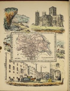
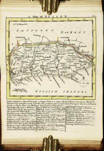
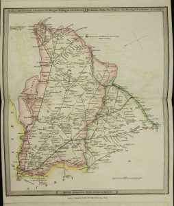
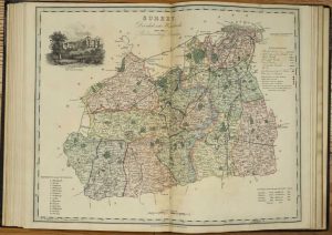
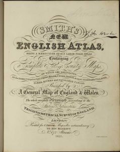
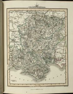
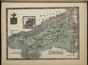
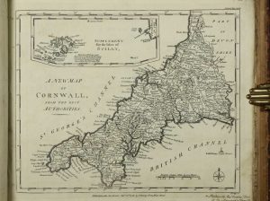
C. Smith, Mapseller extraordinary to His Majesty No. 172 Strand, London, 1822
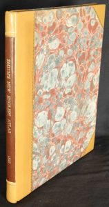
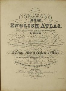
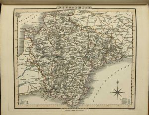
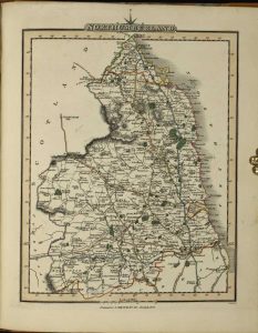
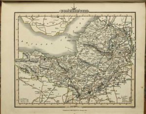
Quarto (280 x 230 mm.), recent half calf, marbled paper boards, ornate gilt ruling, spine with two raised bands, each with gilt ruling, calf gilt title label. With engraved title page, contents leaf, 43 engraved maps including a large folding one of Yorkshire, all in fine early outline colour, a 4 page list of Principal Towns followed by 4 blank leaves for 'Remarks' the final one of which has half removed, old repair to binders tear and one small split to the folding map of Yorkshire, otherwise in good condition.
Stock number: 10265
£ 950
C. Smith, Mapseller extraordinary to His Majesty No. 172 Strand, London, 1825
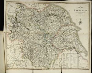
A VERY RARE EDITION. Quarto (275 x 225 mm.), contemporary half calf, marbled paper boards, rebacked with gilt ruled bands, red calf gilt title label, light wear. With engraved title page, contents leaf, 43 engraved maps including a large folding one of Yorkshire, all in fine early outline colour, a 4 page list of Principal Towns followed by 2 blank leaves for 'Remarks', small split to binders fold on the folding map of Yorkshire, otherwise in good condition.
Stock number: 10266
£ 1,100
Thos. Johnson, Manchester, 1863
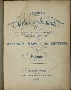
ONE OF ONLY TWO KNOWN EXAMPLES. Quarto (265 x 210 mm.), contemporary half calf, cloth boards, blind embossed title and globe on upper board, rebacked retaining original spine, blind ruled compartments and blind title, light wear. With lithographic title page and 42 full bold early wash coloured maps, interleaved, in good condition.
Stock number: 10293
£ 1,950
Langley & Belch, 173, High Street, Borough, London, 1818
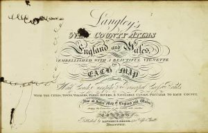
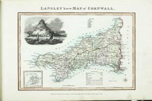
FIRST EDITION. Oblong quarto (225 x 375 mm.), contemporary half calf, marbled paper boards with original publisher's paper title to upper cover, ornate gilt ruled (worn), rebacked preserving original spine, with gilt ruled compartments and title, light wear. With engraved title page (ink stain) and 53 maps all in early wash colour, consisting of one general map and 52 of the English and Welsh counties, otherwise in good condition.
Stock number: 10249
£ 3,950
London, 1782-90
ONE OF ONLY THREE KNOWN BOUND COLLECTIONS OF FIRST STATE MAPS. Oblong folio (335 x 360 mm.), full contemporary calf, with very unusual ornate early decoration affixed and now worn, later endpapers, uncut. With 40 engraved maps of the English counties, traces of old folds, with manuscript index to the front free original endpaper, some trimmed with loss of imprint, frail edges to many, ink notations to the margins of some maps, those of Dorset, Essex Hertfordshire bound upside down, otherwise in good condition.
Stock number: 10210
£ 1,950
London, c.1795
Quarto (325 x 215 mm.), modern quarter calf by Temple Bindery, marbled paper boards, gilt ruled, spine with raised bands, gilt ruled compartments, black calf gilt title label, uncut. With original publisher's typographic 'title' and index loosely inserted, 40 engraved maps of the English counties, old liquid stain to first and final few maps lower corner, otherwise in good condition.
Stock number: 10211
£ 1,750