


Mr. Philip D. Burden
P.O. Box 863,
Chalfont St. Giles, Bucks HP6 9HD,
UNITED KINGDOM
Tel: +44 (0) 1494 76 33 13
Email: enquiries@caburden.com
29 map-related books matched your search criteria.
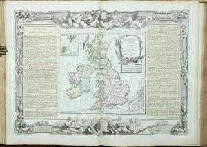
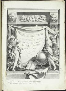
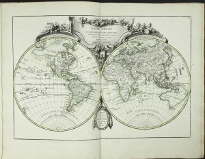
Daniel Browne, Thomas Taylor, John Darby, John Senex, William Taylor, Joseph Smith, Andrew Johnston, William Bray and Edward Symon, London, 1721
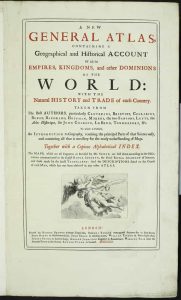
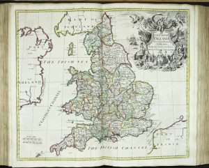
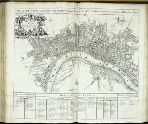
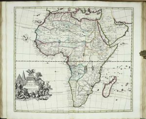
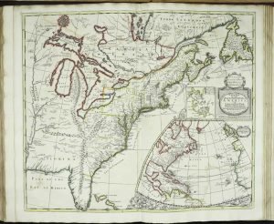
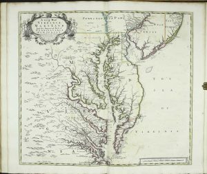
SUBSCRIBER'S COPY. Folio (550 x 360 mm.), tall paper copy, full contemporary marled calf, ornate gilt ruled boards, spine with gilt ruled raised bands, each compartment with ornate central floral motif, gilt titles, marbled endpapers, upper joint cracking. With typographic title page printed in red and black with engraved vignette, Dedication, Preface, List of Subscribers, 13 engraved plates of arms of the subscribers, pp. (8), (1)-272, 141-261, (11), (with the second page numbered '261' in error), with 34 double-page maps (3 of which are town plans), all in early outline colour with the usual exception of the town plans and mounted on stubs, some marginal spotting, otherwise in good condition.
Stock number: 11848
£ 25,000
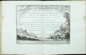
Chez Jean rue Jean de Beauvais. No. 32, Paris, [1790]
Quarto (280 x 205 mm.), contemporary quarter calf, marbled paper boards, spine with raised bands, calf gilt title label affixed, worn corners professionally repaired. With ornate double page title engraved by C. Varin and 91 double page maps, all in early outline colour, light waterstaining to first few leaves, with some foxing throughout, loss to upper margin of map of Normandy, otherwise in good condition.
Stock number: 11838
£ 750
Oxford, 1700
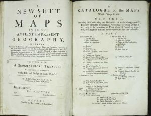
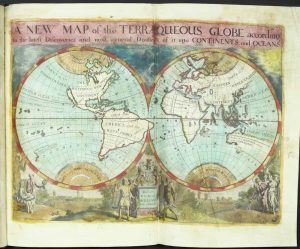
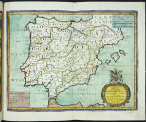
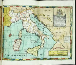
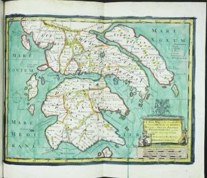
Folio (450 x 295 mm.), contemporary mottled calf with blind panelled boards, rebacked with ribbed spine, extensive gilt decoration and red calf gilt title label to spine. With typographic title page, catalogue, and 41 full wash coloured folding engraved maps, a few with folds repaired and strengthened (maps 4 and 22, Europe, and the Aegean with loss), some soiling, otherwise in good condition.
Stock number: 11849
£ 7,500
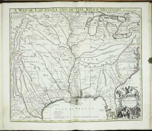
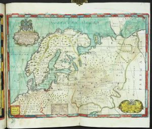
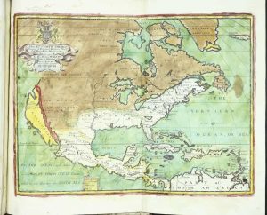
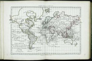
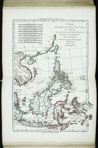
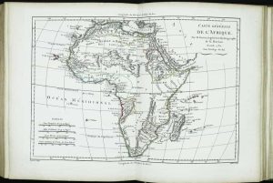
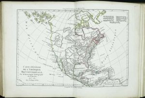
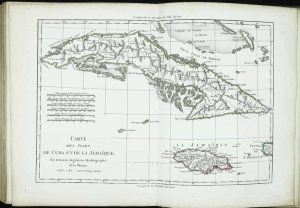
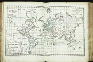
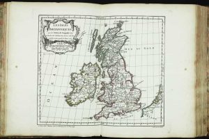
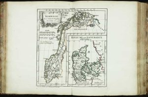
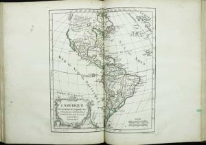
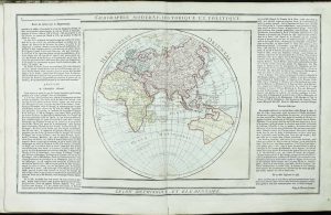
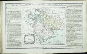
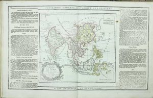
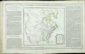
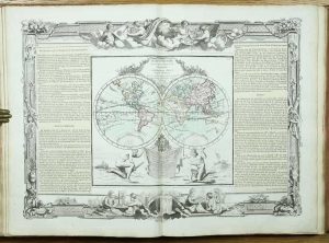
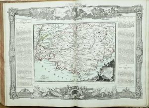
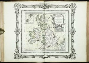
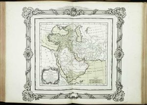
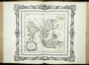
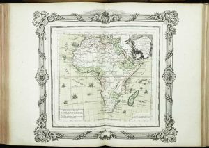
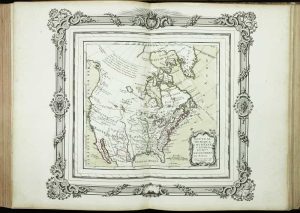
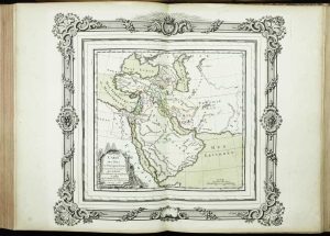
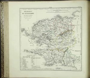
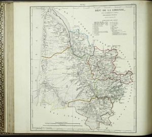
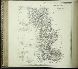
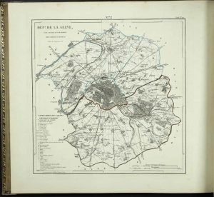
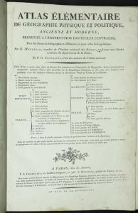
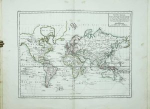
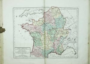
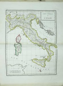
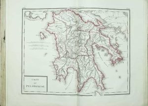
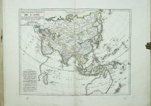
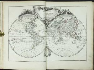
[Jean Leonard Pellet], Geneva, [1780]
Quarto (250 x 195 mm.), full contemporary golden calf, gilt ruled boards, with ribbed spine, gilt ruled, pasted on gilt title labels, gilt edged, retaining original silk tie. With typographic title, 2 page contents list, typographic 'Analyse', pp. (4), 28, with 50 maps (numbered to 49, (17 and 17 bis), light offsetting of binding on first and last leaves, otherwise in very good condition.
Stock number: 11836
£ 1,500
Chez renard, ibraire, Rue Sainte-Anne, No. 71, Paris, 1824-26
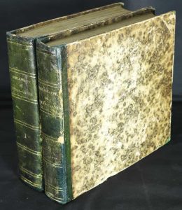
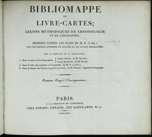
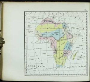
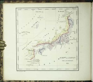
Oblong quarto, two volumes (200 x 230 mm. each), contemporary quarter calf, gilt ruled spines, gilt titles, light wear. With typographic half-titles, titles, pp. (6), 8, iii-xvj, vii, (v), xvi, 180, 40, 724; (2), 680, with 68 maps (1 folding, 3 duplicated to accompany an Oceanie section at the end, all in early wash colour, in good condition.
Stock number: 11842
£ 950
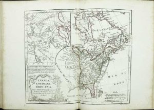
Holland?, [1786]
Quarto (265 x 215 mm.), full contemporary green painted paper boards, spine with raised bands, red calf gilt title label affixed. With ornate double page title engraved by C. Varin and 44 double page maps, all in early outline colour, minor light foxing as usual, otherwise in very good condition.
Stock number: 11837
£ 750
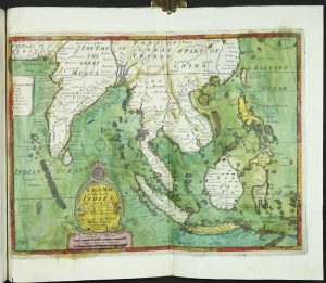
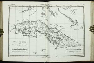
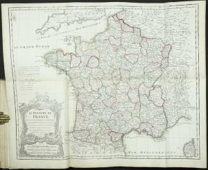
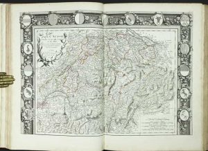
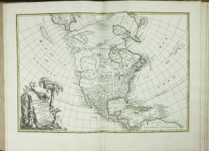
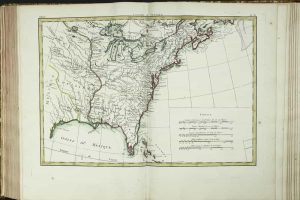
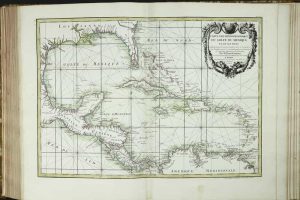
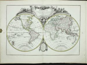
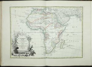
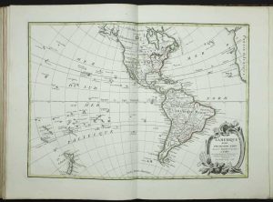
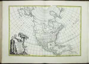
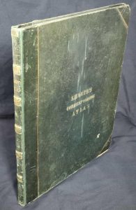
Quai de l'Horloge du Paais proche le Pont neuf, Paris, 1762
FIRST EDITION. Quarto (290 x 225 mm.), full contemporary calf, blind ruled boards, rebacked preserving original spine with raised bands, ornate gilt floral compartments, gilt title, with original marbled endpapers. With ornate engraved title page, engraved plates of description, contents, and index, with 53 maps (contents call for 52), all in early outline colour, light waterstain to Europe, minor splits to some lower centrefolds, otherwise in good condition.
Stock number: 11839
£ 2,750
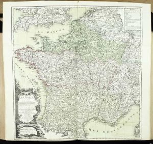
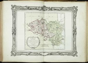
Hotel de Thou, Rue des Poitevins, Paris, 1787-88
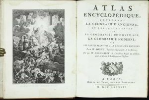
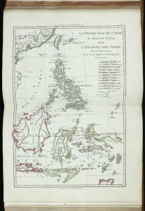
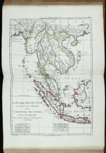
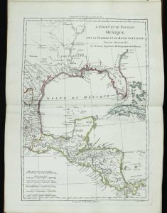
FIRST EDITION. Quarto, 2 volumes (295 x 225 mm. each), full contemporary marbled calf, spines with raised bands, each compartment with ornate gilt decoration, volumes numbers, and red calf gilt titles. With engraved frontispiece, typographic title page, pp. (2), 65, (1), with 77 numbered engraved maps, mostly double-page; pp. 110, (2), with a further 63 engraved maps (numbered 78-140), mostly double-page, all in early outline colour, second volume with light waterstain to first four leaves, Gascony and Spain with split lower centrefolds, otherwise a good example in original binding.
Stock number: 11841
£ 4,250
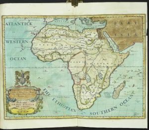
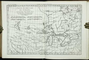
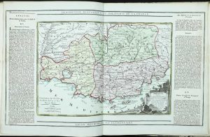
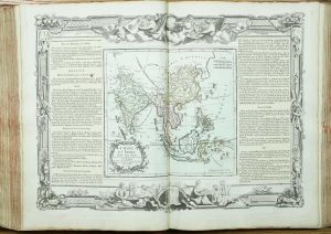
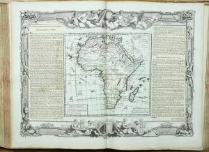
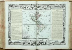
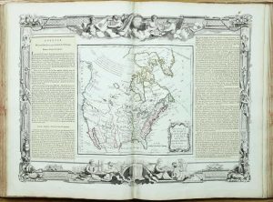
S[ieur] Delamarche, Geographe, Rue du Foin St. Jacques, au College de Mtre. Gervais, Paris, 1790
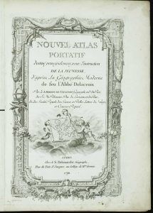
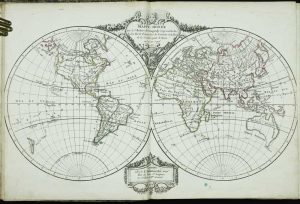
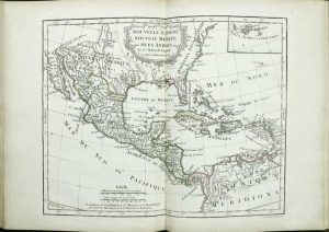
Quarto (285 x 230 mm.), contemporary half calf, marbled paper boards, excellent reback preserving the original spine with gilt ruled bands, red calf gilt title affixed. With ornate engraved title page, engraved plates of description, contents, and index, with 54 maps (contents call for 52), all in early outline colour, ink stain to one of the world maps, loss of area of margin to Europe, Germany reinstated, Switzerland in wash colour, light stains here and there, otherwise in good condition.
Stock number: 11840
£ 1,500
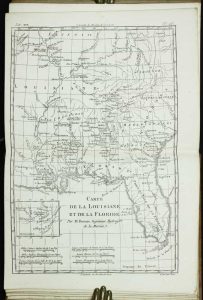
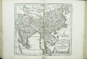
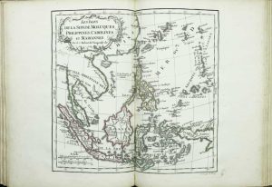
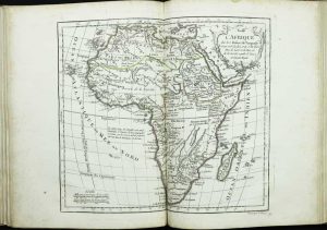
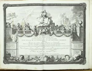
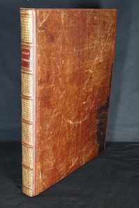
Desnos ... Rue S. Jacques, a l'Ensigne du Globe et de la Sphere, Paris, 1786
Folio (330 x 290 mm.), early quarter calf preserving the original repaired marbled paper boards, spine with raised bands, ornate gilt compartments, red calf gilt title label, on thick paper. With ornate single-page engraved title, pp. (10), with 66 plates consisting of 7 plates of spheres and diagrams, 44 of the world, and 15 of French provinces, all in early wash colour and all with two panels of text pasted down the sides, otherwise in very good condition.
Stock number: 11808
£ 3,500
Rue S. Jacques, Paris, c.1790
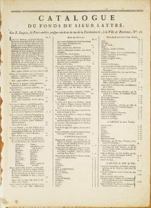
320 x 425 mm., two-page typographic catalogue of the publisher Sieur Lattre, in good condition.
Stock number: 10429
£ 450
Desnos ... Rue S. Jacques, a l'Ensigne du Globe et de la Sphere, Paris, 1770-[71]
Folio (420 x 320 mm.), recent half calf preserving the original marbled paper boards, rebacked with raised bands, preserving the original spine, recent calf gilt title label. With extremely ornate double page engraved title page, pp. (6), with 66 plates consisting of 7 plates of spheres and diagrams, 44 of the world, and 15 of French provinces, all in early wash colour and all printed within a large ornate outer frame with two panels of text pasted down the sides, one or two lower centrefold splits, otherwise in very good condition.
Stock number: 11807
£ 7,500
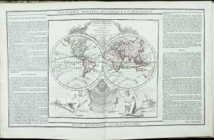
Desnos ... Rue S. Jacques, a l'Ensigne du Globe et de la Sphere, Paris, 1766
FIRST EDITION. Quarto, half calf, paper boards, rebacked preserving the original spine with raised bands, gilt ruled compartments and gilt title, original endpapers. With ornate double-page engraved title, engraved 'Avertissement', 2 diagrammatic plates, 1 double-hemispheric world, 2 hemispheric & 40 double-page maps; 2 general maps of France (1 folding), engraved title to 'Atlas de France' dated 1765, 15 regional maps of France, all in early wash colour and with separate ornate engraved borders, engraved list of maps, engraved throughout, in good condition.
Stock number: 11809
£ 3,500
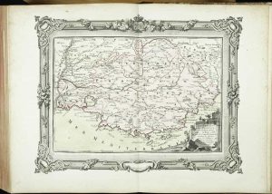
Chez Robiquet, Editeur, Quai des Grands-Augustins, No. 39, Paris, 1841
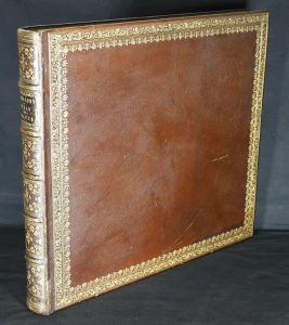
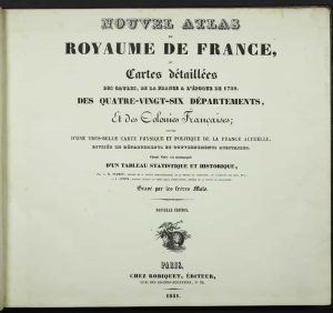
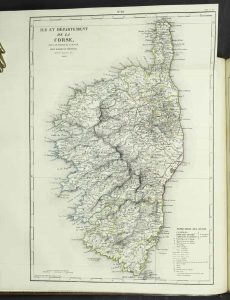
Oblong folio (365 x 410 mm.), fine full contemporary red Morocco, with ornate gilt borders to boards both outside and inside, spine with gilded raised bands, each compartment with ornate gilt floral decoration and title, gilt edged, marbled endpapers. With typographic half title, title, pp. xxi, (1), with 97 engraved maps consisting of one large folding map of France, 86 numbered of the Départements arranged in alphabetic order, followed by a further 10 maps of French possessions, (4 folding in total including Corsica), that of Algerie not called for in the index, all in early outline colour, each accompanied by descriptive text page, in excellent condition.
Stock number: 11812
£ 1,500
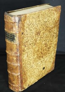
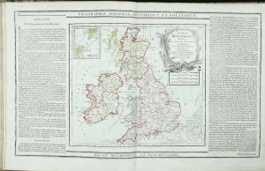
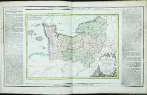
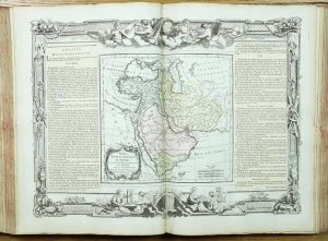
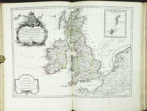
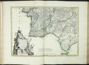
P. G. Chanlaire, rue Geoffroy-l'Angevin, no. 328 ; F. Mentelle, galeries du Louvre, no. 19, Paris, 1800
Folio (430 x 290 mm.), recent half calf retaining original boards, marbled paper, spine with raised bands gilt ruled, ornate red calf gilt title label affixed. Title page with repaired split to gutter, with 35 maps, some uncoloured, in outline colour, and with early wash colour, light browning in lower margin of one or two maps, map 8 has a wax mark, 13 with split repaired and weak lower edge, Switzerland with inkmark, numeration of maps does not match the list of contents on the titlepage, otherwise in good condition.
Stock number: 11810
£ 1,500
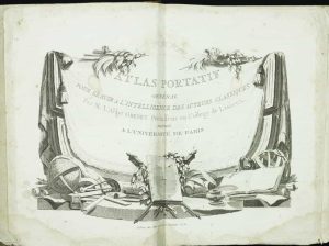
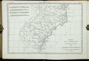
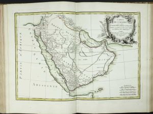
Chez Jean Lattré & Thomas Herissant, Paris, 1762

FIRST EDITION. Folio (380 x 280 mm.), recased in full early calf, bind panelled, spine with gilded raised bands, extensive gilt decoration to compartments, red calf gilt title label affixed to the spine, later endpapers. With ornate engraved title page, 'Avertissement' dated 1762, Table, and 36 copper engraved plates (Sphere Armillaire numbered 'c' and 35 maps numbered to 36, 25 omitted from Table), complete, all in early outline colour, final leaf with 'Catalogue' of Sr. Lattre, engraved throughout, some light foxing, particularly to final two maps, otherwise in good condition.
Stock number: 11804
£ 3,950
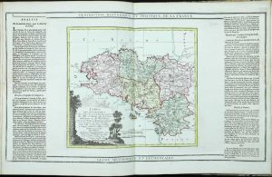
Chez Jean Lattré & Thomas Herissant, Paris, 1771


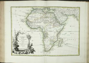
VERY GOOD EXAMPLE. Folio (390 x 280 mm.), contemporary quarter calf, marbled paper boards, spine with raised bands, compartments with ornate gilt decoration, with red calf gilt title label affixed to the spine, some professional repair to corners and spine. With ornate engraved title page, 'Avertissement' dated 1771, Table printed on two pages, and 73 copper engraved maps, all in particularly fine early outline colour, light stain to that of Lorraine, otherwise in good condition.
Stock number: 11805
£ 6,950
Chez Jean Lattré & Nicolas-Auguste Delalain, Paris, 1783


Folio (390 x 290 mm.), full contemporary calf, blind panelled, rebacked with raised spines, each compartment with ornate gilt decoration, with red calf gilt title label affixed to the spine, original marbled endpapers, with title page trimmed and laid down, lacking Table, Avertissement trimmed lower right corner, frontispiece one table plate and 35 copper engraved maps, some water stain to Allemagne I, Turkey in Europe, East Indies and South America, all in early outline colour.
Stock number: 11806
£ 4,950
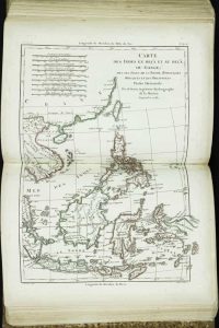
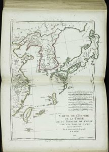
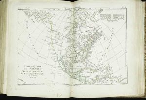
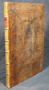
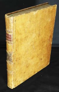
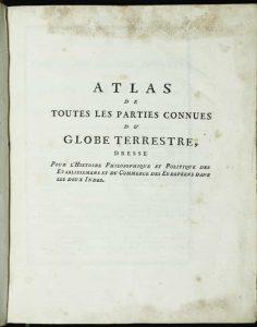
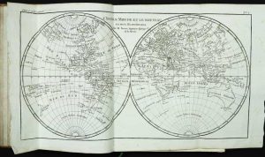
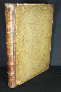
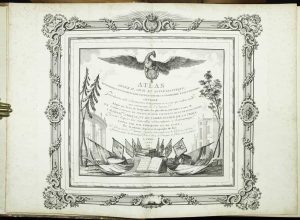
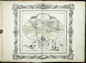
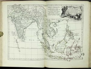
J & F Tallis, London, c.1851
![The Illustrated Atlas and Modern History of the World Geographical, Political, Commercial & Statistical [bound with] Index-Gazetteer of the World](https://www.caburdenraremaps.com/wp-content/uploads/2026/03/11813b-211x300.jpg)
![The Illustrated Atlas and Modern History of the World Geographical, Political, Commercial & Statistical [bound with] Index-Gazetteer of the World](https://www.caburdenraremaps.com/wp-content/uploads/2026/03/11813c-300x219.jpg)
![The Illustrated Atlas and Modern History of the World Geographical, Political, Commercial & Statistical [bound with] Index-Gazetteer of the World](https://www.caburdenraremaps.com/wp-content/uploads/2026/03/11813d-300x216.jpg)
![The Illustrated Atlas and Modern History of the World Geographical, Political, Commercial & Statistical [bound with] Index-Gazetteer of the World](https://www.caburdenraremaps.com/wp-content/uploads/2026/03/11813e-300x216.jpg)
![The Illustrated Atlas and Modern History of the World Geographical, Political, Commercial & Statistical [bound with] Index-Gazetteer of the World](https://www.caburdenraremaps.com/wp-content/uploads/2026/03/11813f-218x300.jpg)
![The Illustrated Atlas and Modern History of the World Geographical, Political, Commercial & Statistical [bound with] Index-Gazetteer of the World](https://www.caburdenraremaps.com/wp-content/uploads/2026/03/11813g-300x210.jpg)
![The Illustrated Atlas and Modern History of the World Geographical, Political, Commercial & Statistical [bound with] Index-Gazetteer of the World](https://www.caburdenraremaps.com/wp-content/uploads/2026/03/11813h-300x215.jpg)
![The Illustrated Atlas and Modern History of the World Geographical, Political, Commercial & Statistical [bound with] Index-Gazetteer of the World](https://www.caburdenraremaps.com/wp-content/uploads/2026/03/11813i-300x210.jpg)
![The Illustrated Atlas and Modern History of the World Geographical, Political, Commercial & Statistical [bound with] Index-Gazetteer of the World](https://www.caburdenraremaps.com/wp-content/uploads/2026/03/11813j-300x207.jpg)
![The Illustrated Atlas and Modern History of the World Geographical, Political, Commercial & Statistical [bound with] Index-Gazetteer of the World](https://www.caburdenraremaps.com/wp-content/uploads/2026/03/11813k-300x202.jpg)
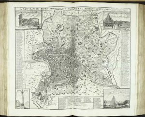
THE PARTS ISSUE BOUND WITH THE TOWN PLANS AND GAZETTEER. Quarto (385 x 275 mm.), contemporary half calf, marbled paper boards, blind ruled, rebacked preserving original ribbed spine, gilt and blind ruled with gilt title, manuscript index on front free endpaper for the maps only, uncut. With ornate engraved title, typographic title to second part, pp. iv, (164), 314, with 107 plates comprising 81 steel engraved maps all in early outline colour, each accompanied by descriptive text, each paginated in a contemporary hand for the use of a manuscript index found inside front free endpaper, 2 plates comparing rivers, mountains etc, 24 city plans (9 of which double page), otherwise in good condition.
Stock number: 11813
£ 7,500
Chapman and Hall, London, 1849
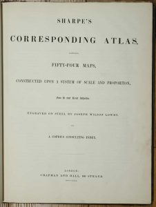
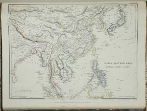
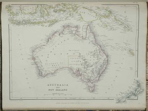
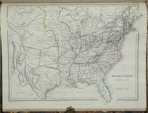
Folio (470 x 370 mm.), contemporary half green morocco, cloth boards, gilt ruled with gilt title to the upper board, rebacked, ornate gilt decorated ribbed spine, with gilt title, marbled endpapers. With half title, typographic titlepage, Preface, Contents, 52 maps numbered to 54 (2 double page), all in early outline colour, 22 pp. Index, in very good condition.
Stock number: 10956
£ 1,250