


Mr. Philip D. Burden
P.O. Box 863,
Chalfont St. Giles, Bucks HP6 9HD,
UNITED KINGDOM
Tel: +44 (0) 1494 76 33 13
Email: enquiries@caburden.com
94 map-related books matched your search criteria.
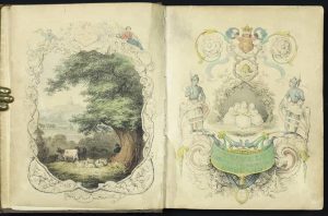
Darton and Clark, London, 1844

Quarto (210 x 175 mm.), early full brown cloth binding, gilt title to spine. Five parts in one volume, with pictorial title, frontispiece and 40 early wash coloured lithographic plates. Tear to the text of Huntingdon, repaired. Old tear to title.
Stock number: 11422
£ 1,350
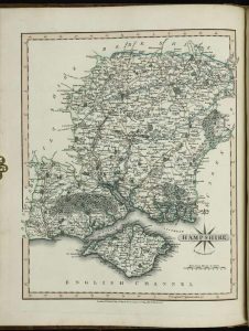
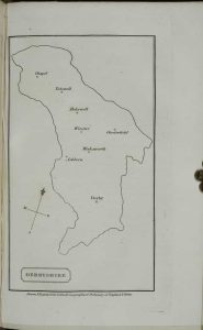
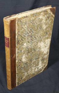
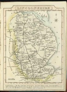
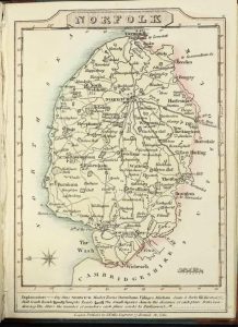
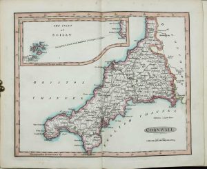
Lackington, Allen & Co, London, 1803-[06]
Octavo (185 x 110 mm.), contemporary half red calf, marbled boards, gilt ruled, with original paper title label affixed to the upper board, gilt ruled spine, with area of loss of marbled paper to upper board professionally restored, light water stain visible on endpapers only. With engraved title, Preface, half title 'England' including a short key, 42 circular maps of the English counties, half title 'Wales', 12 maps of the Welsh counties, an Index map of England and Wales in early outline colour, Index leaf, 54 early wash colour roundel maps in total, each with typographic text below, some light show through on a few maps to the versos, otherwise the maps are VERY FRESH, otherwise in good condition.
Stock number: 11419
£ 2,950
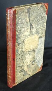
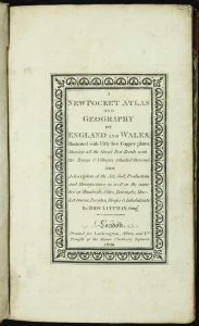
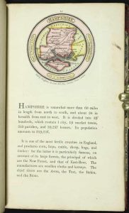
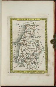
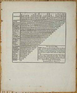
J. Newbery at the Bible and Sun in St. Pauls Church Yard, London, [1759]
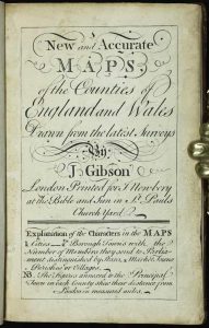
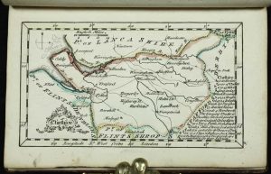
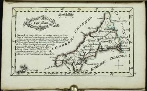
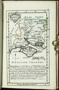
Duodecimo (135 x 90 mm.), full contemporary calf, gilt ruled, rebacked with ribbed spine, two red calf gilt title labels. With engraved title and 53 maps, all in EARLY OUTLINE COLOUR, that of Merionith with small area of right margin missing, otherwise in good condition.
Stock number: 11415
£ 4,850
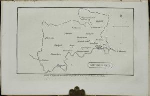
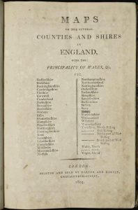
No. 69 St. Paul's Church Yard, London, 1796
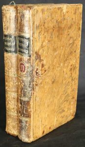
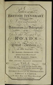
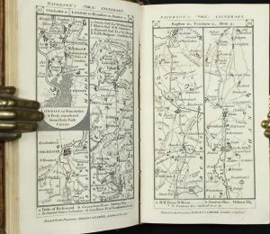
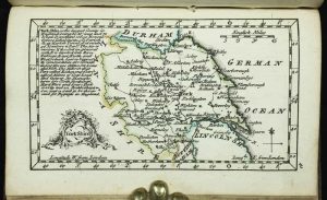
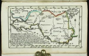
Small quarto (190 x 110 mm.), two volumes, full contemporary tree calf, gilt ruled boards, spines with ornate gilt ruled compartments, blue calf gilt title labels and gilt volume numbers worn, light wear to board volume 1, complete with blank endpapers. Volume 1 with engraved general double-page map of England and Wales, engraved title page, dedication to the King, General Contents, Preface, Index, 340 engraved road strip maps (2 to a page), Direct Roads of a lesser notes paginated 341-403, pp. xxxv, blank. Volume 2: Engraved title page, 46 [cross] road strip maps (2 to a page numbered contiguously from 404-449 in two columns), pp. 450-634, in good condition.
Stock number: 11205
£ 750
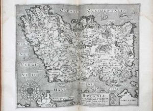
Jacques Nicolas Bellin, Paris, 1757
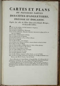
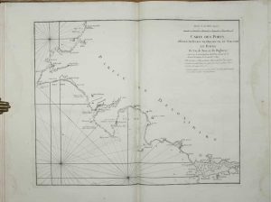
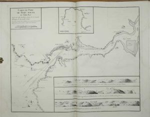
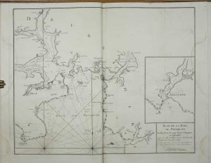
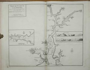
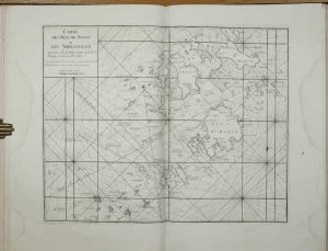
RARE MARITIME WORK. Folio (505 x 340 mm.), full contemporary marbled calf, with French fillet triple gilt ruled boards with floral corner piece, gilt armorials to both boards with fleur de lys enclosed by two ornate 'chains', surmounted by a coronet, gilt decorated ribbed spine with ornate gilt floral compartments, marbled endpapers. With typographic title page containing index and 19 engraved charts (all but one double page), without text as issued, some upper corner of title and lower left corner of the chart of the Orkney's with some restoration, light marginal water staining, otherwise in good condition.
Stock number: 11207
£ 3,500
Printed for O. Hodgson, Maiden Lane Wood St., London, c.1827
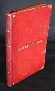
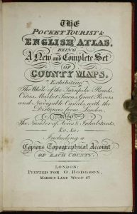
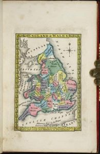
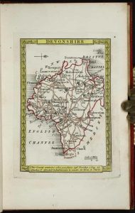
Small octavo (135 x 90 mm.), full contemporary red morocco, boards with gilt title 'Pocket Tourist' to upper cover and corner stars, skilfully rebacked with gilt ruled compartments. With engraved title page, Explanation and Contents on 1 leaf, general map of England and Wales in early wash colour and 42 maps of the English counties and North and South Wales in early outline colour, in very good condition.
Stock number: 11024
£ 5,950
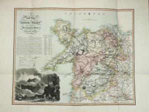
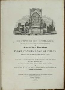
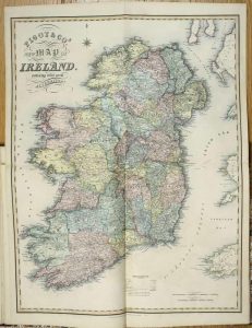
London, [1831]
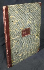
Large folio (485 x 385 mm.), contemporary half red calf, marbled paper boards, with ornate gilt panelled red calf title affixed to centre of upper board, spine with triple gilt ruled bands. With ornate engraved title (lower right corner torn away), 44 engraved maps including 1 large folding map of England and Wales, double-page maps of Ireland, Scotland, and Wales and 40 maps of the counties (Yorkshire in 2 sheets), all in fine early outline colour except for England and Wales as issued, Warwickshire with wax stain, one or two other light marks, otherwise in good condition.
Stock number: 10945
£ 950
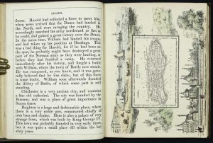
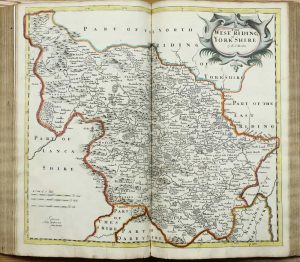
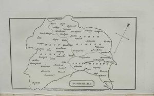
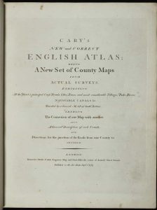
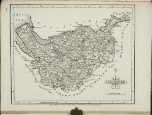
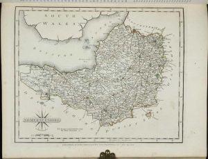
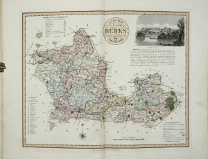
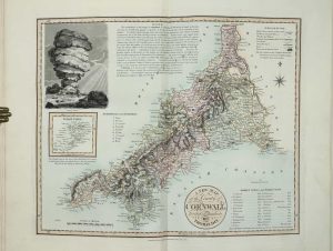
John Cary, Engraver & Map-seller. No. 181, near Norfolk Street, Strand, London, July 1st 1809
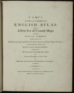
Quarto (315 x 255 mm.), contemporary quarter calf, marbled paper boards, rebacked preserving the original spine, gilt ruled bands, red calf gilt title label. With engraved title page, contents leaf, pp. 14 of 'Directions for the Junction of the Roads of England and Wales, Through all the Counties', 'Market and Borough Towns', 'Principal Post and Sub-Post-Towns', map of South Britain (small tear) and 43 county maps on 44 plates (West Riding being on two plates) and both North and South Wales, 47 maps in total, all in early outline colour, each accompanied by a leaf of descriptive text, with water stain to gutter of last few leaves, otherwise in good condition.
Stock number: 10969
£ 875
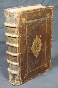
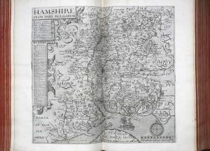
Printed by F. Collins, for A. Swalle, at the Unicorn at the West-end of St. Paul's Church-yard; and A. & J. Churchil, at the Black Swan in Paternoster-row, London, 1695
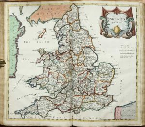
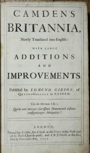
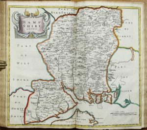
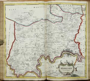
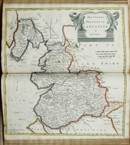
Folio (390 x 245 mm.), full contemporary blind panelled calf, rebacked with raised bands, preserving original calf gilt title, boards loose. Engraved portrait of Camden by R. White with small area of loss lower right, title within double rule border, 7 engraved general maps and 43 double page county maps by Robert Morden, all in EARLY OUTLINE COLOUR, 8 engraved plates of coins, engraved and woodcut illustrations, neat manuscript additions to the maps, 2 leaves of text supplied in facsimile, Somerset, Bucks, Herts, Leics, Scotland and Islands trimmed close, Wiltshire paper crease, Beds with portion of margin missing, otherwise in good condition.
Stock number: 10941
£ 3,950
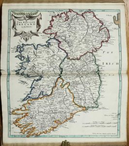
George Bishop and John Norton, London, 1610-[c.22]
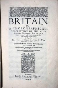
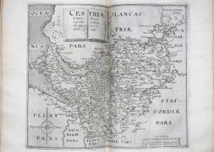
Large quarto (345 x 240 mm.), full contemporary calf gilt panelled calf, with large ornamental central design on both boards below which is found a blind stamped monograph of 'HL' above which is a coronet, original spine with raised bands, with gilt ruled compartments each with central gilt design, ornate gilt title with frame, repaired. With engraved title page by William Hole with central map of the British Isles copied from that in the 1600 edition, flanked by figures of Neptune and Ceres, verso blank; dedication to King James, verso blank; typographic title page, verso blank; 'The Author to the Reader' pp. 4; Latin verses pp. 4; Alphabet verso blank; text paginated 1-822, one blank leaf, half-title Scotland verso blank, paginated 1-233 with another half-title for Ireland and the Smaller Ilands in the British Ocean, with 57 engraved maps and 8 plates of coins; p. (234) 'The Shires of England', indexes pp. 54. Complete in pp. (16), 822, (2), 234 (numbered to 233), (54). With 58 engraved maps in total, three of which are single page including the title. All maps are in the final third state with pagination on those called for. That of Gloucestershire with repair to tear upper centre, otherwise in good condition.
Stock number: 10935
£ 8,950
Fisher, Son, & Co., Caxton Press, Angel Street, St. Martin's-Le-Grand, London, [1845]
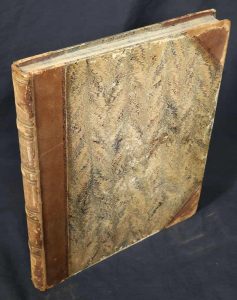
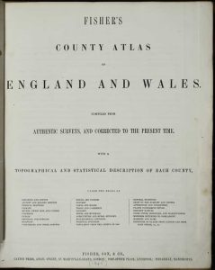
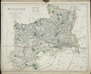
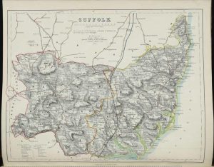
FIRST EDITION. Folio (370 x 305 mm.), contemporary half calf, marbled paper boards, blind ruled spine with raised bands, gilt ruled compartments, gilt title, marbled endpapers, light wear. With title page, preface and contents leaf and 96 pages of descriptive text interspersed with 48 maps consisting of 1 folding general map of England and Wales, 41 maps of the counties (Leicestershire and Rutland together) and Wales made up of 6 sheets, those of Lincolnshire and Devon are double page, all in early wash colour, laid on contemporary silk, otherwise in good condition.
Stock number: 9569
£ 595
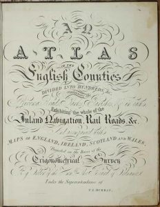
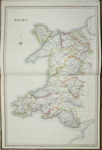
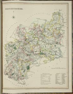
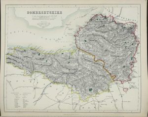
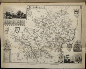
Chapman & Hall 186, Strand, London, 1833
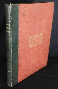
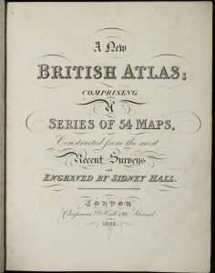
FIRST EDITION. Quarto (315 x 240 mm.), contemporary quarter green calf, red cloth embossed boards, with gilt title to the upper board, with ribbed spine, blind ruled compartments, gilt title. With engraved title page, List of Maps and 47 steel engraved maps on 54 sheets all in full early wash colour, Yorkshire, Ireland, Scotland, and Wales double page, Inland Navigation backed on linen and loose, each accompanied by descriptive text, otherwise in good condition.
Stock number: 9553
£ 495
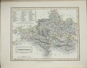
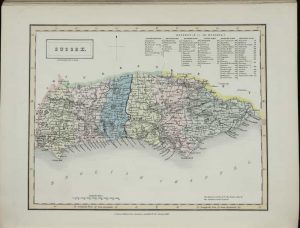
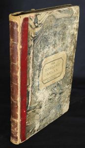
Wm. Cobbett, 11, Bolt-Court, Fleet-Street; and may be had of all booksellers, London, 1832
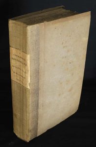
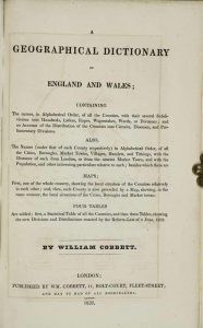
Octavo (230 x 145 mm.), uncut tall paper copy, in contemporary quarter cloth, paper boards, spine with paper title affixed. With typographic title page, pp. viii, 546, (2), with 43 maps, consisting of 1 general, 40 of the counties of England, and 2 of Wales, printed on thick paper, with pp. 12 catalogue of the 'Cobbett-Library' printed on smaller paper inserted at the end, otherwise in good condition.
Stock number: 9552
£ 225
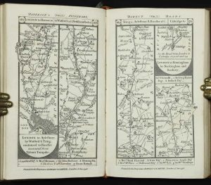
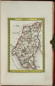
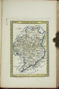
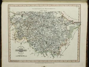
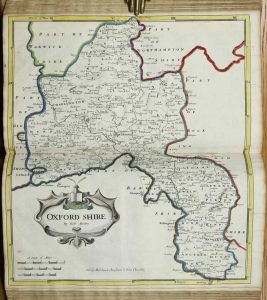
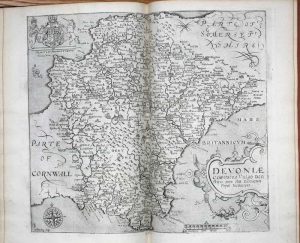
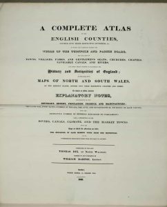
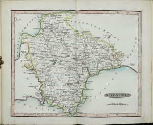
John Cary, Engraver, Map and Print-seller, the corner of Arundel Street, Strand, London, 1787-[89]
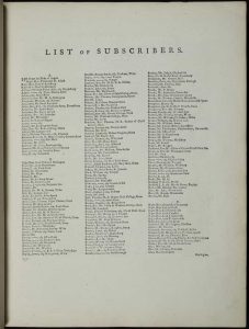
Quarto (325 x 250 mm.), fine modern half calf with marbled paper boards, blind ruled, spine with blind and gilt bands and green calf gilt title label affixed. With typographic Advertisement, engraved title page, engraved dedication, List of Subscribers pp. 6, typographic Contents, map of South Britain, pp. (12), and 43 county maps on 44 plates (West Riding being on two plates) and both North and South Wales, 47 maps in total, each accompanied by a leaf of descriptive text, all in early outline colour with main routes coloured brown with wash to wooded areas, 'Directions for the Junctions of the Roads of England and Wales through all the Counties', 'Market and Borough Towns in England and Wales', 'List of the Principal Post and Sub-Post Towns in England and Wales', pp. 17, some very light foxing as usual, otherwise in good condition.
Stock number: 9550
£ 895
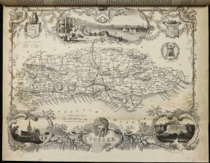
58, Holborn Hill, London, 1822
EXTREMELY RARE AND DESIRABLE. Folio (460 x 310 mm.), contemporary half calf, marbled boards, gilt ruled, rebacked with gilt ruled compartments, each with central gilt floral feature, red calf gilt title label. Double page typographic title, dedication, contents, and forty-two double-page engraved maps with excellent original wash colour, Chester, Hampshire, Shropshire, and Sussex with centrefolds repaired, otherwise a good example.
Stock number: 9541
£ 8,500
W. Lewis, No. 21 Finch Lane, Cornhill, London, [1819]
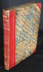
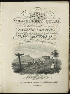
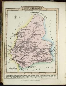
Octavo (155 x 120 mm.), contemporary half red calf, with marbled paper boards, gilt ruled, spine with gilt decoration and title. With general map of England and Wales, engraved title page, Preface dated 1819, Contents, List of Mail-Coaches etc., pp. (8), with 40 maps of the counties, North and South Wales as called for, in all 43 maps, each with a page of descriptive text, Yorkshire folding, all in full contemporary wash colour, Devon tight to left margin, otherwise a good example.
Stock number: 9539
£ 265
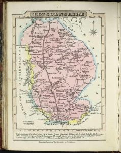
J Wallis Engraver, Berwick St. Soho and Sold by Davies & Eldridge Exeter, London, c.1812-[14]
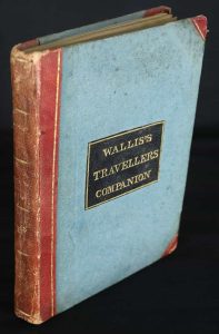
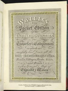
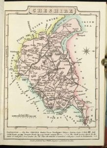
Octavo (145 x 115 mm.), contemporary half red calf, paper boards, with original calf gilt title label affixed to upper board. With engraved title page, Address to the Public, 44 maps including general map of England and Wales, 40 maps of the English counties, separate maps of North and South Wales and the last a smaller map of the Isle of Wight not called for in the contents, all single page with the exception of the double page map of Yorkshire, all in early wash colour, in very good condition.
Stock number: 9530
£ 295
William Darton and Joseph Harvey, London, 1804
A VERY RARE ATLAS. Octavo (215 x 145 mm.), contemporary quarter red morocco, marbled paper boards, with paper title label affixed to upper board, spine with gilt ruled compartments, light wear. With 41 (of 46) maps by Benjamin Baker, lacking Cheshire, the 4 of Yorkshire, all in early outline colour, the last map a little frayed, otherwise in good condition.
Stock number: 9522
£ 1,350
George Virtue, London, c.1848
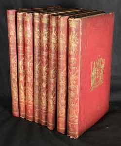
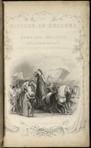
Quarto, eight volumes (285 x 175 mm. each), full contemporary red cloth, ornate blind boards with central gilt feature to upper covers, ornate gilt spines with titles. With 28 county maps by Thomas Moule not called for, a large number of steel engavings and portraits of kings and queens of England, in good condition.
Stock number: 9577
£ 395
Pigot & Co. 59, Fleet-Street, London, and Fountain-Street, Manchester, London, [1840]
Large quarto (410 x 295 mm.), fine recent burgundy half calf, marbled paper boards, blind ruled, spine with gilt title. With typographic title page, Address with Contents, double page 'Reciprocal Distance Table' with tables of routes on the recto and verso, 43 steel engraved maps in early outline colour, folding maps of England & Wales, Ireland, and Scotland all dated 1840, Yorkshire and Environs of London folding, light staining to Lincolnshire, otherwise in good condition.
Stock number: 9565
£ 1,150