


Mr. Philip D. Burden
P.O. Box 863,
Chalfont St. Giles, Bucks HP6 9HD,
UNITED KINGDOM
Tel: +44 (0) 1494 76 33 13
Email: enquiries@caburden.com
94 map-related books matched your search criteria.
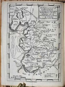
Printed by R. Walker, in Fleet-Lane; and Sold by the Booksellers in Town and Country, London, 1746
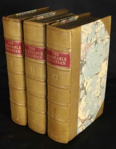
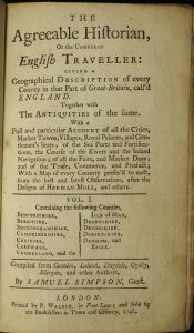
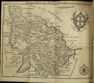
Octavo, three volumes (170 x 105 mm. each), recent half calf, marbled paper boards, blind ruled, spines with raised bands and blind ruled compartments, red calf gilt title labels, gilt volume numbers and dates. With typographic title page to each volume, pp. (2), 554 with 11 (of 12) maps; (2), 638 with 11 maps; (2), paginated 639-1194 with 19 (of 20) maps, offering 39 (of 42) maps in total, Berkshire with portion torn away, omitting Durham, Warwickshire and Monmouthshire (latter including 2 leaves of text) apparently never bound, some foxing and toning as usual, otherwise in good condition.
Stock number: 10730
£ 1,500
Printed & Sold by Henry Overton at ye white Horse without Newgate, London, 1743


ONE OF THE RAREST EDITIONS OF SPEED. Folio (435 x 290 mm.), contemporary quarter calf, marbled paper boards, spine with raised bands, black calf gilt title label affixed, light wear. With engraved title page dated 1743, 'A Sett of the Counties of England and Wales' with contemporary manuscript notations, and 58 double-page engraved maps, all in fine early outline colour, front free endpaper with light waterstain, wormtrack though lower corner of first few leaves, mostly in the margin, Lincoln with wax mark, Northumberland with old repaired tear, final map with wrinkle to right side, otherwise in good condition.
Stock number: 10728
£ 42,500
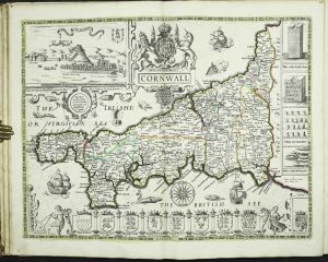
In the Savoy: Printed by Eliz. Nutt; and Sold by M. Nutt in Exeter-Exchange in the Strand, and J. Morphew near Stationers-Hall, London, 1720-31
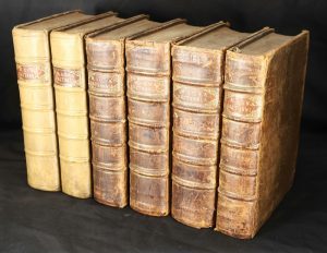
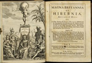
FIRST EDITION. Quarto, 6 volumes (225 x 165 mm. each), full contemporary gilt panelled calf, ribbed spines with gilt ruled compartments, gilt calf title labels and gilt volume numbers, first two volumes rebacked. Volume 1: dated 1720 pp. (4), viii, 752, with 18 maps, 12 tables and 3 plates. Volume 2: dated 1720 pp. (2), 753-1516, with 9 maps and 9 tables. Volume 3: dated 1724 pp. (2), 762, with 4 maps and 4 tables. Volume 4: dated 1727 pp. (2), 912, with 5 maps and 5 tables. Volume 5: dated 1730 pp. (2), 920, with 5 maps and 5 tables. Volume 6: dated 1731 pp. (2), 710, with 5 maps and 4 tables. Volumes 1 and 2 only have continuous pagination, the publishers imprint for volumes 3-6 is 'Printed by E. and R. Nutt; and sold by T. Cox'. The work contains 48 maps, 40 tables and 3 plates, some browning occasionally as usual, first map with loss upper right, otherwise in good condition.
Stock number: 10725
£ 2,250
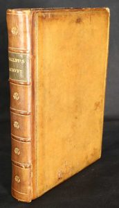
Joseph Wild, at the Elephant at Charing-Cross, London, 1701
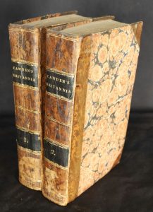
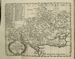
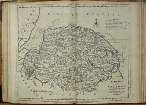
Octavo, two volumes (185 x 111 mm. each), early half calf, marbled paper boards, spine with double gilt ruled compartments, dark calf gilt title labels affixed. With typographic title pages to both volumes laid down, pp. (34), 462 (lacking final two leaves); (10); frontispiece engraved portrait of William Camden by M. V. Gucht (repaired tear), (2), (paginated 467-822), 103, 2 copies of Camden's portrait laid down, with 61 engraved maps (complete).
Stock number: 10724
£ 1,150
Amsterdam, 1654
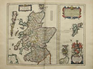
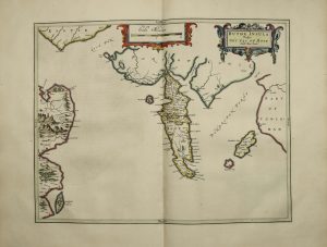
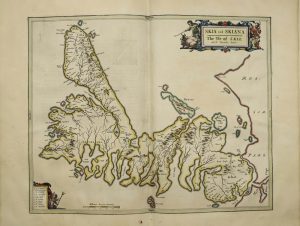
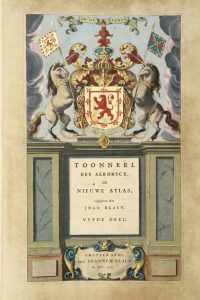
FIRST EDITION. Folio (565 x 360 mm.), full contemporary vellum, ornate gilt panelled boards, rebacked in sheepskin with gilded raised bands, each compartment with ornate central gilt feature, gilt calf title labels affixed, later endpapers. With ornate heavily gilded engraved title page, pp. (8), 189, (1), 70, (2), with 54 double page maps and 1 single page, all in excellent early outline and wash colour.
Stock number: 10719
£ 7,500
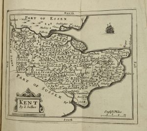
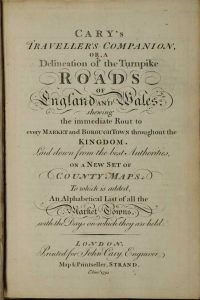
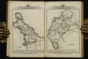
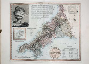
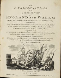
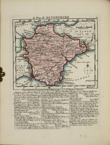
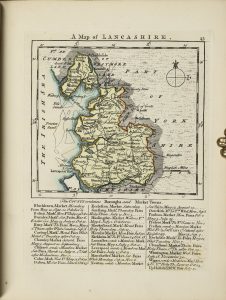
John Cary, Engraver, Map and Print-seller, the corner of Arundel Street, Strand, London, 1787-[c.92]
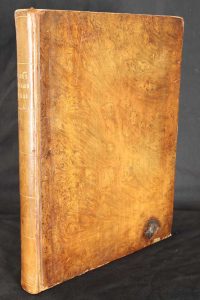
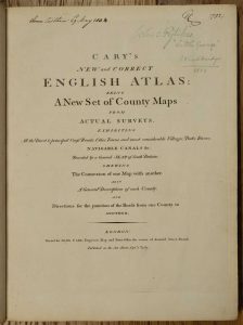
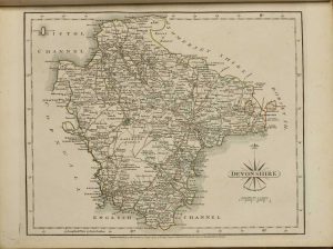
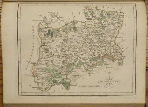
Quarto (320 x 240 mm.), full contemporary tree calf, rebacked with gilt ruled compartments and gilt title, later endpapers. With Advertisement, engraved title page, engraved dedication, typographic Contents, map of South Britain, and 43 county maps on 44 plates (West Riding being on two plates) and both North and South Wales, 47 maps in total, each accompanied by a leaf of descriptive text, all in early outline colour with main routes coloured brown with wash to wooded areas, each with original publisher's tissue, 6 pp. 'Directions for the Junctions of the Roads of England and Wales through all the Counties', 4 pp. 'Market and Borough Towns in England and Wales', 7 pp. 'List of the Principal Post and Sub-Post Towns in England and Wales', in good condition.
Stock number: 10500
£ 750
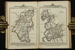
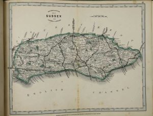
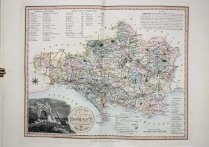
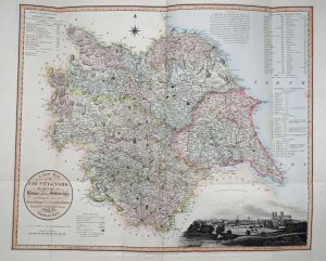
Longman, Rees & Co. Paternoster Row, and J. & C. Walker, 9, Castle Street, Holborn, London, 1838-[39]
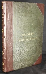
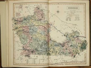
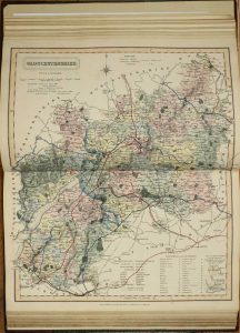
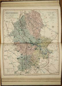
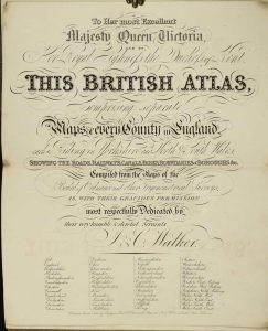
Folio (350 x 235 mm.), contemporary half calf, blind green cloth boards, with gilt title to upper board, rebacked and recornered, spine with raised bands, blind and gilt ruled, each compartment with central gilt feature, gilt date and titles, later endpapers. With double page engraved title page and 47 steel engraved maps comprising 1 general, 42 of English counties and Wales quartered, all in fine early wash colour, some very light foxing, otherwise in very good condition.
Stock number: 10300
£ 750
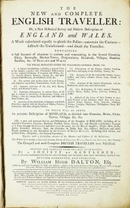
Historical Descriptions of New and Elegant Picturesque Views of The Antiquities of England and Wales
Alexander Hogg, at the King's Arms, No. 16, Paternoster-Row, and Sold by all Booksellers, Printsellers, and News-Carriers, in Town and Country, London, c.1787-89
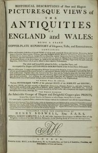

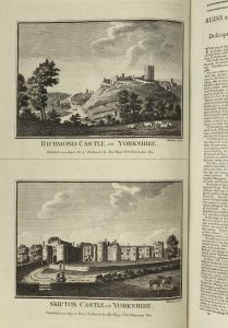
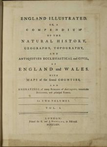
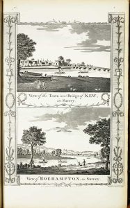
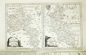
FIRST EDITION. Folio (385 x 245 mm.), full contemporary tree calf, decorative floral gilt panelled boards, rebacked preserving the original spine with raised bands, ornate gilt ruled compartments, red calf gilt title, marbled endpapers, light wear. With engraved frontispiece, recto blank, typographic title page, with intervening contemporary tissue, Preface signed by Boswell, Index List of the Plates, List of Subscribers, pp. iv, 42, numerous unpaginated typographic descriptions, (8), with c.195 copper plate engravings and 50 maps including 40 of the English counties, maps of South Wales, North Wales and 8 further plates of maps of the Scottish districts and Irish provinces, in good condition.
Stock number: 10173
£ 950
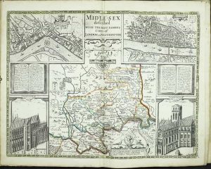
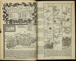
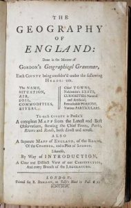
Printed for R. and J. Dodsley, in Pall-mall, London, 1763[64]
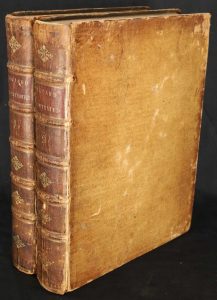
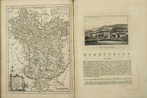
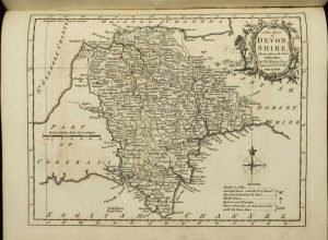
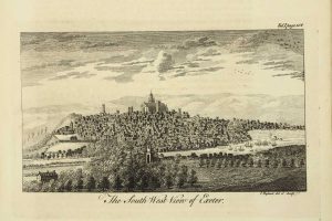
Quarto, two volumes (290 x 225 mm. each), full contemporary speckled calf, ribbed spines gilt ruled with decorative gilt central features, gilt red calf title labels. With typographic title page, Preface, Contents, Introduction, pp. (8), xiii, blank, 426; typographic title page, Contents, pp. (4), 490, with two general folding maps, 52 engraved county maps, all by Thomas Kitchin, 39 engraved town views and numerous other engravings set in the text, complete with blank endpapers, some offsetting from maps to text second folding map wrinkled, B2 in the first volume not fully bound, otherwise a good example.
Stock number: 10175
£ 1,250
Printed for John Cary, Engraver, Map & Printseller, Strand, London, 1 Jan. 1791-[92]
Small quarto (160 x 105 mm.), full contemporary marbled calf, ornate gilt panelled, rebacked with gilt ruled compartments, marbled endpapers. With engraved title page, Advertisement and Contents and 43 engraved maps bound back-to-back, all in early outline colour, that of Yorkshire folding with binders tear repaired by backing on paper, Index with an advert leaf on verso of final leaf pp. 7, (1), endpapers detaching, otherwise in good condition.
Stock number: 10203
£ 195
Thomas Bowles, London, 1736
Octavo (195 x 135 mm.), full contemporary calf, gilt panelled, rebacked with ribbed spine, gilt ruled compartments each with ornate gilt floral feature, with green calf title label attached, marbled endpapers. With title page, pp. 5, (3), 273, with 273 engraved plates of road strips and county maps printed back-to-back, a good example.
Stock number: 10145
£ 1,250
London, 1830
Large folio (480 x 380 mm.), full contemporary calf with inset marbled paper within gilt panels on both covers, upper cover bearing an ornate gilt calf title label. An extensively gilded spine. With engraved title and 45 early wash coloured maps, the Yorkshire in four sheets. Folding maps of England & Wales, Ireland and Scotland, with general maps of North and South Wales. With some foxing to the general maps and Middlesex with a margin tear repaired.
Stock number: 1767
£ 1,750
G. F. Cruchley, Map Seller & Globe Maker, 81, Fleet Street, London, London, c.1864
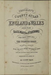
THE ERIC GARDNER COPY. Oblong quarto (230 x 310 mm.), recent half green calf, cloth boards, gilt ruled and titled spine. With title page laid on oblong paper to match and 45 (of 47) lithographic maps comprising a general map of England and Wales, 43 county maps on 44 plates (West Riding being on two plates) and North Wales, all in early outline colour, some light centrefold show through, lacking index, Cheshire and South Wales, Middlesex supplied from another copy, otherwise generally fine.
Stock number: 9893
£ 450
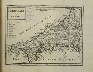
Robert Dodsley, at Tully's Head in Pall Mall, London, 1744-[43]
Octavo (205 x 130 mm.), full contemporary calf, joints strengthened and small spine repair. With typographic title page, pp. 40 (5- 8 in roman), 270 (of 271), 48 (of 51) maps, lacking the folding general map of England and Wales, one leaf dedication by the author, plan of London, last leaf of text p. 271 and Roads of England, as is often the case. Those of Bedfordshire, Leicestershire, Shropshire, Surrey and Anglesey with some amateur wash colour, Rutland with a light stain, otherwise in good condition.
Stock number: 9677
£ 950
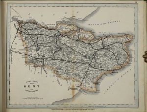
London, 1822
EXTREMELY RARE AND DESIRABLE. Folio (475 x 315 mm.), nineteenth century half calf, rebacked, light wear. Folding typographic title, dedication and contents, forty-two folding engraved maps with original wash hand colour. Five maps with strengthening to lower centrefolds, not affecting the image, with light wear to map of Sussex at lower centrefold, otherwise a good example.
Stock number: 9671
£ 8,500
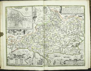
London, 1782-90
ONE OF ONLY THREE KNOWN BOUND COLLECTIONS OF FIRST STATE MAPS. Quarto (280 x 195 mm.), recent half calf preserving original marbled paper boards, spine with raised bands, gilt ruled compartments each with ornate blind central feature. With 40 (of 41) engraved maps, including 3 general and the English counties, lacking Derby, the following with some trimming into the imprints; Cheshire, Cornwall, Essex, Hampshire, Leicester, Middlesex (in poor condition), with some traces of old folds, some light offsetting, otherwise in good condition.
Stock number: 9395
£ 1,500
Alexander Hogg, No. 16 Paternoster-Row, London, c.1794
Folio (400 x 250 mm.), contemporary half calf, marbled paper boards, corners worn, joints weak, spine with gilt ruled raised bands, calf title label missing. With engraved frontispiece, typographic title page, pp. 520 (the first 6 in roman numerals), (4), (2) and 23 plates of maps (4 double page general, 12 with 2 maps, 1 with 3, 2 with 4 maps and 4 single page for a total of 43 maps, c.44 engraved views (comprising 28 single page, c.55 plates with two to a plate, 5 with 3 to the plate for a total of c.153.
Stock number: 9301
£ 1,100
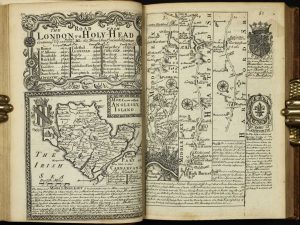
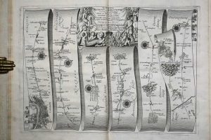
Thomas Taylor at ye Golden Lyon in Fleetstreet, London, 1717-[18]
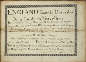
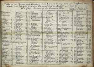
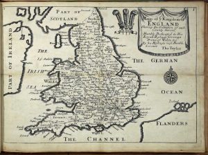
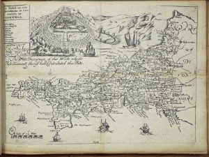
Oblong quarto (210 x 290 mm.), modern half calf, green cloth boards, gilt ruled, spine with gilt ruled raised and ornate gilt feature to compartments, red calf gilt title label. With engraved title page and 42 maps numbered to 41, Scotland and Ireland unnumbered and here unusually bound at the end, Cumberland and Westmoreland combined '8 & 9'. The England map is in Hodson's state c, Scotland state b and Ireland state a, with all county maps in their expected state bearing roads. Manuscript notation lower right of the title. All leaves backed on linen as they were originally folded twice for the pocket, with loss at the folds to some, notably the title page, Chester, Devon, Durham, Gloucestershire, Monmouth, Suffolk and Wiltshire. Otherwise in good condition.
Stock number: 9276
£ 1,950
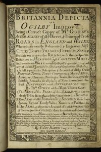
London, 1675-[76]
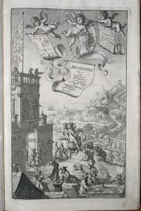
Folio (425 x 275 mm.), contemporary speckled calf, rebacked ribbed spine, ribs with ornate blind strokes, double gilt and blind ruled compartments, each with ornate gilt feature, preserving original red calf gilt title label. With frontispiece engraved by Wenceslaus Hollar; typographic title page as above printed in black and red, verso blank; dedication to Charles II pp. (3), blank verso; Preface pp. (5); Post Roads pp. (3); London description pp. (8); Catalogue of the roads pp. (4), pp. 1-200 with 100 strip maps interspersed; A Table directing to the Cities ... pp. (4), general map omitted, never bound in, title with two small areas of margin loss repaired, upper corner of first leaf of dedication with small loss repaired, marbled fore-edges, complete with original blank endpapers, small paper fault to Hh2, light worming in lower margin maps 90-94, otherwise in good condition.
Stock number: 9042
£ 13,950
Robert Sayer, London, 1787
VERY RARE EDITION. Small quarto (235 x 190 mm.), contemporary half calf, marbled paper boards, with gilt bands to spine along with red calf gilt title label, joints repaired. Engraved pictorial title, Preface and Index, 49 engraved maps including a newly introduced folding map of England and Wales by Thomas Jefferys, ALL IN EARLY WASH COLOUR, and a larger folding distance chart, a superb example.
Stock number: 8830
£ 5,500