Clive A. Burden LTD. Rare Maps, Antique Atlases, Books and Decorative Prints
to
Show items


The Mapping of North America

Mr. Philip D. Burden​
P.O. Box 863,
Chalfont St. Giles, Bucks HP6 9HD,
UNITED KINGDOM
Tel: +44 (0) 1494 76 33 13
Email: enquiries@caburden.com

50 rare maps matched your search criteria.
TALLIS, John
London, 1838-39
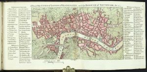
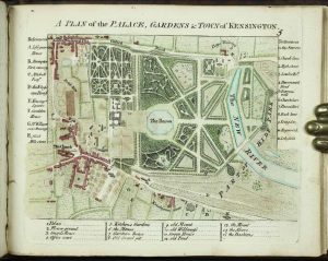
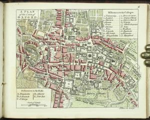
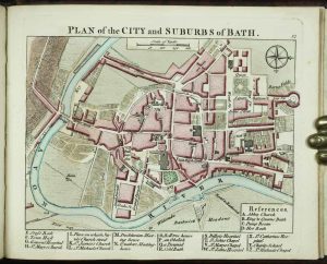
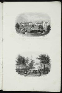
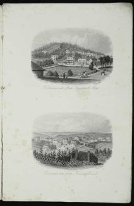
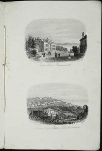
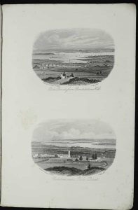
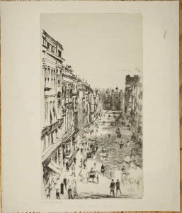
Tallis' Guide through LondonTallis' Guide through LondonTallis' Guide through LondonTallis' Guide through LondonTallis' Guide through LondonTallis' Guide through London
AN IMPORTANT RECORD OF THE COMMERCIAL LIFE IN VICTORIAN LONDON. Oblong quarto (145 x 220 mm.), 66 uncut parts (nos. 3-68), all with the accompanying text, bound in contemporary marbled paper boards, rebacked to style, blind ruled, spine with gilt ruled bands and decorative features, gilt title, otherwise in excellent condition.
Stock number: 10952
£ 3,750
   

GARRETT, John
Printed and are to be sold By John Garrett, at the south Entrance of ye Royall Exchange in Corn-hill, London, c.1677
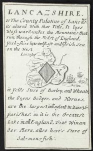
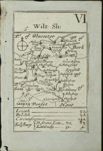
A Direction for the English Traviller By which he Shal be inabled to Coast about all England and WalesA Direction for the English Traviller By which he Shal be inabled to Coast about all England and WalesA Direction for the English Traviller By which he Shal be inabled to Coast about all England and WalesA Direction for the English Traviller By which he Shal be inabled to Coast about all England and WalesA Direction for the English Traviller By which he Shal be inabled to Coast about all England and WalesA Direction for the English Traviller By which he Shal be inabled to Coast about all England and Wales
Duodecimo (140 x 85 mm.), full contemporary calf, blind panelled, repaired and rebacked with blind ruled compartments and just one brass clasp. With title page, two engraved pages explaining 'The use of all the ensueing Tables', plate number 2 supplied from another copy, 37 plates each bearing a triangular distance table with accompanying small map of the county, 4 folding plates: 'The high Wayes', table with map of England and Wales, table with Yorkshire map and another table with Wales, plate 2 with some margin loss, otherwise in good condition, engraved throughout.
Stock number: 10951
£ 2,250
   

BONNE, Rigobert
Paris, c.1785
Isles Maidenland de Hawkins, et le Detroit de Fakland
240 x 345 mm., recent wash colour, lower mark in margin, otherwise in good condition.
Stock number: 10948
£ 125
   

WYLD, James
John Thomson & Co., Edinburgh, c.1825
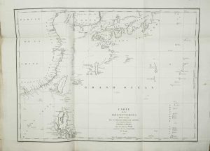
Discoveries of Capts. Ross, Parry, & Franklin. in the Arctic Regions in 1818. 1819. 1820. 1821. & 1822.
310 x 445 mm., early outline colour, some light offsetting, otherwise in good condition.
Stock number: 10946
£ 495
   

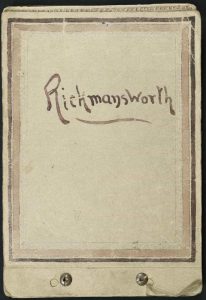
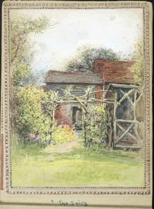
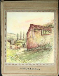
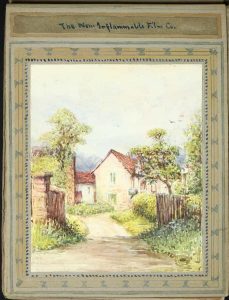
RICHARDSON, Thomas Miles
1845
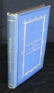
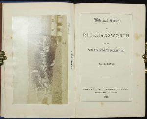
Rickmansworth, Hertfordshire
230 x 250 mm., watercolour with white, signed and inscribed, framed and in good condition.
Stock number: 10944
£ 1,500
   

DRAYTON, Michael
Marriott, John Grismand and Thomas Dewe, London, 1622
[Poly-Olbion] A Chorographicall Description of All the Tracts, Rivers, Movntains, Forests, and other Parts of this Renowned Isle of Great Britain, With intermixture of the most Remarkable Stories, Antiquities … Diuided into two Bookes; the latter containing twelve Songs, neuer before Imprinted[Poly-Olbion] A Chorographicall Description of All the Tracts, Rivers, Movntains, Forests, and other Parts of this Renowned Isle of Great Britain, With intermixture of the most Remarkable Stories, Antiquities … Diuided into two Bookes; the latter containing twelve Songs, neuer before Imprinted[Poly-Olbion] A Chorographicall Description of All the Tracts, Rivers, Movntains, Forests, and other Parts of this Renowned Isle of Great Britain, With intermixture of the most Remarkable Stories, Antiquities … Diuided into two Bookes; the latter containing twelve Songs, neuer before Imprinted[Poly-Olbion] A Chorographicall Description of All the Tracts, Rivers, Movntains, Forests, and other Parts of this Renowned Isle of Great Britain, With intermixture of the most Remarkable Stories, Antiquities … Diuided into two Bookes; the latter containing twelve Songs, neuer before Imprinted[Poly-Olbion] A Chorographicall Description of All the Tracts, Rivers, Movntains, Forests, and other Parts of this Renowned Isle of Great Britain, With intermixture of the most Remarkable Stories, Antiquities … Diuided into two Bookes; the latter containing twelve Songs, neuer before Imprinted[Poly-Olbion] A Chorographicall Description of All the Tracts, Rivers, Movntains, Forests, and other Parts of this Renowned Isle of Great Britain, With intermixture of the most Remarkable Stories, Antiquities … Diuided into two Bookes; the latter containing twelve Songs, neuer before Imprinted[Poly-Olbion] A Chorographicall Description of All the Tracts, Rivers, Movntains, Forests, and other Parts of this Renowned Isle of Great Britain, With intermixture of the most Remarkable Stories, Antiquities … Diuided into two Bookes; the latter containing twelve Songs, neuer before Imprinted[Poly-Olbion] A Chorographicall Description of All the Tracts, Rivers, Movntains, Forests, and other Parts of this Renowned Isle of Great Britain, With intermixture of the most Remarkable Stories, Antiquities … Diuided into two Bookes; the latter containing twelve Songs, neuer before Imprinted[Poly-Olbion] A Chorographicall Description of All the Tracts, Rivers, Movntains, Forests, and other Parts of this Renowned Isle of Great Britain, With intermixture of the most Remarkable Stories, Antiquities … Diuided into two Bookes; the latter containing twelve Songs, neuer before Imprinted[Poly-Olbion] A Chorographicall Description of All the Tracts, Rivers, Movntains, Forests, and other Parts of this Renowned Isle of Great Britain, With intermixture of the most Remarkable Stories, Antiquities … Diuided into two Bookes; the latter containing twelve Songs, neuer before Imprinted
THE RARE ENLARGED EDITION. ONE OF THE LONGEST POEMS IN THE ENGLISH LANGUAGE. Folio (270 x 180 mm.), two parts bound in one, full contemporary calf, blind panelled boards with ornate corner features, rebacked with ribbed spine, very ornate gilt decorated compartments, gilt calf title label affixed, speckled-edged, with original endpapers. Verses describing the engraved frontispiece, recto blank; engraved allegorical title (with title 'Poly-Olbion'), verso blank; typographic title page worded as above, verso blank; Dedication to Henry Prince of Wales, verses on the verso; engraved portrait of Prince Henry at lance exercises in its second state, verso blank; Address by Michael Drayton 'To the Generall Reader' [A1]; 'From the Author of The Illustrations' [John Selden] dated 9 May 1612 [A2r-A4v]; 'A Table to the Chiefest Passages, in the Illustrations ...' pp. 8; Text of the 18 poems by Drayton, each preceded by its proper map most probably engraved by William Hole; misprint in pagination of 285 for 258 still present; without 'Finis' sometimes found between the two woodblocks at the end of the first part on p. 303; typographic title to the second part without Drayton's name present; Dedication to Charles Prince of Wales, verso blank [A1]; Drayton's Preface [A2]; Commendatory verses [A3r-4v]; text of the 12 further songs by Drayton, each song preceded by its proper map most probably again engraved by William Hole. pp. (22), 303, (1); (10), 168, with contemporary manuscript notations to first and last free endpapers, in excellent condition.
Stock number: 10943
£ 8,950
   

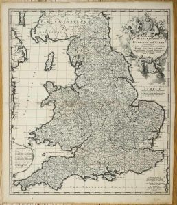
JENNER, Thomas
John Garrett, London, 1644-[c.1752]
The Kingdome of England, & Principality of Wales, Exactly Described Whi=th every Sheere, & the small townes in every one of them, in Six Mappes, Portable for every Mans Pocket ...The Kingdome of England, & Principality of Wales, Exactly Described Whi=th every Sheere, & the small townes in every one of them, in Six Mappes, Portable for every Mans Pocket ...The Kingdome of England, & Principality of Wales, Exactly Described Whi=th every Sheere, & the small townes in every one of them, in Six Mappes, Portable for every Mans Pocket ...The Kingdome of England, & Principality of Wales, Exactly Described Whi=th every Sheere, & the small townes in every one of them, in Six Mappes, Portable for every Mans Pocket ...The Kingdome of England, & Principality of Wales, Exactly Described Whi=th every Sheere, & the small townes in every one of them, in Six Mappes, Portable for every Mans Pocket ...The Kingdome of England, & Principality of Wales, Exactly Described Whi=th every Sheere, & the small townes in every one of them, in Six Mappes, Portable for every Mans Pocket ...The Kingdome of England, & Principality of Wales, Exactly Described Whi=th every Sheere, & the small townes in every one of them, in Six Mappes, Portable for every Mans Pocket ...The Kingdome of England, & Principality of Wales, Exactly Described Whi=th every Sheere, & the small townes in every one of them, in Six Mappes, Portable for every Mans Pocket ...The Kingdome of England, & Principality of Wales, Exactly Described Whi=th every Sheere, & the small townes in every one of them, in Six Mappes, Portable for every Mans Pocket ...
A VERY RARE EDITION. Small quarto (220 x 125 mm.), twentieth century half calf, marbled paper boards, blind ruled, spine with raised bands and gilt panelled compartments. With single page leaf containing the title and a separate plate displaying the Isle of Man and Cornwall extension folding from below, and six double page maps making a general map, all in early outline colour, some professional repairs to folds and a tear to sheet 2, otherwise in good original condition.
Stock number: 10942
£ 3,500
   

CAMDEN, William
Printed by F. Collins, for A. Swalle, at the Unicorn at the West-end of St. Paul's Church-yard; and A. & J. Churchil, at the Black Swan in Paternoster-row, London, 1695
Camden's Britannia, Newly Translated into English: with large Additions and ImprovementsCamden's Britannia, Newly Translated into English: with large Additions and ImprovementsCamden's Britannia, Newly Translated into English: with large Additions and ImprovementsCamden's Britannia, Newly Translated into English: with large Additions and ImprovementsCamden's Britannia, Newly Translated into English: with large Additions and ImprovementsCamden's Britannia, Newly Translated into English: with large Additions and ImprovementsCamden's Britannia, Newly Translated into English: with large Additions and ImprovementsCamden's Britannia, Newly Translated into English: with large Additions and Improvements
Folio (390 x 245 mm.), full contemporary blind panelled calf, rebacked with raised bands, preserving original calf gilt title, boards loose. Engraved portrait of Camden by R. White with small area of loss lower right, title within double rule border, 7 engraved general maps and 43 double page county maps by Robert Morden, all in EARLY OUTLINE COLOUR, 8 engraved plates of coins, engraved and woodcut illustrations, neat manuscript additions to the maps, 2 leaves of text supplied in facsimile, Somerset, Bucks, Herts, Leics, Scotland and Islands trimmed close, Witlshire paper crease, Beds with portion of margin missing, otherwise in good condition.
Stock number: 10941
£ 4,250
   

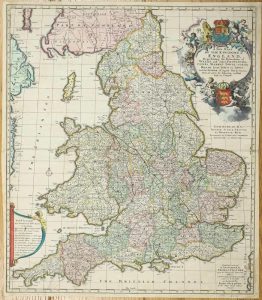
JENNER, Thomas
John Garrett, London, 1644-[1752]
The Kingdome of England, & Principality of Wales, Exactly Described Whi=th every Sheere, & the small townes in every one of them, in Six Mappes, Portable for every Mans Pocket ...The Kingdome of England, & Principality of Wales, Exactly Described Whi=th every Sheere, & the small townes in every one of them, in Six Mappes, Portable for every Mans Pocket ...The Kingdome of England, & Principality of Wales, Exactly Described Whi=th every Sheere, & the small townes in every one of them, in Six Mappes, Portable for every Mans Pocket ...The Kingdome of England, & Principality of Wales, Exactly Described Whi=th every Sheere, & the small townes in every one of them, in Six Mappes, Portable for every Mans Pocket ...The Kingdome of England, & Principality of Wales, Exactly Described Whi=th every Sheere, & the small townes in every one of them, in Six Mappes, Portable for every Mans Pocket ...The Kingdome of England, & Principality of Wales, Exactly Described Whi=th every Sheere, & the small townes in every one of them, in Six Mappes, Portable for every Mans Pocket ...The Kingdome of England, & Principality of Wales, Exactly Described Whi=th every Sheere, & the small townes in every one of them, in Six Mappes, Portable for every Mans Pocket ...The Kingdome of England, & Principality of Wales, Exactly Described Whi=th every Sheere, & the small townes in every one of them, in Six Mappes, Portable for every Mans Pocket ...
Folio (420 x 310 mm.), recent half calf preserving the original paper boards, spine with raised bands. With single page leaf containing the title and a separate plate displaying the Isle of Man and Cornwall extension folding from below, and six double page maps making a general map, overall in very good original condition.
Stock number: 10919
£ 3,950
   

TAYLOR, George & SKINNER, Andrew
Sold by G. Nicol, Strand; I. Murray, Fleet-Street, London. and by W. Wilson, No.6, Dame-Street, Dublin, London & Dublin, 1778
Taylor and Skinner's Maps of the Roads of Ireland, Surveyed 1777Taylor and Skinner's Maps of the Roads of Ireland, Surveyed 1777Taylor and Skinner's Maps of the Roads of Ireland, Surveyed 1777Taylor and Skinner's Maps of the Roads of Ireland, Surveyed 1777Taylor and Skinner's Maps of the Roads of Ireland, Surveyed 1777Taylor and Skinner's Maps of the Roads of Ireland, Surveyed 1777
FIRST EDITION OF THE FIRST ROAD BOOK OF IRELAND. Tall octavo (255 x 150 mm.), full contemporary calf, spine worn, soft flap missing, marbled endpapers. With engraved title page with vignette, Dedication, Explanation, Index and 288 plates, Subscribers, with 16 page list of subscribers, pp. xvi, 288, 16, several blank leaves for notes at the end, lacking folding general map from pocket, otherwise in good condition.
Stock number: 9595
£ 750
   

ANDREWS, John & DURY, Andrew
William Faden, London, 1773-[1 January 1810]
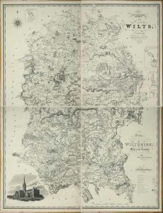
A Topographical Map of the County of Wilts. Describing the Seats of the Nobility and Gentry, Turnpike and Cross Roads, Canals, etc.A Topographical Map of the County of Wilts. Describing the Seats of the Nobility and Gentry, Turnpike and Cross Roads, Canals, etc.A Topographical Map of the County of Wilts. Describing the Seats of the Nobility and Gentry, Turnpike and Cross Roads, Canals, etc.A Topographical Map of the County of Wilts. Describing the Seats of the Nobility and Gentry, Turnpike and Cross Roads, Canals, etc.
Folio (560 x 400 mm.), contemporary half calf, ornate blind ruled, with original red calf gilt title label affixed to upper board, rebacked. With typographic title page, index table, general index map of the county, and 18 double page sheets each approximately 460 x 630 mm., all in early outline colour, light offsetting as usual, otherwise in good condition.
Stock number: 9574
£ 1,750
   

LEWIS, Samuel
London, c.1840
(A Topographical Dictionary of England)(A Topographical Dictionary of England)(A Topographical Dictionary of England)(A Topographical Dictionary of England)(A Topographical Dictionary of England)(A Topographical Dictionary of England)(A Topographical Dictionary of England)
Quarto (290 x 225 mm.), original publisher's ornate blind panelled cloth, rebacked preserving original spine with ornate blind ruling and decoration, gilt titles. With 58 engraved maps including large folding engraved general map of England and Wales (torn), 52 engraved maps of the counties, maps of Guernsey, Isle of Man, and Jersey, Yorkshire folding as is a large plan of London, with additional folding map of the whole of Wales not usually present, all in early outline colour, no title as issued, some light foxing, otherwise in good condition.
Stock number: 9556
£ 275
   

SMITH, Charles
London, c.1822
(Smith's New English Atlas)(Smith's New English Atlas)(Smith's New English Atlas)(Smith's New English Atlas)(Smith's New English Atlas)
Six matching slipcases, each half calf with marbled paper boards, spines with gilt ruling and black calf gilt titles. With 47 engraved maps comprising 1 general, 44 county maps including a larger one of Yorkshire in four sheets, and two of Wales, all in fine early wash colour, all dissected and laid on contemporary linen, each with paper title label affixed, in good condition.
Stock number: 9542
£ 1,350
   

LUFFMAN, John
Lackington, Allen & Co. Temple of the Muses Finsbury Square, London, 1806
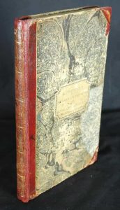
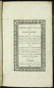
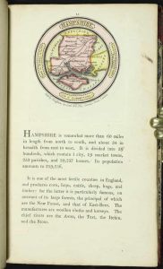
A New Pocket Atlas and Geography of England and Wales, Illustrated with Fifty-five Copper plates, Shewing all the Great Post Roads ...A New Pocket Atlas and Geography of England and Wales, Illustrated with Fifty-five Copper plates, Shewing all the Great Post Roads ...A New Pocket Atlas and Geography of England and Wales, Illustrated with Fifty-five Copper plates, Shewing all the Great Post Roads ...A New Pocket Atlas and Geography of England and Wales, Illustrated with Fifty-five Copper plates, Shewing all the Great Post Roads ...A New Pocket Atlas and Geography of England and Wales, Illustrated with Fifty-five Copper plates, Shewing all the Great Post Roads ...A New Pocket Atlas and Geography of England and Wales, Illustrated with Fifty-five Copper plates, Shewing all the Great Post Roads ...
Octavo (165 x 100 mm.), recent half red calf, preserving original marbled paper boards gilt ruled, gilt ruled bands, original paper title label affixed to the upper board. With engraved title, Preface dated March 1803, half title 'England', 42 circular maps of the English counties, half title 'Wales', 12 maps of the Welsh counties, folding map of England and Wales, Index leaf, 54 roundel maps in total, each with typographic text below, some slight trimming above to some plate numbers as often, otherwise in good condition.
Stock number: 9525
£ 1,850
   

BOWLES, Henry Carington & CARVER, Samuel
No. 69 St. Paul's Church Yard, London, 1796
Paterson's British Itinerary being A new and accurate Delineation and Description of the Direct and Principal Cross Roads …Paterson's British Itinerary being A new and accurate Delineation and Description of the Direct and Principal Cross Roads …Paterson's British Itinerary being A new and accurate Delineation and Description of the Direct and Principal Cross Roads …Paterson's British Itinerary being A new and accurate Delineation and Description of the Direct and Principal Cross Roads …Paterson's British Itinerary being A new and accurate Delineation and Description of the Direct and Principal Cross Roads …
HENRY CARINGTON BOWLES'S OWN COPY WITH MANUSCRIPT ADDITIONS AND CORRECTIONS. Small quarto (185 x 110 mm.), two volumes, full early marbled calf, gilt panelled, rebacked spines with ornate gilt and blind ruled bands, ornate central gilt decoration to compartments, calf gilt title and volume numbers affixed. Volume 1 with engraved general double-page map of England and Wales with old tape repair to lower centrefold split, engraved title page, dedication, General Contents, Preface, Index, 340 engraved road strip maps (2 to a page), Direct Roads of a lesser notes paginated 341-403, pp. xxxv, blank. Volume 2: Engraved title page, 46 [cross] road strip maps (2 to a page), pp. 450-634, some strips with early outline colour, manuscript notes throughout, otherwise in good condition.
Stock number: 9517
£ 750
   

OVERTON, Philip - BOWLES, Thomas
London, 1728
A New Map of the County of York
Two sheets, 565 x 480 mm. each (565 960 mm. if joined), in superb full contemporary colour, in very god condition.
Stock number: 9516
£ 2,500
   

SCALE, Bernard
Robt. Sayer, Map & Printseller, No. 53, Fleet Street, London, 1788
An Hibernian Atlas; or General Description of the Kingdom of Ireland: Divided into Provinces; with its sub-divisions of Counties, Baronies, &c.An Hibernian Atlas; or General Description of the Kingdom of Ireland: Divided into Provinces; with its sub-divisions of Counties, Baronies, &c.An Hibernian Atlas; or General Description of the Kingdom of Ireland: Divided into Provinces; with its sub-divisions of Counties, Baronies, &c.An Hibernian Atlas; or General Description of the Kingdom of Ireland: Divided into Provinces; with its sub-divisions of Counties, Baronies, &c.An Hibernian Atlas; or General Description of the Kingdom of Ireland: Divided into Provinces; with its sub-divisions of Counties, Baronies, &c.An Hibernian Atlas; or General Description of the Kingdom of Ireland: Divided into Provinces; with its sub-divisions of Counties, Baronies, &c.An Hibernian Atlas; or General Description of the Kingdom of Ireland: Divided into Provinces; with its sub-divisions of Counties, Baronies, &c.
A VERY RARE SECOND EDITION. Quarto (240 x 190 mm.), contemporary half calf, marbled paper boards, spine with gilt ruled compartments, red calf gilt title label. With engraved title page, Preface, Index and 37 engraved maps, all in early wash colour, with interleaved descriptive text printed back to back, some offsetting as usual, otherwise in good condition.
Stock number: 9511
£ 2,350
   

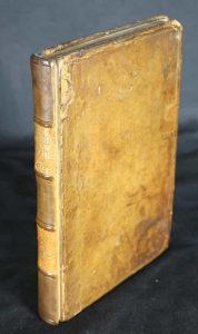
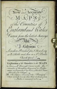
GIBSON, John
J. Newbery at the Bible and Sun in St. Pauls Church Yard, London, [1759]
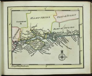
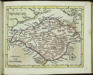
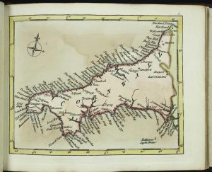
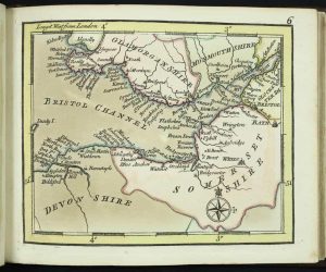
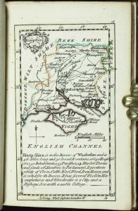
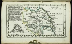
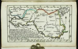
New and Accurate Maps, of the Counties of England and WalesNew and Accurate Maps, of the Counties of England and WalesNew and Accurate Maps, of the Counties of England and WalesNew and Accurate Maps, of the Counties of England and WalesNew and Accurate Maps, of the Counties of England and WalesNew and Accurate Maps, of the Counties of England and WalesNew and Accurate Maps, of the Counties of England and WalesNew and Accurate Maps, of the Counties of England and Wales
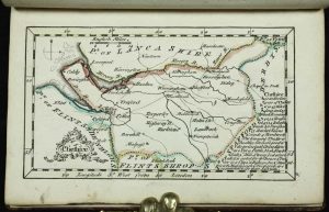
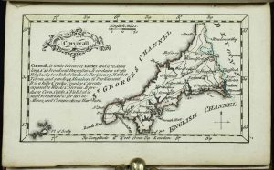
FIRST EDITION IN EARLY COLOUR. Duodecimo (130 x 90 mm.), rebound full calf, gilt panels, spine with gilt ruled raised bands and gilt red calf title label. With engraved title and 53 maps, all in early outline colour, otherwise in good condition.
Stock number: 9499
£ 4,950
   

HARIOT, Thomas - WHITE, John
Johann Wechel for Dieterich Bry Werden verkauftt in H. Sigmund Feyerabends Laden, Frankfurt, 1590
Wunderbarliche, doch Warhafftige Erklarung, Von der Gelegenheit und Sitten der Wilden in Virginia ...Wunderbarliche, doch Warhafftige Erklarung, Von der Gelegenheit und Sitten der Wilden in Virginia ...Wunderbarliche, doch Warhafftige Erklarung, Von der Gelegenheit und Sitten der Wilden in Virginia ...Wunderbarliche, doch Warhafftige Erklarung, Von der Gelegenheit und Sitten der Wilden in Virginia ...Wunderbarliche, doch Warhafftige Erklarung, Von der Gelegenheit und Sitten der Wilden in Virginia ...Wunderbarliche, doch Warhafftige Erklarung, Von der Gelegenheit und Sitten der Wilden in Virginia ...Wunderbarliche, doch Warhafftige Erklarung, Von der Gelegenheit und Sitten der Wilden in Virginia ...Wunderbarliche, doch Warhafftige Erklarung, Von der Gelegenheit und Sitten der Wilden in Virginia ...Wunderbarliche, doch Warhafftige Erklarung, Von der Gelegenheit und Sitten der Wilden in Virginia ...Wunderbarliche, doch Warhafftige Erklarung, Von der Gelegenheit und Sitten der Wilden in Virginia ...
FIRST GERMAN EDITION. Folio (325 x 240 mm), full seventeenth century calf, blind panelled with ornate gilt corners and central gilt feature to both boards, rebacked with raised bands, blind ruled with central gilt embossed decoration to compartments, with painted foredges. With engraved title-page (minor margin tear repaired), privilege statement on pasted-in slip as called for, dedication to Christiano Hertzogen of Saxony with his large engraved arms, double-page map of Virginia by Theodor de Bry after John White in the third state (two minor margin repairs and a paper fault left side), 28 further engravings, comprising Adam and Eve (a full page engraving unnumbered), plates numbered 2-23 (comprising 16 half page with letterpress text, plates 17, 19, 20 & 22 full page and plates 13 and 18 larger), plus 5 full page engravings of Picts, pp. 3-33, (5), (5), full page plates with additional leaves of descriptive text, woodcut head- and tail-piece ornaments and initials, blank leaf D6 present, light stain to 16, 22 inserted from another copy, text to second Pict plate with replacement lower left including some facsimile, minor repairs to plates 11, 12, 13, 17, 18, 19, 23, Pict 1, and Pict 5, all professionally undertaken, otherwise in good condition.
Stock number: 10938
$ 69,500
   

CAMDEN, William
J. Nichols for T. Payne & Son, G.G.J. & J. Robinson, London, 1789
Britannia: or, a Chorographical Description of the Flourishing Kingdoms of England, Scotland, and Ireland, and the Islands Adjacent; from the Earliest Antiquity. By William Camden. Translated from the Edition Published by the Author in MDCVII [1607]. Enlarged by the Latest Discoveries, By Richard Gough, F. A. & R. SS.Britannia: or, a Chorographical Description of the Flourishing Kingdoms of England, Scotland, and Ireland, and the Islands Adjacent; from the Earliest Antiquity. By William Camden. Translated from the Edition Published by the Author in MDCVII [1607]. Enlarged by the Latest Discoveries, By Richard Gough, F. A. & R. SS.Britannia: or, a Chorographical Description of the Flourishing Kingdoms of England, Scotland, and Ireland, and the Islands Adjacent; from the Earliest Antiquity. By William Camden. Translated from the Edition Published by the Author in MDCVII [1607]. Enlarged by the Latest Discoveries, By Richard Gough, F. A. & R. SS.Britannia: or, a Chorographical Description of the Flourishing Kingdoms of England, Scotland, and Ireland, and the Islands Adjacent; from the Earliest Antiquity. By William Camden. Translated from the Edition Published by the Author in MDCVII [1607]. Enlarged by the Latest Discoveries, By Richard Gough, F. A. & R. SS.Britannia: or, a Chorographical Description of the Flourishing Kingdoms of England, Scotland, and Ireland, and the Islands Adjacent; from the Earliest Antiquity. By William Camden. Translated from the Edition Published by the Author in MDCVII [1607]. Enlarged by the Latest Discoveries, By Richard Gough, F. A. & R. SS.
Folio, three volumes (440 x 270 mm. each), full contemporary calf, worn, rebacked with gilt ruled compartments, gilt calf title and volume labels to each. With portrait of the author, 4 plates of coins, circa 90 plates of antiquities, 52 general and county maps, 8 others mostly folding by John Cary, folding letterpress genealogy of Oliver Cromwell, errata leaves, some light offsetting as often found, otherwise in good condition.
Stock number: 10937
£ 950
   

CAMDEN, William
James and John Knapton, John Darby, Arthur Bettesworth, Francis Fayram, John Osborn and Tho. Longman, John Pemberton, Charles Rivington, Francis Clay, Jeremiah Batley, and Aaron Ward, London, [1730]
Britannia: or, a Chorographical Description of Great BritainBritannia: or, a Chorographical Description of Great BritainBritannia: or, a Chorographical Description of Great BritainBritannia: or, a Chorographical Description of Great BritainBritannia: or, a Chorographical Description of Great Britain
Folio (410 x 265 mm.), two volumes, full contemporary calf, gilt panelled, rebacked with ribbed spine, gilt ruled compartments to the spine, calf gilt title labels. Volume 1; with engraved portrait of Camden by R. White, typographic title page printed in red and black, 36 double page county maps by Robert Morden, 9 engraved plates; volume 2; typographic title page, 15 double page county maps by Robert Morden. pp. (66), cclxviii (double column numeration), (2), 696 (double column numeration); (2), 697-1526, (176), small area of water stain to the lower centrefold of the very end of the first volume affecting Shropshire, Chester, Herefordshire only, otherwise a good example.
Stock number: 10936
£ 1,500
   

CAMDEN, William
George Bishop and John Norton, London, 1610-[c.22]
Britain, or a Chorographicall Description of the Most flourishing Kingdomes, England, Scotland, and Ireland, and the Ilands adioyning ...Britain, or a Chorographicall Description of the Most flourishing Kingdomes, England, Scotland, and Ireland, and the Ilands adioyning ...Britain, or a Chorographicall Description of the Most flourishing Kingdomes, England, Scotland, and Ireland, and the Ilands adioyning ...Britain, or a Chorographicall Description of the Most flourishing Kingdomes, England, Scotland, and Ireland, and the Ilands adioyning ...Britain, or a Chorographicall Description of the Most flourishing Kingdomes, England, Scotland, and Ireland, and the Ilands adioyning ...Britain, or a Chorographicall Description of the Most flourishing Kingdomes, England, Scotland, and Ireland, and the Ilands adioyning ...
Large quarto (345 x 240 mm.), full contemporary calf gilt panelled calf, with large ornamental central design on both boards below which is found a blind stamped monograph of 'HL' above which is a coronet, original spine with raised bands, with gilt ruled compartments each with central gilt design, ornate gilt title with frame, repaired. With engraved title page by William Hole with central map of the British Isles copied from that in the 1600 edition, flanked by figures of Neptune and Ceres, verso blank; dedication to King James, verso blank; typographic title page, verso blank; 'The Author to the Reader' pp. 4; Latin verses pp. 4; Alphabet verso blank; text paginated 1-822, one blank leaf, half-title Scotland verso blank, paginated 1-233 with another half-title for Ireland and the Smaller Ilands in the British Ocean, with 57 engraved maps and 8 plates of coins; p. (234) 'The Shires of England', indexes pp. 54. Complete in pp. (16), 822, (2), 234 (numbered to 233), (54). With 58 engraved maps in total, three of which are single page including the title. All maps are in the final third state with pagination on those called for. That of Gloucestershire with repair to tear upper centre, otherwise in good condition.
Stock number: 10935
£ 8,950
   

LUFFMAN, John
London, 1803
Middlesex
70 x 70 mm., with text below, in fine full early wash colour.
Stock number: 10817
£ 95
   

BLAEU, Joan
Amsterdam, c.1650
Comitatus Nottinghamiensis Nottingham Shire
385 x 505 mm., early outline colour with Dutch text to the verso, in good condition.
Stock number: 10813
£ 325
   

DUGDALE, Thomas
L. Tallis, 3 Jewin Street, City, London, c.1842
Curiosities of Great Britain. England & Wales DelineatedCuriosities of Great Britain. England & Wales DelineatedCuriosities of Great Britain. England & Wales DelineatedCuriosities of Great Britain. England & Wales Delineated
Quarto, four volumes (215 x 135 mm. each), contemporary half calf, cloth boards, gilt ruled, all rebacked preserving original spine with gilt decorated raised bands, calf gilt title and volume labels. With 58 steel engraved maps consisting of 2 general, 43 English county maps (Yorkshire divided into 4), Isle of Wight and 12 Welsh counties and c.200 steel engraved plates, pp. 1586, light foxing and offsetting, otherwise in good condition.
Stock number: 9583
£ 195
   

MACLAUCHLAN, Henry
Duke of Northumberland, Newcastle, 1857-[58]
The Roman Wall & Illustrations of the Principal Vestiges of Roman Occupation in the North of England & Eastern Branch of the Watling Street in the County of NorthumberlandThe Roman Wall & Illustrations of the Principal Vestiges of Roman Occupation in the North of England & Eastern Branch of the Watling Street in the County of NorthumberlandThe Roman Wall & Illustrations of the Principal Vestiges of Roman Occupation in the North of England & Eastern Branch of the Watling Street in the County of NorthumberlandThe Roman Wall & Illustrations of the Principal Vestiges of Roman Occupation in the North of England & Eastern Branch of the Watling Street in the County of NorthumberlandThe Roman Wall & Illustrations of the Principal Vestiges of Roman Occupation in the North of England & Eastern Branch of the Watling Street in the County of NorthumberlandThe Roman Wall & Illustrations of the Principal Vestiges of Roman Occupation in the North of England & Eastern Branch of the Watling Street in the County of Northumberland
PRESENTATION COPY BY DUKE OF NORTHUMBERLAND TO HENRY MACLAUGHLAN. Large folio (560 x 400 mm.), contemporary half calf, gilt ruled with gilt title to upper board, rebacked with raised bands, gilt decoration and gilt title, with marbled endpapers. With title page, 5 double-page maps, further title, 6 further double-page maps, each with early outline colour, in good condition.
Stock number: 9581
£ 395
   

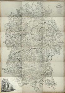
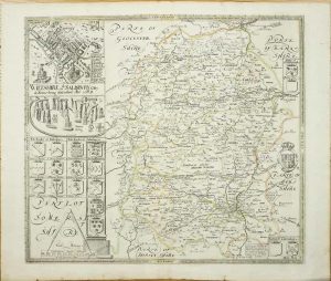
ANDREWS, John & DURY, Andrew
London, 1773
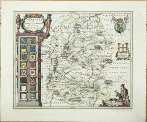
A Topographical Map of Wiltshire on a scale of 2 inches to a mile, from an Actual Survey, by John Andrews & Andrew DuryA Topographical Map of Wiltshire on a scale of 2 inches to a mile, from an Actual Survey, by John Andrews & Andrew DuryA Topographical Map of Wiltshire on a scale of 2 inches to a mile, from an Actual Survey, by John Andrews & Andrew Dury
ONE OF A HANDFUL OF LARGE-SCALE MAPS AT TWO INCHES TO THE MILE. Folio (535 x 395 mm.), recent half calf, marbled paper boards, with ribbed spine, red calf gilt title label. With general index map of the county and 18 double page sheets, each approximately 460 x 630 mm. All in early outline colour, some light foxing, otherwise a good example.
Stock number: 9571
£ 2,950
   

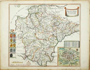
FISHER, SON & Co
Fisher, Son, & Co., Caxton Press, Angel Street, St. Martin's-Le-Grand, London, [1845]
Fisher's County Atlas of England and Wales. Compiled from Authentic Surveys, and Corrected to the Present Time. With a Topographical and Statistical Description of Each CountyFisher's County Atlas of England and Wales. Compiled from Authentic Surveys, and Corrected to the Present Time. With a Topographical and Statistical Description of Each CountyFisher's County Atlas of England and Wales. Compiled from Authentic Surveys, and Corrected to the Present Time. With a Topographical and Statistical Description of Each CountyFisher's County Atlas of England and Wales. Compiled from Authentic Surveys, and Corrected to the Present Time. With a Topographical and Statistical Description of Each CountyFisher's County Atlas of England and Wales. Compiled from Authentic Surveys, and Corrected to the Present Time. With a Topographical and Statistical Description of Each County
FIRST EDITION. Folio (370 x 305 mm.), contemporary half calf, marbled paper boards, blind ruled spine with raised bands, gilt ruled compartments, gilt title, marbled endpapers, light wear. With title page, preface and contents leaf and 96 pages of descriptive text interspersed with 48 maps consisting of 1 folding general map of England and Wales, 41 maps of the counties (Leicestershire and Rutland together) and Wales made up of 6 sheets, those of Lincolnshire and Devon are double page, all in early wash colour, laid on contemporary silk, otherwise in good condition.
Stock number: 9569
£ 750
   

CARY, John
Printed for John Cary, Engraver, Map & Printseller, Strand, London, 1791-[c.1800]
Cary's Traveller's Companion, or, a Delineation of the Turnpike Roads of England and Wales. [Bound with] Cary's New Itinerary: or, an Accurate Delineation of the Great RoadsCary's Traveller's Companion, or, a Delineation of the Turnpike Roads of England and Wales. [Bound with] Cary's New Itinerary: or, an Accurate Delineation of the Great RoadsCary's Traveller's Companion, or, a Delineation of the Turnpike Roads of England and Wales. [Bound with] Cary's New Itinerary: or, an Accurate Delineation of the Great RoadsCary's Traveller's Companion, or, a Delineation of the Turnpike Roads of England and Wales. [Bound with] Cary's New Itinerary: or, an Accurate Delineation of the Great Roads
Octavo (175 x 110 mm.), full contemporary mottled calf, rebacked preserving original spine with ornate gilt panelling, green calf gilt title label. With gilt tooling and label to spine. With engraved title, advertisement, contents leaf, general map and 42 county maps printed back to back, that of Yorkshire folding and with minor binders tear as usual, all in early outline colour, 6 page Index with an advert leaf for John Cary. 'New Itinerary' with engraved title, engraved dedication, folding general map in full early wash colour, pp. (56), 796 (to 740 2 per page), otherwise in good condition.
Stock number: 9568
£ 250
   

STOCKDALE, John
Printed for John Stockdale, Piccadilly, London, 1806
Britannia: or, a Chorographical Description of the Flourishing Kingdoms of England, Scotland, and Ireland, and the Islands Adjacent; from the Earliest Antiquity. By William Camden. Translated from the Edition Published by the Author in MDCVII [1607]. Enlarged by the Latest Discoveries, By Richard Gough, F. A. & R. SS.Britannia: or, a Chorographical Description of the Flourishing Kingdoms of England, Scotland, and Ireland, and the Islands Adjacent; from the Earliest Antiquity. By William Camden. Translated from the Edition Published by the Author in MDCVII [1607]. Enlarged by the Latest Discoveries, By Richard Gough, F. A. & R. SS.Britannia: or, a Chorographical Description of the Flourishing Kingdoms of England, Scotland, and Ireland, and the Islands Adjacent; from the Earliest Antiquity. By William Camden. Translated from the Edition Published by the Author in MDCVII [1607]. Enlarged by the Latest Discoveries, By Richard Gough, F. A. & R. SS.Britannia: or, a Chorographical Description of the Flourishing Kingdoms of England, Scotland, and Ireland, and the Islands Adjacent; from the Earliest Antiquity. By William Camden. Translated from the Edition Published by the Author in MDCVII [1607]. Enlarged by the Latest Discoveries, By Richard Gough, F. A. & R. SS.Britannia: or, a Chorographical Description of the Flourishing Kingdoms of England, Scotland, and Ireland, and the Islands Adjacent; from the Earliest Antiquity. By William Camden. Translated from the Edition Published by the Author in MDCVII [1607]. Enlarged by the Latest Discoveries, By Richard Gough, F. A. & R. SS.
Folio, four volumes (430 x 270 mm. each), full contemporary marbled calf, spines with gilt ruled raised bands, gilt calf volume numbers and titles, large paper copy, one joint volume 2 weak. With frontispiece engraved portrait of William Camden in the first volume, typographic title pages to each volume, pp. ccvi, 415, [29]; iv, 518, [26]; iv, 527, [31]; iv, 570, [30], with 160 engraved plates and maps, of these, 104 are engraved plates of which 8 are double page and 56 are engraved maps, of which 51 are double page, there is one further plate set within the text listed in the contents of volume IV accordingly, a folding letterpress in volume two (p. 235) on the genealogy of Oliver Cromwell, other additional engraved illustrations within the text, 11 maps trimmed close to the neatline, some worm holes first 4 leaves near lower edge of volume 4, otherwise in good condition.
Stock number: 9566
£ 650
   

DUNCAN, James
James Duncan, Paternoster Row, London, 1827[37]
A Complete County Atlas of England & Wales, containing Forty Four Superior Maps. With all the Improvements --- Projected or CompletedA Complete County Atlas of England & Wales, containing Forty Four Superior Maps. With all the Improvements --- Projected or CompletedA Complete County Atlas of England & Wales, containing Forty Four Superior Maps. With all the Improvements --- Projected or CompletedA Complete County Atlas of England & Wales, containing Forty Four Superior Maps. With all the Improvements --- Projected or Completed
Folio (400 x 260 mm.), recent half red calf retaining contemporary green cloth boards, with original publisher's gilt title to upper board, spine with gilt ruling and gilt title. With typographic title, double page typographic 'Geographical and Statistical Table', map of England and Wales and a further 43 maps of the counties and Wales, some light offsetting, otherwise in good condition.
Stock number: 9562
£ 650
   

HALL, Sidney
Chapman & Hall 186, Strand, London, 1833
Sidney Hall's British AtlasSidney Hall's British AtlasSidney Hall's British AtlasSidney Hall's British AtlasSidney Hall's British Atlas
FIRST EDITION. Quarto (315 x 240 mm.), contemporary quarter green calf, red cloth embossed boards, with gilt title to the upper board, with ribbed spine, blind ruled compartments, gilt title. With engraved title page, List of Maps and 47 steel engraved maps on 54 sheets all in full early wash colour, Yorkshire, Ireland, Scotland, and Wales double page, Inland Navigation backed on linen and loose, each accompanied by descriptive text, otherwise in good condition.
Stock number: 9553
£ 495
   

COBBETT, William
Wm. Cobbett, 11, Bolt-Court, Fleet-Street; and may be had of all booksellers, London, 1832
A Geographical Dictionary of England and WalesA Geographical Dictionary of England and WalesA Geographical Dictionary of England and WalesA Geographical Dictionary of England and WalesA Geographical Dictionary of England and Wales
Octavo (230 x 145 mm.), uncut tall paper copy, in contemporary quarter cloth, paper boards, spine with paper title affixed. With typographic title page, pp. viii, 546, (2), with 43 maps, consisting of 1 general, 40 of the counties of England, and 2 of Wales, printed on thick paper, with pp. 12 catalogue of the 'Cobbett-Library' printed on smaller paper inserted at the end, otherwise in good condition.
Stock number: 9552
£ 275
   

MURRAY, T. Laurie
London, [1830]
An Atlas of the English CountiesAn Atlas of the English CountiesAn Atlas of the English CountiesAn Atlas of the English CountiesAn Atlas of the English Counties
Folio (475 x 370 mm.), contemporary half calf, marbled paper boards, spine with red calf gilt title label, a little worn, marbled endpapers. With ornate engraved title page, Dedication, and 44 engraved maps including 1 large folding map of England with small tear at double fold repaired, double-page maps of Ireland, Scotland and Wales and 40 maps of the counties (Yorkshire in 2 sheets), all in fine early outline colour, in very good condition.
Stock number: 9551
£ 1,000
   

CARY, John
John Cary, Engraver, Map and Print-seller, the corner of Arundel Street, Strand, London, 1787-[89]
Cary's New and Correct English Atlas: Being A New Set of County Maps from Actual SurveysCary's New and Correct English Atlas: Being A New Set of County Maps from Actual SurveysCary's New and Correct English Atlas: Being A New Set of County Maps from Actual SurveysCary's New and Correct English Atlas: Being A New Set of County Maps from Actual SurveysCary's New and Correct English Atlas: Being A New Set of County Maps from Actual Surveys
Quarto (325 x 250 mm.), fine modern half calf with marbled paper boards, blind ruled, spine with blind and gilt bands and green calf gilt title label affixed. With typographic Advertisement, engraved title page, engraved dedication, List of Subscribers pp. 6, typographic Contents, map of South Britain, pp. (12), and 43 county maps on 44 plates (West Riding being on two plates) and both North and South Wales, 47 maps in total, each accompanied by a leaf of descriptive text, all in early outline colour with main routes coloured brown with wash to wooded areas, 'Directions for the Junctions of the Roads of England and Wales through all the Counties', 'Market and Borough Towns in England and Wales', 'List of the Principal Post and Sub-Post Towns in England and Wales', pp. 17, some very light foxing as usual, otherwise in good condition.
Stock number: 9550
£ 895
   

DUNCAN, James
James Duncan, Paternoster Row, London, 1838
A Complete County Atlas of England & Wales, containing Forty Four Superior Maps. With all the Improvements --- Projected or CompletedA Complete County Atlas of England & Wales, containing Forty Four Superior Maps. With all the Improvements --- Projected or CompletedA Complete County Atlas of England & Wales, containing Forty Four Superior Maps. With all the Improvements --- Projected or CompletedA Complete County Atlas of England & Wales, containing Forty Four Superior Maps. With all the Improvements --- Projected or CompletedA Complete County Atlas of England & Wales, containing Forty Four Superior Maps. With all the Improvements --- Projected or CompletedA Complete County Atlas of England & Wales, containing Forty Four Superior Maps. With all the Improvements --- Projected or CompletedA Complete County Atlas of England & Wales, containing Forty Four Superior Maps. With all the Improvements --- Projected or Completed
Folio (400 x 260 mm.), recent quarter calf retaining contemporary green cloth boards, with original publisher's gilt title to upper board, spine with gilt ruling and gilt title. With typographic title, double page typographic 'Geographical and Statistical Table', general map of England and Wales and a further 43 maps of the counties and Wales, maps numbered by a later hand on verso matching those of old manuscript contents list loosely inserted, otherwise in good condition.
Stock number: 9546
£ 595
   

DARTON, William & DIX, Thomas
58, Holborn Hill, London, 1822
A Complete Atlas of the English Counties, Divided into their Respective Hundreds &c.A Complete Atlas of the English Counties, Divided into their Respective Hundreds &c.A Complete Atlas of the English Counties, Divided into their Respective Hundreds &c.A Complete Atlas of the English Counties, Divided into their Respective Hundreds &c.A Complete Atlas of the English Counties, Divided into their Respective Hundreds &c.A Complete Atlas of the English Counties, Divided into their Respective Hundreds &c.A Complete Atlas of the English Counties, Divided into their Respective Hundreds &c.A Complete Atlas of the English Counties, Divided into their Respective Hundreds &c.A Complete Atlas of the English Counties, Divided into their Respective Hundreds &c.
EXTREMELY RARE AND DESIRABLE. Folio (460 x 310 mm.), contemporary half calf, marbled boards, gilt ruled, rebacked with gilt ruled compartments, each with central gilt floral feature, red calf gilt title label. Double page typographic title, dedication, contents, and forty-two double-page engraved maps with excellent original wash colour, Chester, Hampshire, Shropshire, and Sussex with centrefolds repaired, otherwise a good example.
Stock number: 9541
£ 8,500
   

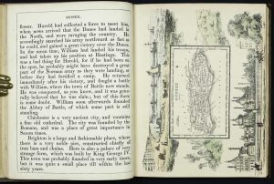
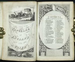
REID, William Henry
W. H. Reid, Charing Cross, London, c.1820
The Panorama: or, Traveller's Instructive Guide; Through England and Wales; Exhibiting all the Direct and Principal Cross Roads, Cities, Towns, Villages, Parks, Canals, &c. ...The Panorama: or, Traveller's Instructive Guide; Through England and Wales; Exhibiting all the Direct and Principal Cross Roads, Cities, Towns, Villages, Parks, Canals, &c. ...The Panorama: or, Traveller's Instructive Guide; Through England and Wales; Exhibiting all the Direct and Principal Cross Roads, Cities, Towns, Villages, Parks, Canals, &c. ...The Panorama: or, Traveller's Instructive Guide; Through England and Wales; Exhibiting all the Direct and Principal Cross Roads, Cities, Towns, Villages, Parks, Canals, &c. ...The Panorama: or, Traveller's Instructive Guide; Through England and Wales; Exhibiting all the Direct and Principal Cross Roads, Cities, Towns, Villages, Parks, Canals, &c. ...
CHARMING LITTLE ATLAS. Octavo (125 x 85 mm.), full contemporary marbled calf, ornate gilt panelled, rebacked preserving original spine, gilt ruled compartments, each with central ornate gilt feature, with marbled endpapers. With decorative pictorial engraved title page, engraved Contents, typographic title page with Index on verso, Address with Errata on the verso, two engraved divisional titles of England and Wales, pp. (4), 162, and 53 maps (1 general and 52 county maps) all in excellent early full wash colour, in good condition.
Stock number: 9540
£ 1,950
   

LEWIS, William
W. Lewis, No. 21 Finch Lane, Cornhill, London, [1819]
Lewis's New Traveller's Guide, or a Pocket Edition of the English Counties. Containing all the Direct & Cross Roads in England & WalesLewis's New Traveller's Guide, or a Pocket Edition of the English Counties. Containing all the Direct & Cross Roads in England & WalesLewis's New Traveller's Guide, or a Pocket Edition of the English Counties. Containing all the Direct & Cross Roads in England & WalesLewis's New Traveller's Guide, or a Pocket Edition of the English Counties. Containing all the Direct & Cross Roads in England & Wales
Octavo (155 x 120 mm.), contemporary half red calf, with marbled paper boards, gilt ruled, spine with gilt decoration and title. With general map of England and Wales, engraved title page, Preface dated 1819, Contents, List of Mail-Coaches etc., pp. (8), with 40 maps of the counties, North and South Wales as called for, in all 43 maps, each with a page of descriptive text, Yorkshire folding, all in full contemporary wash colour, Devon tight to left margin, otherwise a good example.
Stock number: 9539
£ 295
   

ELLIS, George
G. Ellis, No. 5. Smith's Square, Westminster, London, [1819]
Ellis's New and Correct Atlas of England and Wales being an Entire New Set of County MapsEllis's New and Correct Atlas of England and Wales being an Entire New Set of County MapsEllis's New and Correct Atlas of England and Wales being an Entire New Set of County MapsEllis's New and Correct Atlas of England and Wales being an Entire New Set of County MapsEllis's New and Correct Atlas of England and Wales being an Entire New Set of County MapsEllis's New and Correct Atlas of England and Wales being an Entire New Set of County Maps
Small folio (305 x 245 mm.), contemporary half calf, marbled paper boards, upper board with morocco gilt label priced 'L3. 3s. 0D.', spine with gilt ruled bands, worn. With engraved title, 44 maps, comprising 42 engraved maps of the English counties and maps of North and South Wales, all in early wash colour, a leaf of descriptive text accompanies each map, pp. 2, (26), (14), otherwise in good condition.
Stock number: 9538
£ 695
   

WALLIS, James
Jas. Wallis, Berwick Street, Soho, London, c.1814[16]
Wallis's Second & Superior British Atlas Containing a Complete Set of County Maps Divided into HundredsWallis's Second & Superior British Atlas Containing a Complete Set of County Maps Divided into HundredsWallis's Second & Superior British Atlas Containing a Complete Set of County Maps Divided into HundredsWallis's Second & Superior British Atlas Containing a Complete Set of County Maps Divided into HundredsWallis's Second & Superior British Atlas Containing a Complete Set of County Maps Divided into HundredsWallis's Second & Superior British Atlas Containing a Complete Set of County Maps Divided into Hundreds
THE RARE SECOND EDITION. Folio (325 x 230 mm.), later full cloth binding, preserving the original green calf gilt title label on the upper board. With engraved title page (tear repaired), 1 general map of England and Wales (with loss) and 42 maps of the counties, all in early wash colour, bound slightly out of alphabetical sequence as usual, otherwise in good condition.
Stock number: 9537
£ 450
   

WALLIS, James
Jas. Wallis, Berwick Street, Soho, London, c.1814[16]
Wallis's Second & Superior British Atlas Containing a Complete Set of County Maps Divided into HundredsWallis's Second & Superior British Atlas Containing a Complete Set of County Maps Divided into HundredsWallis's Second & Superior British Atlas Containing a Complete Set of County Maps Divided into HundredsWallis's Second & Superior British Atlas Containing a Complete Set of County Maps Divided into HundredsWallis's Second & Superior British Atlas Containing a Complete Set of County Maps Divided into Hundreds
THE RARE SECOND EDITION. Folio (320 x 240 mm.), contemporary half calf, marbled paper boards with original publisher's printed paper title label affixed to upper board, gilt ruled, marbled floral endpapers. With engraved title page, 1 general map of England and Wales and 42 maps of the counties, all in early wash colour, bound slightly out of alphabetical sequence as usual, those of Yorkshire slightly loose, light foxing to title and Contents, otherwise in good condition.
Stock number: 9536
£ 450
   

WALLIS, James
J Wallis Engraver, Berwick St. Soho and Sold by Davies & Eldridge Exeter, London, c.1812-[14]
Wallis's New Pocket Edition of the English Counties or Traveller's CompanionWallis's New Pocket Edition of the English Counties or Traveller's CompanionWallis's New Pocket Edition of the English Counties or Traveller's CompanionWallis's New Pocket Edition of the English Counties or Traveller's CompanionWallis's New Pocket Edition of the English Counties or Traveller's Companion
Octavo (145 x 115 mm.), contemporary half red calf, paper boards, with original calf gilt title label affixed to upper board. With engraved title page, Address to the Public, 44 maps including general map of England and Wales, 40 maps of the English counties, separate maps of North and South Wales and the last a smaller map of the Isle of Wight not called for in the contents, all single page with the exception of the double page map of Yorkshire, all in early wash colour, in very good condition.
Stock number: 9530
£ 350
   

LAURIE, Robert & WHITTLE, James
Robert Laurie and James Whittle, No. 53, Fleet-Street, London, 1807
Laurie and Whittle's New and Improved English Atlas, divided into CountiesLaurie and Whittle's New and Improved English Atlas, divided into CountiesLaurie and Whittle's New and Improved English Atlas, divided into CountiesLaurie and Whittle's New and Improved English Atlas, divided into CountiesLaurie and Whittle's New and Improved English Atlas, divided into Counties
Oblong quarto (230 x 295 mm.), contemporary half black calf, marbled paper boards, spine with gilt ruled compartments, each with central gilt floral design, gilt title, light wear. With finely engraved title page (slight loss to lower gutter ), typographic title, Advertisement, Contents, engraved Explanation in early colour and 48 engraved maps (West Riding in 2 sheets) all in fine early outline colour with wash borders, each accompanied by a leaf of descriptive text, Lincolnshire with repaired tear, text to Northants and Shropshire with repaired tears, otherwise in good fresh example.
Stock number: 9527
£ 950
   

DARTON, William & HARVEY, Joseph
William Darton and Joseph Harvey, London, 1804
Maps of the Several Counties and Shires in EnglandMaps of the Several Counties and Shires in EnglandMaps of the Several Counties and Shires in EnglandMaps of the Several Counties and Shires in EnglandMaps of the Several Counties and Shires in England
A VERY RARE ATLAS. Octavo (215 x 145 mm.), contemporary quarter red morocco, marbled paper boards, with paper title label affixed to upper board, spine with gilt ruled compartments, light wear. With 41 (of 46) maps by Benjamin Baker, lacking Cheshire, the 4 of Yorkshire, all in early outline colour, the last map a little frayed, otherwise in good condition.
Stock number: 9522
£ 1,500
   

BARCLAY, The Rev. James
Virtue & Co., City Road and Ivy Lane, London, c.1854
A Complete and Universal DictionaryA Complete and Universal DictionaryA Complete and Universal DictionaryA Complete and Universal DictionaryA Complete and Universal DictionaryA Complete and Universal DictionaryA Complete and Universal Dictionary
Quarto (280 x 220 mm.), recent half blue calf, marbled paper boards, blind ruled, ornate spine with raised bands, gilt decoration to the compartments, silver embossed calf title label. With engraved frontispiece title, typographic title page, pp. (viii), 984, with 1 general map, 42 county maps, the environs of London and Portsmouth, plan of Oxford (with small hole), and 3 of islands, several further engravings, generally good margins, otherwise in good condition.
Stock number: 9521
£ 500
   

CARY, John
G. & J. Cary, 86 St. James's Street, London, 1832-[c.48]
Cary's Improved Map of England & Wales, with a Considerable Portion of Scotland, Planned Upon a Scale of Two Statute Miles to One InchCary's Improved Map of England & Wales, with a Considerable Portion of Scotland, Planned Upon a Scale of Two Statute Miles to One InchCary's Improved Map of England & Wales, with a Considerable Portion of Scotland, Planned Upon a Scale of Two Statute Miles to One InchCary's Improved Map of England & Wales, with a Considerable Portion of Scotland, Planned Upon a Scale of Two Statute Miles to One InchCary's Improved Map of England & Wales, with a Considerable Portion of Scotland, Planned Upon a Scale of Two Statute Miles to One InchCary's Improved Map of England & Wales, with a Considerable Portion of Scotland, Planned Upon a Scale of Two Statute Miles to One Inch
Nine slipcases (260 x 165 mm. each), contemporary half calf, marbled paper boards, spines with raised bands, gilt ruled with gilt titles. With 67 dissected maps laid on contemporary linen, consisting of title, index and 65 maps, each with identifying tab, all in early outline colour, 32 supplied from another example, otherwise in good condition.
Stock number: 9519
£ 995
   

LODGE, John
London, c.1795
Atlas of Great Britain and IrelandAtlas of Great Britain and IrelandAtlas of Great Britain and IrelandAtlas of Great Britain and IrelandAtlas of Great Britain and Ireland
Folio (315 x 205 mm.), recent half calf preserving original marbled paper boards, upper cover with printed paper title and contents, spine with gilt ruled bands, retaining original endpapers. With no title page as issued and 43 engraved maps of which 3 are folding general maps, light creasing to Yorkshire, otherwise in good condition.
Stock number: 9513
£ 1,950
   

NEW JERSEY
Burlington, 1776
One ShillingOne Shilling
69 x 104 mm., printed in red and black, in good condition.
Stock number: 10837
$ 350
   

CONTINENTAL CURRENCY
Continental Congress, Philadelphia, 1777
Thirty DollarsThirty Dollars
72 x 96 mm., printed paper currency.
Stock number: 10834
$ 450
   

Send us your name and email address.
We'll add you to our subscriber list and alert you to new catalogues and similar news